 |
United States Location Monuments--"Mini" Historical Sites
|
Prior to the survey of the western United States into the grid of Townships and Sections that is now used to generate legal descriptions of property, US Location Monuments were established as reference points for patented mining claims and homestead locations. The maps generated by the surveys of these properties were referenced to the location of the monuments.
Generally set on high points that were visible in all directions. the monuments were often created from native materials. The records of the old surveys have been scanned and are posted online so it is possible to learn a great deal about each monument's history. The oldest monument that I have been to was established in 1899. The newest was created around 1917.
The location monuments are quite different from the corner markers commonly seen around mining claims or the benchmarks that were installed during the Public Land Surveys.
 |
 |
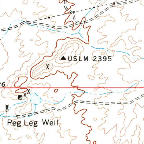
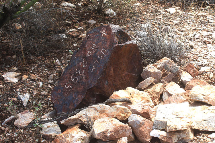
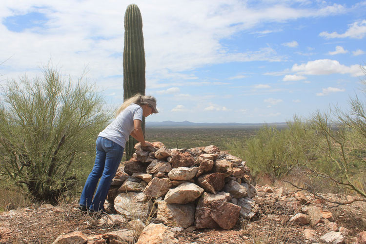
This is USLM 2395 and it is located on a hilltop several miles east of Florence in central Arizona. The monument was established in 1907. The modern Township grid system was not established in this area until the 1920s. This feature was the first USLM monument that I had ever taken the time to check out. I found its structure and history to be so interesting that I have since become an avid Monument "hunter".
 |
The markings on the location monuments were somewhat standardized, A BLM source provides this explanation as to the forms that the monuments could take.
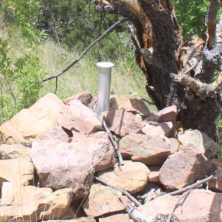
"The monument should consist of an iron post similar to the type used for rectangular surveys or a stone not less than 30 inches long, 20 inches wide, and 6 inches thick, set three-fourths in the ground with a conical mound of stone 4 feet high and having a 6-foot base alongside. The letters "USLM" followed by the number of the survey are marked on the brass cap or plainly chiseled upon the stone. The exact reference point is indicated on the top of the monument by a cross. Any necessary departure from the prescribed material and size of monument is to be explained."
This is the "mound" of stone that is alongside LM2395. Today, it does not quite reach to the recommended 4' height.
 |
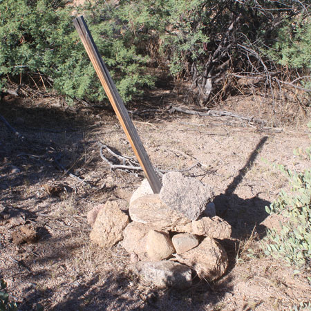
There were supposed to have been at least two other components that were established to support the location of the monument.
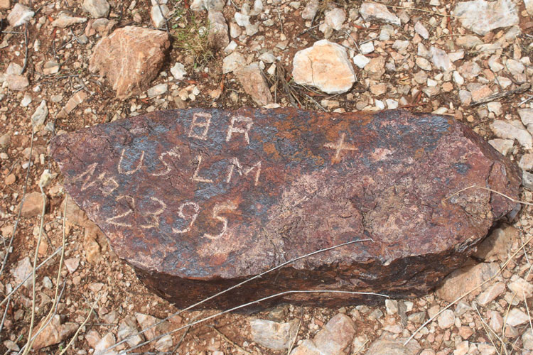
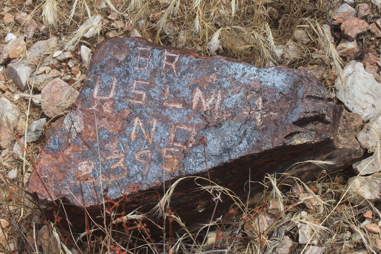
"From the monument the precise course and distance is to be taken to two or more bearing trees or rocks, and to any well-known and permanent objects in the vicinity, such as buildings, shafts, mouths of adits, prominent rocks, or the confluence of streams. Bearing trees are scribed "BT" and the bearing rocks chiseled "BR" together with the number of the location monument. The exact point on the tree or stone to which connection is made is indicated by a cross or other unmistakable mark. Bearings should also be taken to prominent mountain peaks or other landmarks and the approximate distance and direction ascertained to the nearest town or mining camp. A detailed description of the location monument, with a topographic map of its location, is to be furnished in the record of the survey."
These are the two bearing rocks that we found near the LM 2395 monument stone. Apparently, measurements were taken from the crosses on these two stones to the cross on the monument. The monument's position could be checked against these two stones if it was ever thought that the monument had been moved.
 |
 |
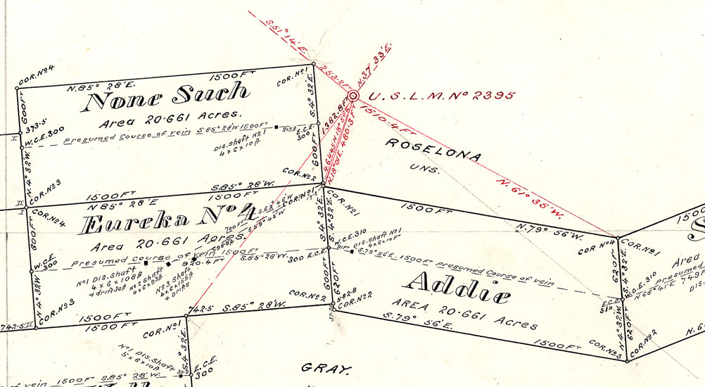
This is a section of the map that was a part of Mineral Survey 2395. The Monument stone was the reference point for the location of several mining claims. Each of the mining claims was identified by 4 corners. The location of Corner No. 1 for each of the claims was referenced by distance and direction. Corner No. 2 for each claim was then referenced to its Corner No. ! and so forth until the outline of each claim had been defined. These measurements provided the legal discriptions for each of the claims.
That this survey was conducted, indicates that the owners of the claims had met the requirements set foth by the federal government to receive outright ownership of the properties.
Once the ownership of the parcels was transferred, the patent holders were free to do whatever they wished with the properties. There are few signs today, that there ever was much mineral production from these claims. Ownership rights to the patented mining claims and homesteads was "forever". Patented mining claims and homesteads are private property. In some cases, the monuments are within the boundaries of those parcels, and in other cases, they are not. Monument 2395 is not a part of the private property of the mining claim.
 |
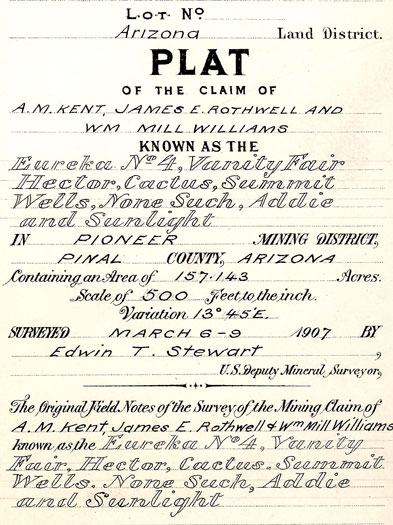
This is a section of the legend that was included with the mineral survey map. The names of the claim holders are listed. Wm Mill Williams was a prominent store owner/businessman in Globe. The surveyor, Edwin T. Stewart would go on to have a career in politics.
 |
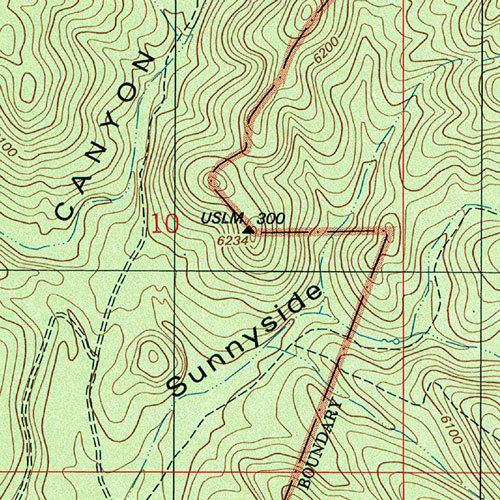
The maps of the Huachuca Mountains in southeastern Arizona show several USLM locations. This is one that is on a hill on the southside of the range near the junction of Sunnyside and Scotia Canyons.
 |
An online search showed that USLM 300 was the reference point for two Homestead Entry Surveys. HES 300 and HES 303.
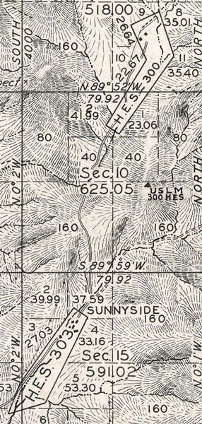 |
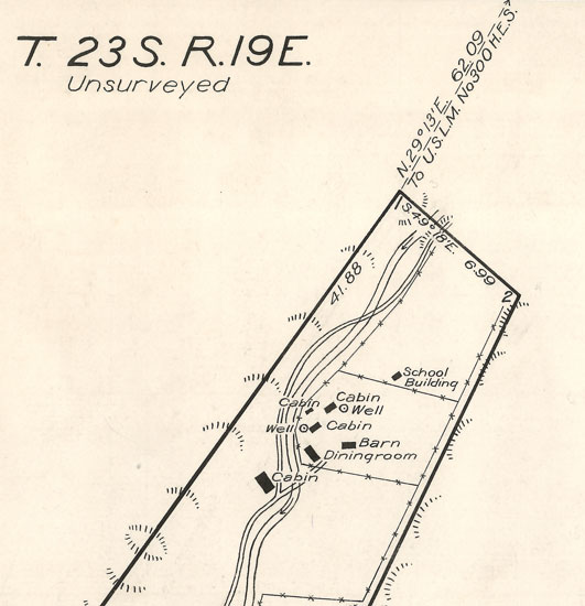
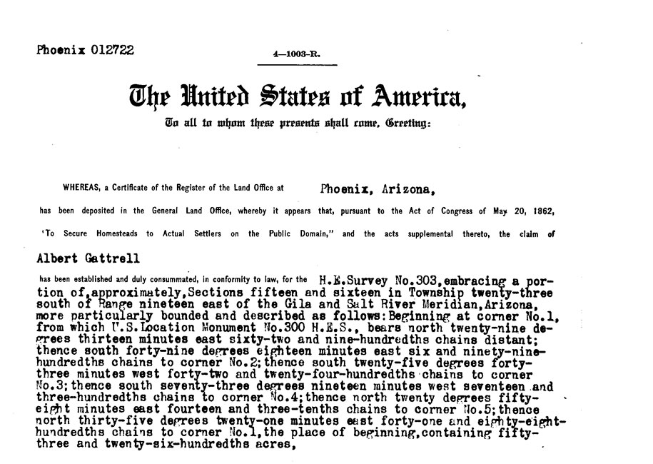
The northern section of the survey map that was created for HES 303 includes the bearing and distance to USLM 300. It was 62.09 chains from corner #1 of the homestead to the monument. With each chain equivalent to approximately 66', the monument was about 4097' to the northeast. The map shows that at the time of the survey, there was a pretty well developed camp at the homestead site. Today, the old Sunnyside Camp is a well-known ghosttown.
 |
This is a portion of the patent that was awarded to Albert Gattrell as the result of the HES 303 survey. The patent shows that Mr. Gattrell had satisfied the requirements of the Homestead Act of 1862. Mr. Gattrell was one of the founders of the Sunnyside Commune/Mine Camp. He is buried in the Sunnyside Cemetery.
 |
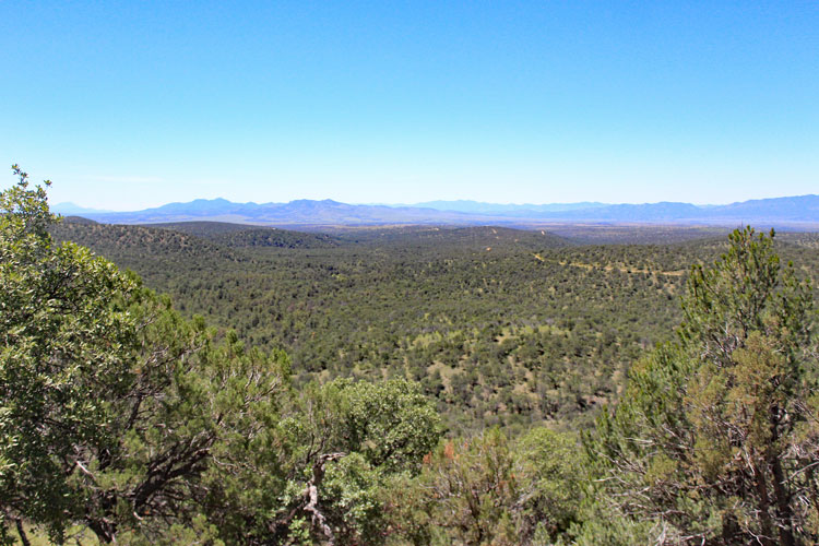
According to the modern topo map, the location monument USLM 300 was situated at the top of the hill in the distance.
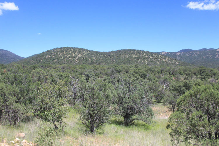 |
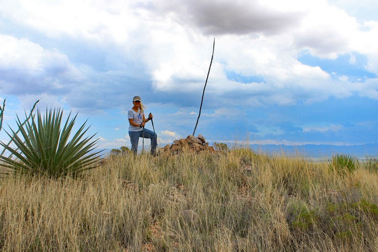
Our experience is that there are usually no trails to the monuments. A cross-country trek is often involved.
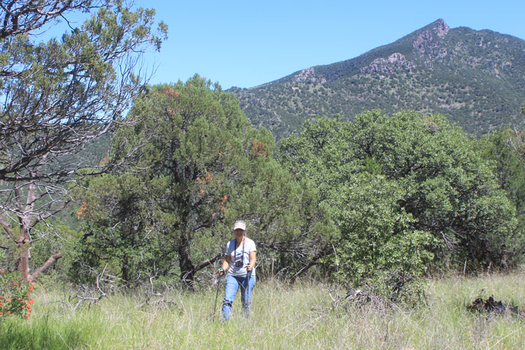 |
The cursor on our gps led us to this location as the site for USLM 300. The large mound/cairn of boulders to the right was an indication that we were at the correct place.
 |
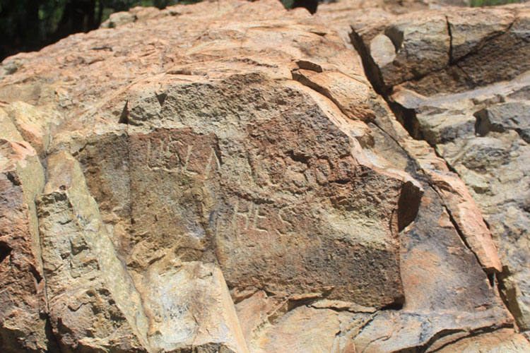
The monument markings were chisled into a flat face on the large rock outcrop.
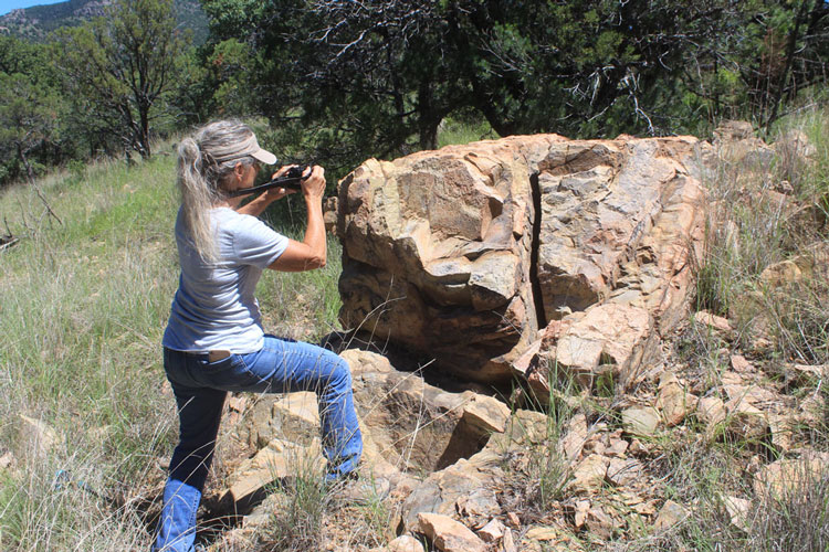 |
Although the inscription is weathered, it can still be read as "USLM NO 300 HES". We did not find a cross chiseled into the rock or a metal post that may have served as the reference point for the monument. There were no bearing rocks that were apparent.
 |
This was the view to the south towards the HES 303 homestead from near the location monument.
 |
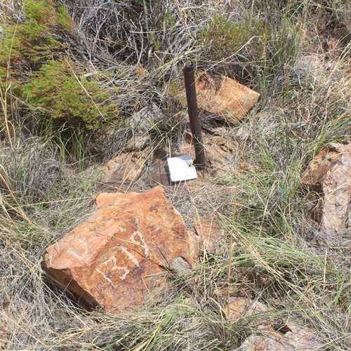
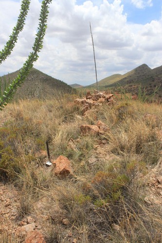
On a hilltop near Courtland in the far southeastern corner of the state is USLM 1319. This particular monument was set in 1899 as the reference point for a mining claim that had qualified for patented status.
 |
In this case, the monument's reference point was an iron pipe set into a rock formation. The markings "USLM 1319" were chiseled onto a stone near the pipe. The metal tag that is attached to the pipe is a modern surveyor's confirmmation that this is USLM 1319.
 |
 |
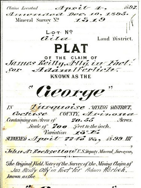
This section of the 1319 survey notes that the mining claim was first located in 1892. The name of the claimholder and the claim are also noted. The survey was conducted in 1899. What is interesting is the name of the surveyor, John A. Rockfellow. Mr. Rockfellow, was a very prominent citizen in the early days of Cochise County. In addition to doing survey work, he was a rancher, university professor and author. Rockfellow Dome at Cochise Stronhold is named for him.
 |
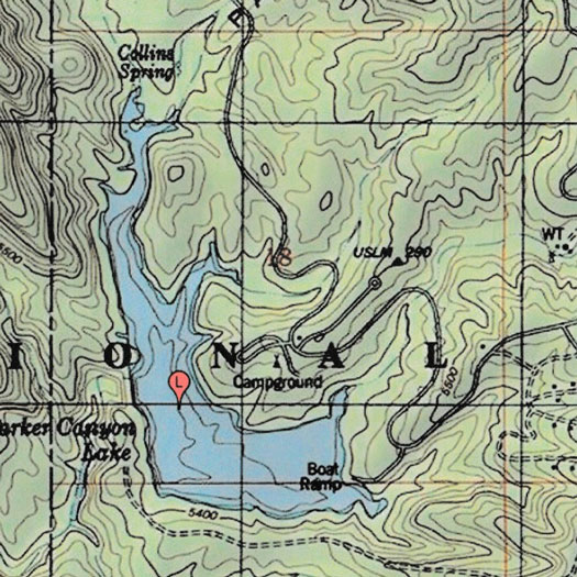
Not all of our searches for location monuments have been successful. Maps show USLM 290 near the campground at Parker Canyon Lake south of Sonoita. We have searched for it on two different occasions with no luck. Established around 1917 as the reference for a Homestead Entry Survey, there is no sign of the monument visible today. Perhaps its position has been incorrectly placed on the map?
 |
I use this BLM webpage, The Official Land Records Site , to research the histories of the surveys associated with the location monuments. The maps, and patents associated with those features can be found here.