 |
Two North
Rim Grand Canyon Sites That are Open Year Round--
Toroweap Overlook And The Nampaweap Petroglyphs
|
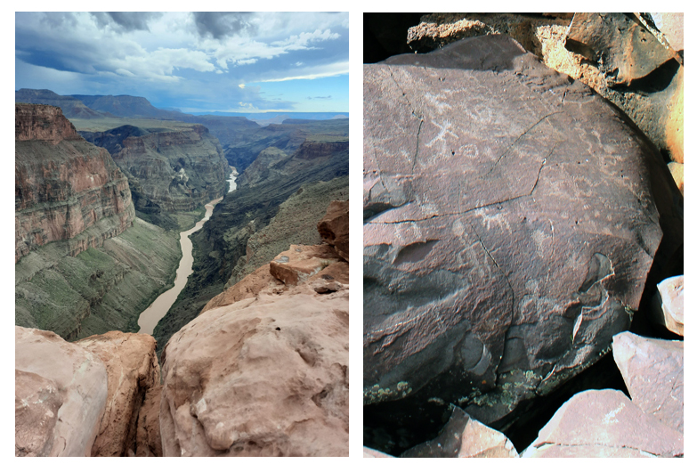
Toroweap Overlook and the Nampaweap Petroglyphs are located on the North Rim of western Grand Canyon approximately 70 miles southwest of Fredonia. The overlook is known for the dramatic views that can be had down into the Inner Gorge of the Canyon, and the petroglyphs are said to be the largest collection of rock art symbols on the Arizona Strip.
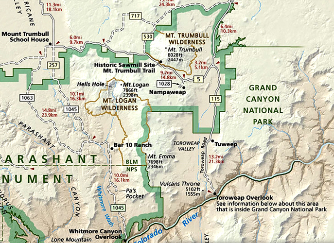
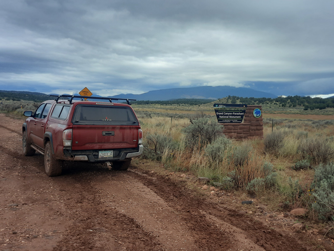
The two sites are shown on this section of the Visitor's Brochure for the Grand Canyon-Parashant National Monument. I downloaded the entire brochure and used it with Avenza to navigate while we were on a trip to the area. The brochure and other regional maps can be found here.
 |
While many of the roads in the eastern part of the North Rim are closed to vehicular access during the winter season, quite a few of the roads in the western portion of the Grand Canyon are kept open. Sections of the western roads may become impassable after stormy weather, however, and travelers should be prepared to deal with those situations.
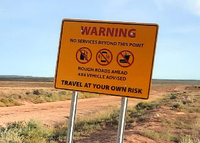
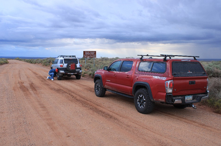
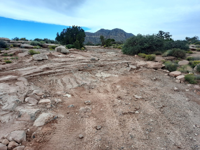
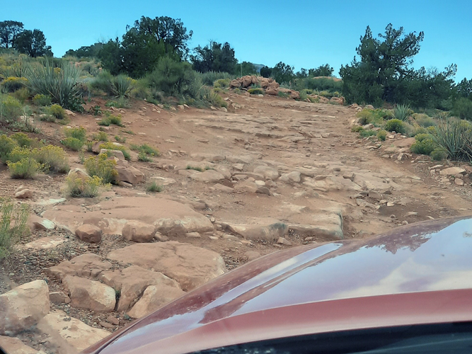
It is not easy to get to Toroweap Overlook in the best of conditions. Each of the three possible routes involves many miles of travel on unpaved roads. 4WD is strongly recommended for the last few miles to Toroweap.
The route that is usually the most reliable begins off Highway 389 approximately 8 miles west of Fredonia. The road is known by several names--"Sunshine Route", Mount Trumbull Road, Antelope Valley Road, Mohave County Road 109.
Road signs near the turn-off warn that the area is remote. The National Parks websites suggest that vehicles should be high clearance, and tires should be of the "All Terrain type, not "Street" tires. Food and other supplies should be brought along in case there is a delay in travel plans.
 |
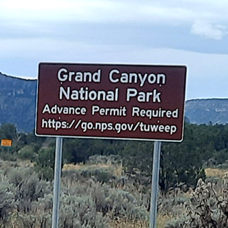
Before traveling to Toroweap Overlook, it is important to know that Day Use Tickets are now required to enter Grand Canyon National Park at Toroweap. Those permits must be acquired in advance. They are not available at the overlook. In addition, an entrance pass to the park is also required. A limited number of permits are distributed each day. Those people who have camping permits at the campground are not required to have the day use permits. Info and permit applications can be found here.
 |
 |
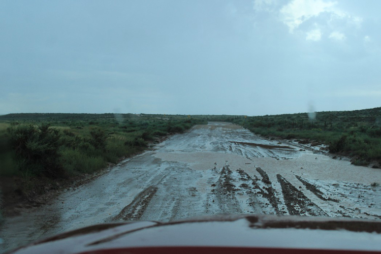
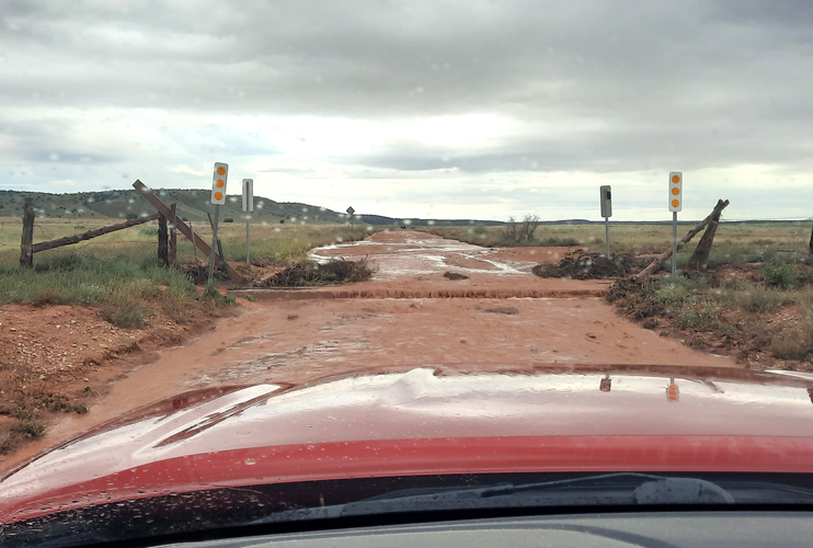
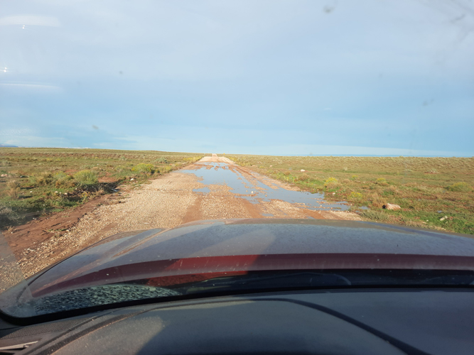
It was a rainy day in October when we made the trek to Toroweap. The weather and road conditions were of concern. But, we had come from southern Arizona and were not willing to forego the trip to the overlook without at least giving it a try. We had two 4wd vehicles and plenty of gas and other supplies. The decision was made to forge ahead and see what happened. Fortunately, none of the washes crossing the road were running when we passed by. It was the cattle guards that were the major issue. Runoff that had collected on their uphill sides formed deep pools that were of concern. Travelers ahead of us had bypassed the deepest one so we followed in their tracks. We were lucky that the mud never clogged up our tires enough for us to ever lose traction. The drive turned out to be rather uneventful.
 |
 |
 |
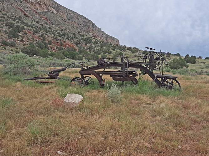
At the ranger station at Tuweep, the permits that my friend had made the arrangements for were checked and found to be in order. OHV vehicles are allowed if they are licensed as "street legal" and have proof of insurance. This old pull type grader is parked near the ranger station.
 |
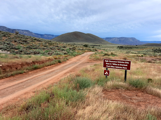
The rain stopped before we got to the overlook. The main road drained off very nicely. At 2.7 miles from the overlook, this sign encouraged low clearance vehicles to park. This is a pretty serious sign. The road got much rougher beyond this point. I engaged 4wd low, so that I could ease my way over some of the boulders and rocky steps.
 |
 |
 |
It is the spectacular views that are the major attraction for people to come to Toroweap Overlook. There are only a few viewpoints in the Park where there is a direct view down into the Inner Gorge and the Colorado River. This is a view upstream to the east from Toroweap Overlook. There are no fences or other barriers to keep people back from the edge.
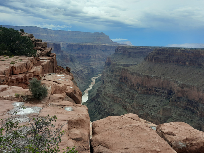 |
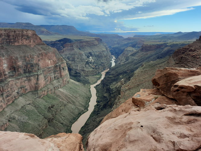
This is the view of the Inner Gorge to the west of Toroweap Overlook. The vertical drop to the river here is reported as being approximately 3000'.
 |
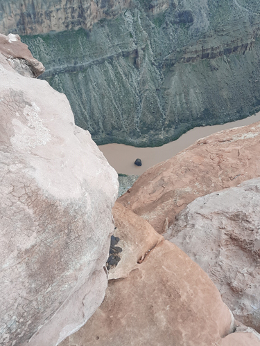
I no longer have the nerve to get as close to the edge of the canyon rim as I used to, but this view of the rock in the river known as Vulcan's Anvil shows how close to vertical the drop is from the overlook.
 |
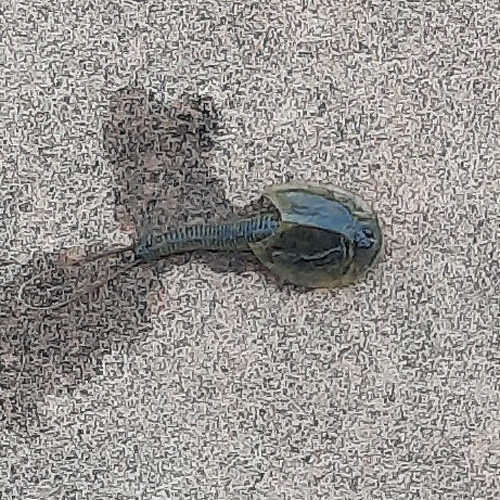
This was my 3rd trip to Toroweap and as on the other trips, I really enjoyed the scenery. But what made this trip really interesting was what we found going on in some of the potholes in the rim rocks that were nearby. At first we thought that the critters that were swimming around were tadpoles.
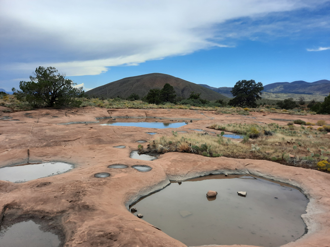 |
This was the type of critter that was in the potholes. They were definitely not tadpoles. We had never seen anything like these before! It was not until we got back to civilization, that we learned that these were Tadpole Shrimp. Apparently, they grow from eggs that may have lain dormant for years in the dry sediment of temporary water sources like potholes. When wet, the eggs hatch into these creatures. They are omnivores and have a life span of several weeks.
 |
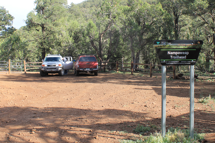
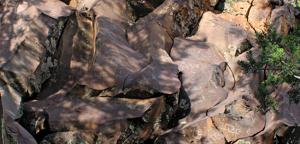
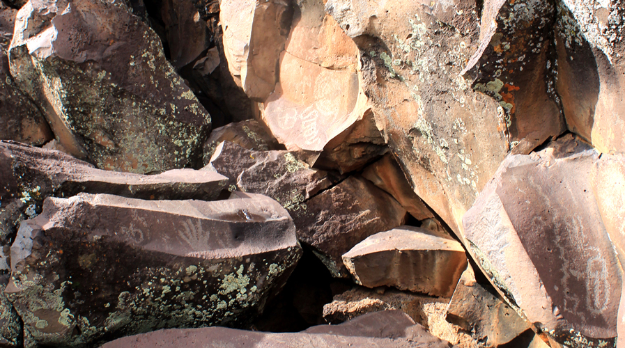
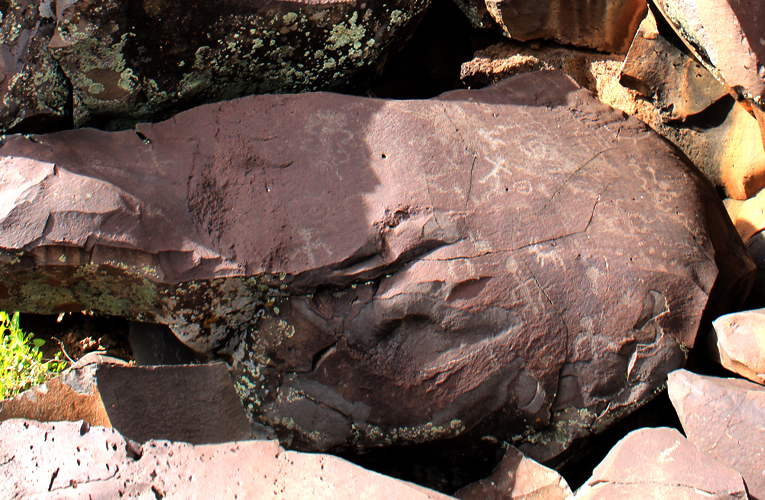
The Nampaweap Petroglyph site is located just outside of Grand Canyon National Park a few miles northwest of Toroweap Overlook. It is a site that is managed by the BLM. We traveled there later on in the day that we had been to Toroweap. The Mount Trumbull road was a bit more messy than the Toroweap road had been.
A short spur road off the Mount Trumbull Road provides the access to the trailhead for the 3/4 mile walk to the petroglyphs. At the parking area for the trailhead, there are restrooms and information kiosks. A well developed trail leads to the petroglyphs which are located on basalt boulders that have fallen into a shallow canyon.
 |
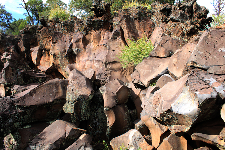
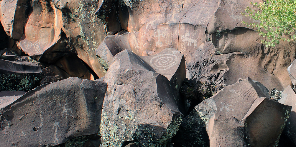
The word "Nampaweap" is a Paiute term that translates as "Foot Canyon". The canyon may have been an ancient corridor for travel between the Grand Canyon and the forests of Mount Trumbull which is not far away. There may have been several cultures involved in the creation of the petroglyphs. The oldest may date back 15,000 years.
There are many human and animal like figures depicted. Modern settlers called the canyon "Billy Goat Canyon" from their interpretation of some of the figures.
 |
 |
 |
 |
 |
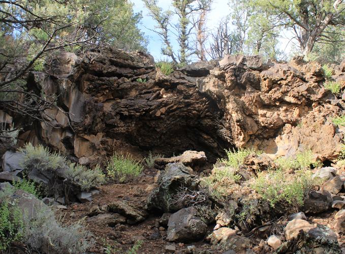
This may have been a part of a lava tube that was exposed by the erosion of the canyon.
 |
We traveled to the two sites as a day trip. It was a very long day with more than 120 miles of dirt road travel involved. Fortunately, the weather cleared and the travel conditions were much less intimidating on the way out.
 |
| Trips |
| Home |