 |
An
Alternate Route to Point Sublime,
North Rim, Grand Canyon
|
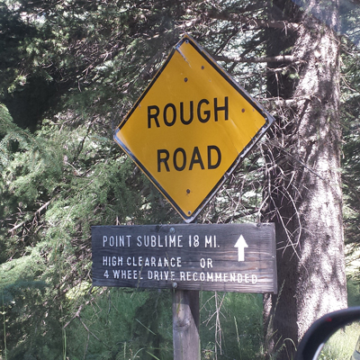
Point Sublime is one of the outstanding viewpoints on the North Rim of the Grand Canyon. The attraction for many people is the backcountry travel necessary to get there. The normal access route is an 18 mile dirt road for which four wheel drive is suggested. This is the sign near the start of that Point Sublime Trail.
 |
I am going to suggest an alternate route that will replace the first 12 miles of the Point Sublime Trail. It begins farther north than the traditional trail. There are several turns to be made, but the roads are well marked. Entrance to Grand Canyon National Park is through a simple backcountry gate, rather than a developed entrance station. Along the way there is the opportunity to investigate the Kanabownitz Fire Lookout Tower and Cabin. Approximately 8 or 9 miles into the Park, this alternate route intersects the Point Sublime Trail to continue on out to the viewpoint.
When my wife and I were in the area in August, we drove the Point Sublime Trail to Point Sublime. We exited the area on the alternate road. We enjoyed that leg much more than the traditional road. If I were to repeat the trip, I would not drive the standard route from Widforss Trailhead to the Crystal Canyon overlook again. I did not find it that interesting. The alternate route was much more so.
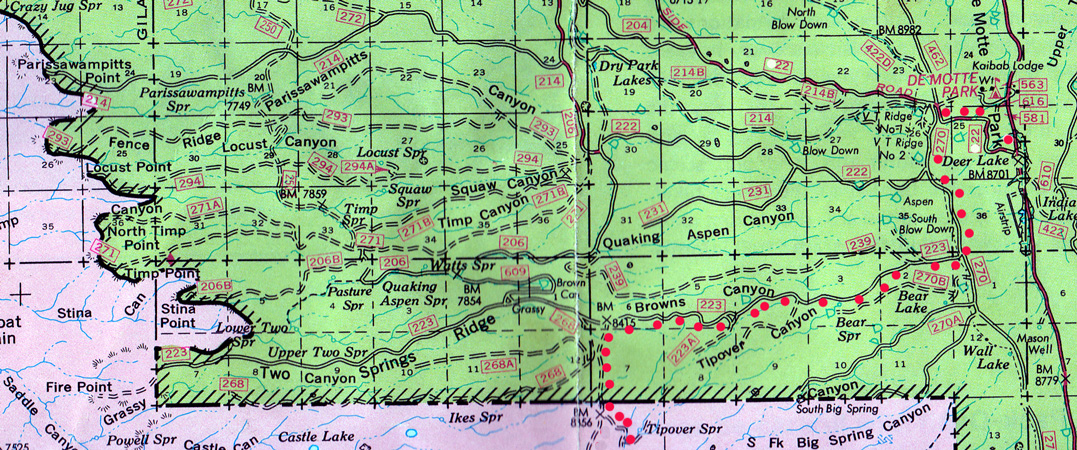
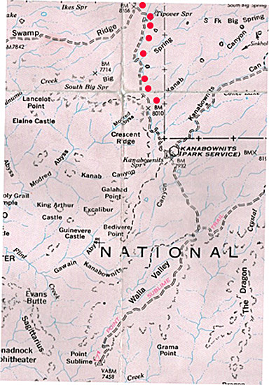
The alternate route begins south of the Demotte Campground along Highway 67. The turn-off is to the west on Forest Road 22, an all-weather road. As indicated by the red dots on the map below, appropriate turns onto the 270, 223, and 268 roads lead to the backcountry entrance of the National Park. It is not marked on this map, but the road into the park is 268B.
I am not sure how the road is identified once inside the park, but it may be known as the Kanabownitz Road.
 |
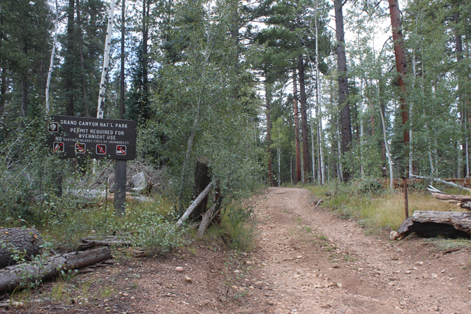
This is the 268B gate into the park. We used this gate on two different excursions. The other trip was to Swamp Point and Teddy's Cabin. The report for that trip can be found here.
 |
Just a short distance into the park, the road forks. The right fork goes to Swamp Point, the left goes to Kanabownitz Lookout and on to Point Sublime. We saw two small signs at the fork, but they did not seem "official". Neither did they appear very sturdy or permanent.
 |
It is approximately 5 1/2 miles from the park boundary down to the spur road to the Kanabownitz Lookout tower. It is not easy to spot the turn to the lookout. The road does not appear to be well traveled. There are no signs. I do not believe that the lookout is visible from the main road.
 |
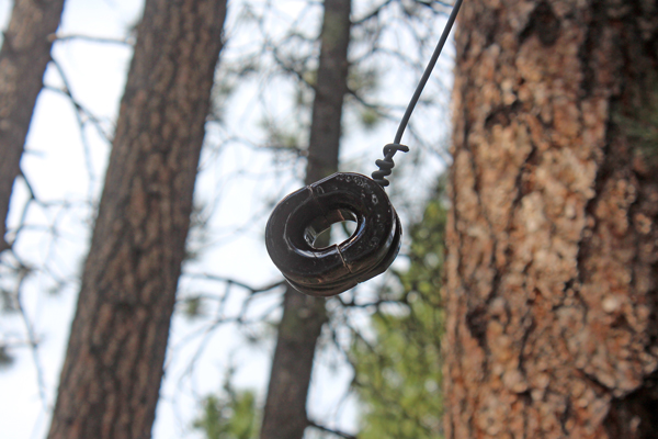
Along the road to the tower, we noticed several insulators hanging in the trees. This type of insulator was used to support communications lines to forest stations. Our guess was that the insulators once supported a telephone line that ran from the lookout to the lookout cabin a short distance on down the main road.
 |
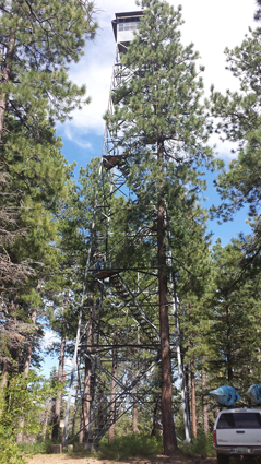
The Kanabownitz Lookout is not clearly visible at the end of the approach road. It is necessary to walk to another side of the structure to gain an unobstructed view. The tower co-ordinates are N36 17.441 and W112 12.705
 |
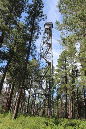 |
The lookout is no longer active. It is listed on the National Historic Lookout Register. Built in 1940 by the CCC, the structure is a 82' 6" tall International derrick tower. The cabin at the top is 7' x 7'.
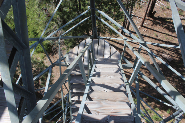
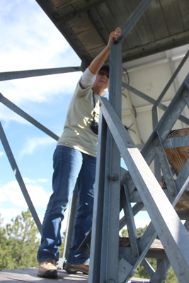
The steps up the tower were accessible. I was somewhat hesitant to climb the tower when I saw the wooden tread pieces. My wife was enthusiastic to see what the views were like, so up we went. From my younger days climbing around on underground mine ladders I knew to keep my feet to the very outside edges of the steps
 |
The floor hatch into the cabin was locked.
 |
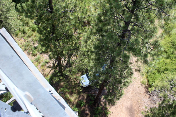
The views out from below the cabin were not great. The trees were too tall. If this lookout was to be put back into service there might have to be some tree trimming done. There were great views looking straight down...
 |
We were pretty cautious on our descent of the tower. Once back to the main road, it was not far down to the Kanabownitz Cabin. There we put one of the old tables to use.
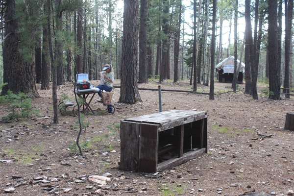 |
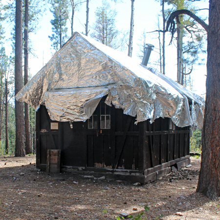
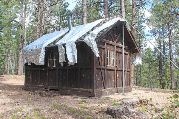
The cabin seemed in good shape. It was shedding its protective foil covering. There must have been a recent fire threat. I assume that it dates back to 1940, the year that the tower was constructed? I wondered why it was not built closer to the tower. Kanabownitz Spring is not far from the cabin. Perhaps that was the reason for the cabin having been located here.
 |
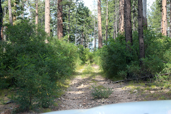
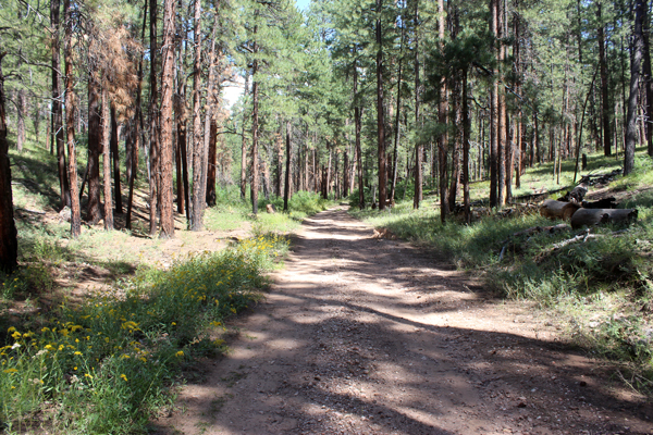
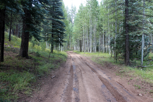
On the day that we drove the Point Sublime Trail and the "Kanabownitz Road", there were a couple of issues with mud on the Point Sublime Trail. Nothing of consequence presented itself on the Kanabownitz Road. The photos below were typical of the road conditions on that road on that particular day.
 |
 |
From the area of the Kanabownitz cabin it is approximately 3 miles down to the intersection with the traditional Point Sublime Road. There is a really neat viewpoint about 1/2 mile down that trail. The views from there are of Crystal Canyon with the ridgeline of Point Sublime on the right.
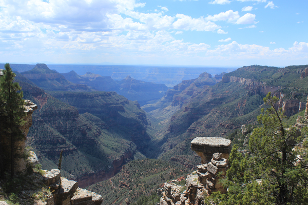 |
For some folks, the rock platforms at the canyon's edge are just too irresistable to stay off of.....
 |
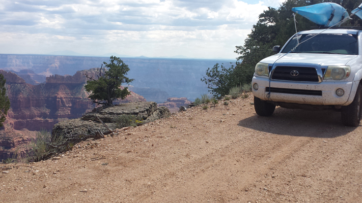
From the intersection of the two roads, it is about 6 or 7 miles onto Point Sublime. Near the point, dramatic photos can be created. The road in at least one location comes very close to the canyon's edge.
 |
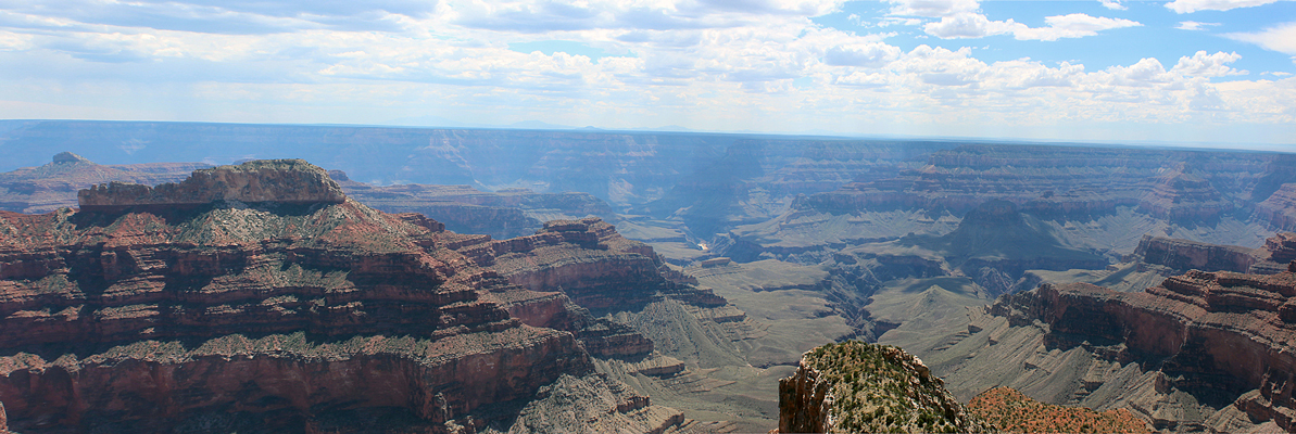
Point Sublime is at the end of a peninsula that juts out into the Canyon. Except for the piece of land that makes up the point, the views are nearly full circle. The Colorado River is just visible in the center in this photo.
 |
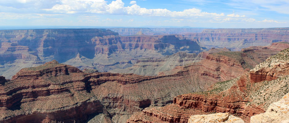
This is looking a bit more to the west of the photo above.
 |
Charles Wells in his book "Guide to Arizona Backroads & 4-Wheel Drive Trails has a description of the drive to Point Sublime along the Point Sublime Trail. He mentions an alternate route, but states that he had not driven it. He warned that it could be a more difficult route.
This report is a description of that alternate route. On the day that we drove it, the road was a more maintained condition than the Point Sublime Trail. We also thought that it was a more scenic route.