 |
Road Trip
Utah:
Sego Canyon Petroglyhs and Sego Ghosttown
|
While on an extended road trip through southeastern Utah and Colorado, we spent one night in Moab. With the information that we found in the Utah edition of Moon Handbooks, we were able to put together a loop ride out from the town that turned into one of our better excursions.
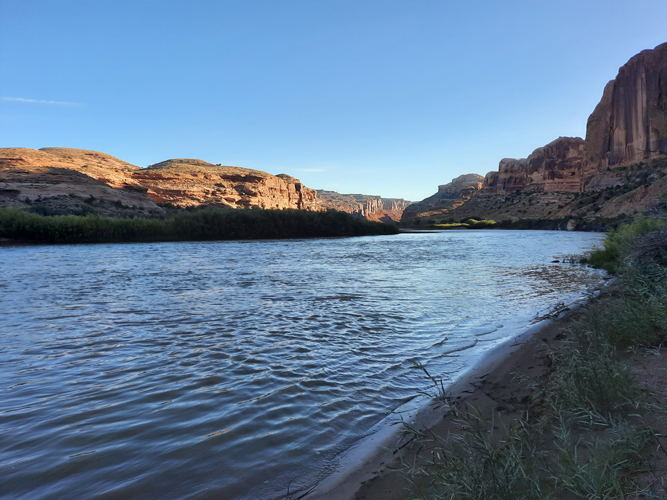
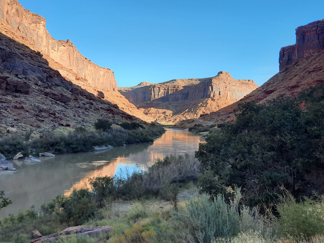
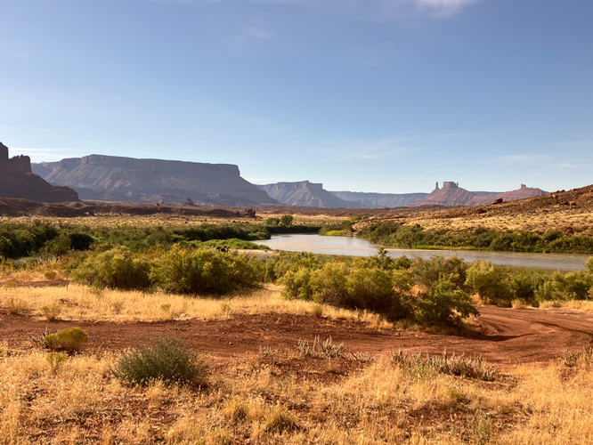
Our adventure began on Scenic Byway 128 which turned off Highway 191 approximately 2 miles north of Moab. This very scenic route followed along the Colorado River for approximately 30 miles. There, at the Dewey Bridge, the road crossed the river and turned northwest to Interstate 70.
There were many places along the road to pull over and walk down to the river. The Moen book described several backcountry roads that could be driven away from the highway. We did not have the time to explore any of those.
 |
 |
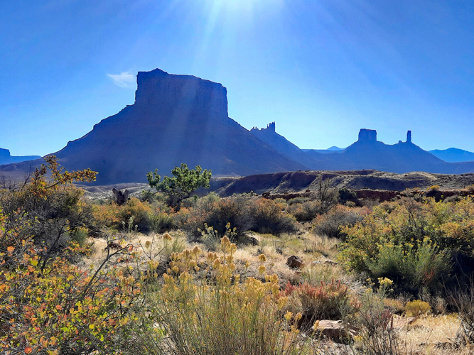
The Fisher Towers are a well-known landscape feature that are visible from the Byway.
 |
 |
It was approximately 15 miles from the Colorado River crossing at Dewey Bridge northwest to Interstate 70 west of Cisco Utah. At I70, we hopped on the Interstate and traveled west about 25 miles to the Thompson Springs Exit. The speed limit on the Interstate was 80 mph. Thompson Springs Road was the access to Thompson Canyon and the Sego Canyon Petroglyph site.
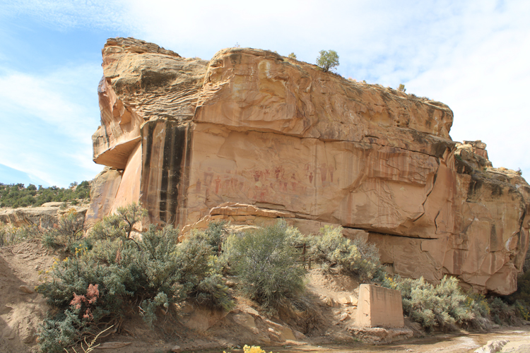
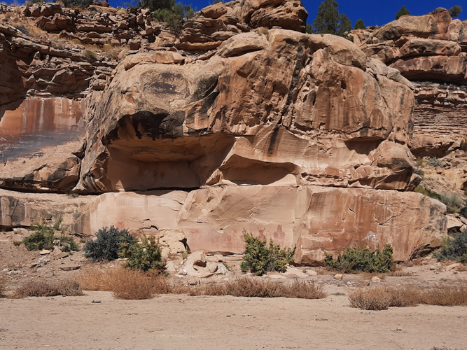
The road is paved as it crosses the tracks, but soon turns to dirt. The BLM has created a small parking area with a restroom at the Petroglyph site approximately 3.5 miles up Thompson Canyon from the Railroad Crossing. A large petroglyph panel on a cliff face is visible from the parking area.
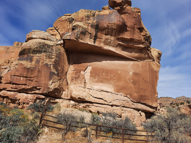 |
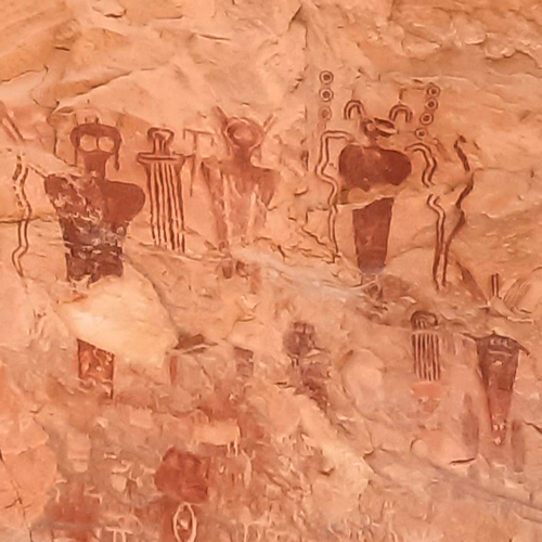
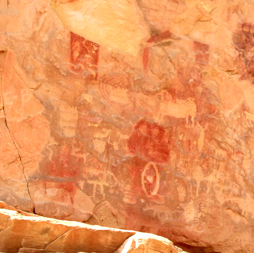
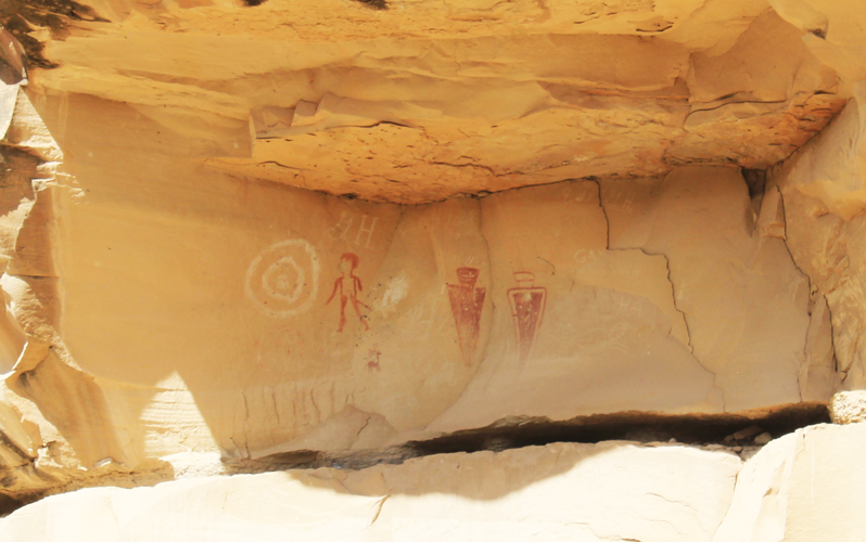
The panel, which today looks pretty inaccessible, is made up of both petroglyphs and painted pictographs. According to the guidebook, the stylized human figures that were made from geometric designs are newer in age than the painted forms. This "Fremont" style may date back only a thousand years ago. The painted forms, which are identified as the "Barrier Canyon" style, may date back 8000 years.
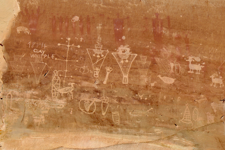 |
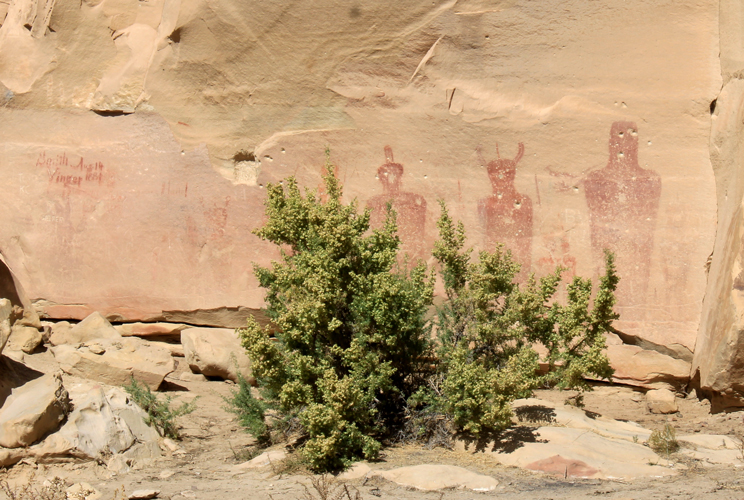
Around the corner to the north on the same rock formation was a second panel. The figures displayed here were some of the most amazing and unusual that we had ever seen.
 |
This was the description of the figures in the guidebook:" The ancient Barrier Canyon figures are typically horned ghostlike beings that look like aliens from early Hollywood sci-fi thrillers." We wondered what had been the "inspiration" for the artist/artists who had created these forms?
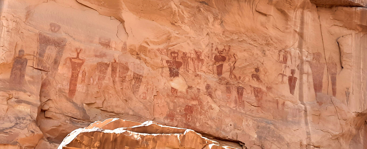 |
It is not really evident in the photos, but there were quite a few petroglyphs scattered amongst the painted figures.
 |
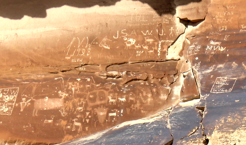
Across the road to the north other petroglyphs and pictographs could be seen on the rock faces. Those areas, however, were on posted private property and were not accessible for a closer viewing.
 |
It appears that at some point in time that several of the figures had been used for target practice.....
 |
 |
 |
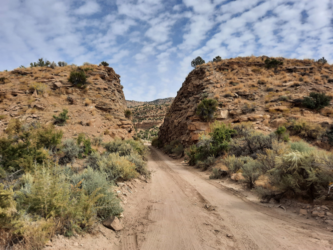
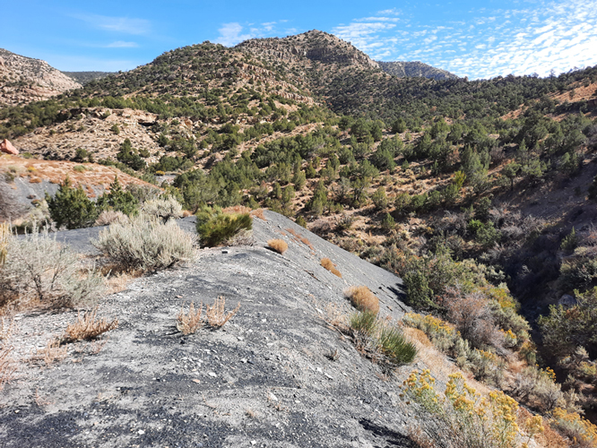
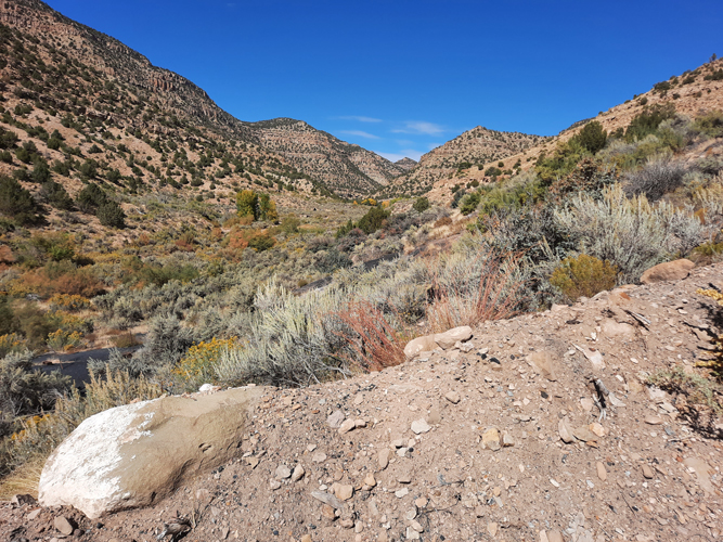
A short distance north of the Sego Petroglyph Site, a right turn takes one into Sego Canyon. Here the road bed follows the route of an old railroad line that used to run from Thompson Springs to a coal mine in Sego Canyon.
 |
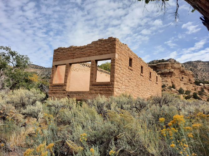
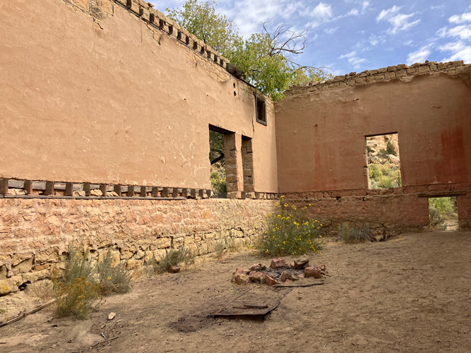
This ruin was once the store in the town of Sego. The name comes from Utah's state flower, the Sego Lily, which grows in the canyon. According to the Moon guidebook, the town was founded in the early 1900s when coal was discovered in the canyon. The population reached a peak of approximately 500 residents. Production at the mine lasted until the 1950s when the demand for coal lessened because of the railroad companies switch from steam locotomotives to diesel engines. The town was sold for salvage.
 |
In this view, it can be seen how the rafters and floor joists were carefully sawn through to salvage the materials.
 |
There are ruins and foundations of other buildings nearby.
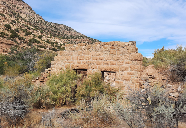 |
This ruin was once a two story boarding house where bachelor miners could stay. Apparently, this building was still standing a few years ago.
 |
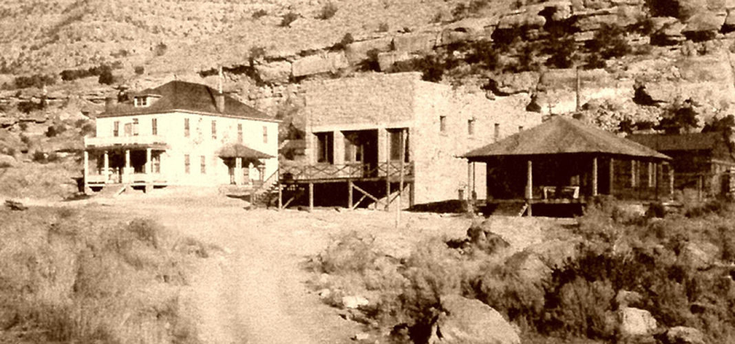
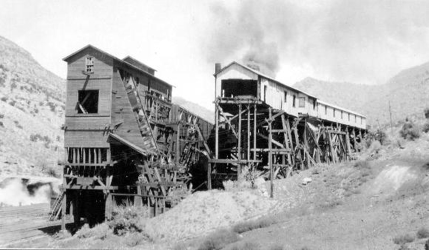
This vintage photo shows the boarding house and the company store at Sego.
 |
North of the townsite are the dumps of the coal mine. The railroad tracks use to run to this location.
 |
In this 1926 USGS photo, some of the coal processing facility that was at Sego is shown.
 |
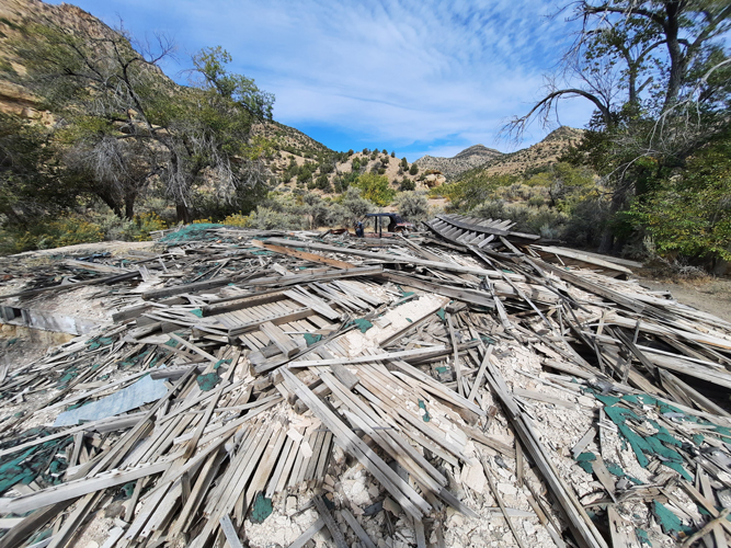
The processing facility is long gone....
 |
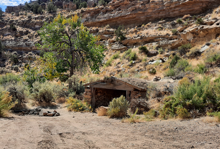
A dugout that was seen along the way.
 |
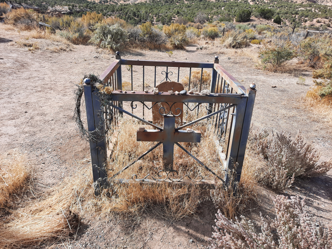
Located between the Sego Canyon Petroglyph Site and the old townsite is the Sego Cemetery. Many of the grave sites here are unmarked. Some have wooden crosses. There are a few with headstones.
 |
After our very interesting day visiting the petroglyph site and the old ghosttown, we returned to Interstate 70 and traveled west a short distance to Highway 191 to return to Moab. This had been a great day.