 |
A
Backcountry Ride across the Raymond Wildlife Area and the Flying
M Ranch
of northern Arizona
|
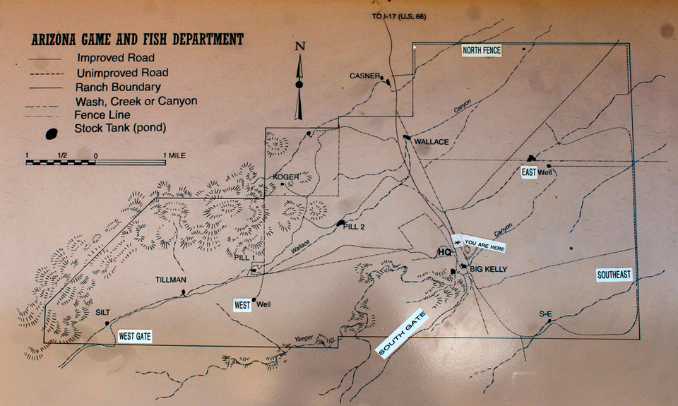
The Raymond Wildlife Area is located south of Interstate 40 between Flagstaff and Winslow in northern Arizona. The wildlife area is best known for its resident buffalo herd but also provides habitat for pronghorn, deer and elk. The nearly 15,000 acre property is owned by the Arizona Game and Fish Department and is open to the public for wildlife viewing, hiking, camping and hunting. Detailed information on the refuge can be found at this AZGFD site.
A trip to the Raymond Wildlife area can be extended beyond the area's boundaries by continuing south of the refuge onto the Arizona State Trust Lands and private lands controlled by the Flying M Ranch, a large cattle raising operation. Through an agreement with Arizona Game and Fish, hunters and recreationists can enter the ranch property to drive, hike, camp and hunt. Permits are required, and can be downloaded online. It is necessary to have those permits in your possession while on the ranch. A listing of the rules, a detailed map of the ranch, and the procedure for downloading the permits can be found here.
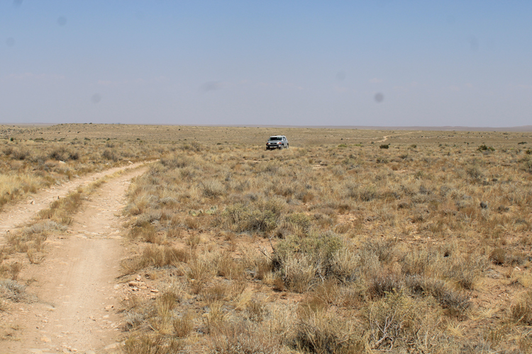
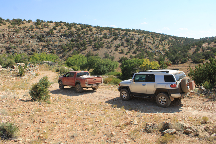
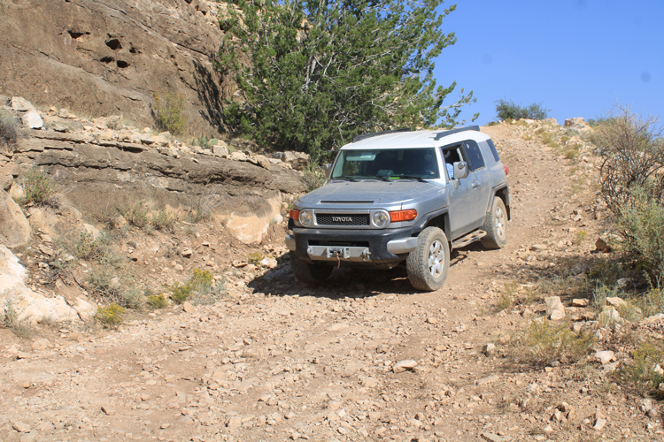
Two friends and I spent two days in September of 2020 driving across the Buffalo Range and the Flying M Ranch from Interstate 40 to Chavez Pass Road(Meteor Crater Road). The distance is around 20 miles. Over the years, I have been on this ride 3 times. It was on this most recent trip that I encountered the first people that were not a part of my group. We crossed paths with a ranch employee and two elk hunters. This does not seem to be an often traveled route.
 |
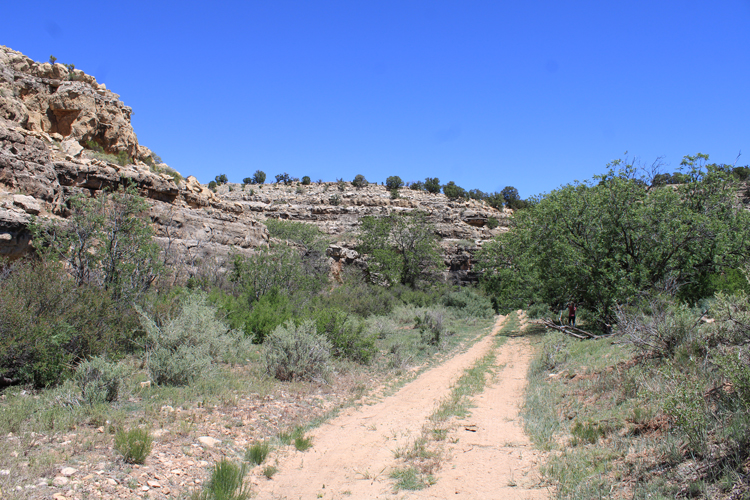
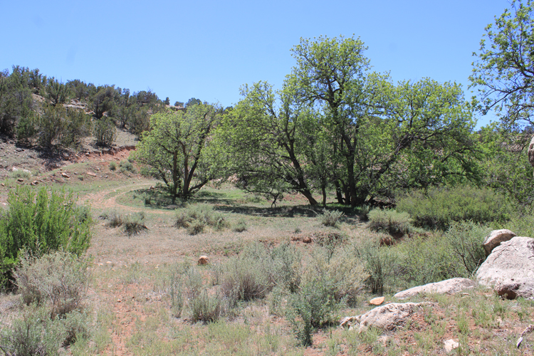
The habitat at the Raymond Wildlife area varies from grassy plains to juniper/ pinyon pine woodlands. Elevations vary from 5,000' to 6,000'. The terrain is gently sloping, but there are occasional deep, steep sided canyons to cross. The roads are primitive. There has not been a lot of human development out here. Clear nights are filled with stars.
 |
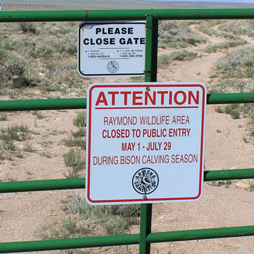
There is a time during the year when the Raymond Wildlife area is closed to the public. During the Bison Calving Season, which runs from May 1 to July 19, the range is closed to the public and the various perimeter gates are locked. My wife and I once arrived at one of those gates a week too late and had to turn back. This was not an issue when we were here in September.
 |
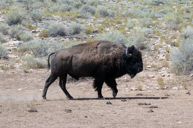
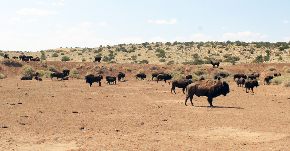
The caretaker for the refuge was away on an elk hunt when we arrived at the refuge, so we were not able to get any information on where to go to see the buffalo. Fortunately, as we headed across the range to the South gate, we came across several of the animals just beyond the headquarters. The group ran off when they spotted us, but seemed reluctant to leave their water source at an earthern water tank nearby. We were able to get quite a close look as we passed by. There were about 20 of the creatures, which may have been about 1/3 of the herd based at the wildlife area.
 |
The bison are described as being "pure" animals with no cattle DNA. They are transplants/descendants from a large Wind Cave herd in South Dakota.
 |
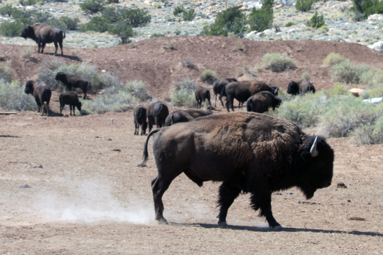
The fellow nearest the camera did not appreciate our presence. While he never charged in our direction, he aggresively pawed the ground to let us know to keep our distance.
 |
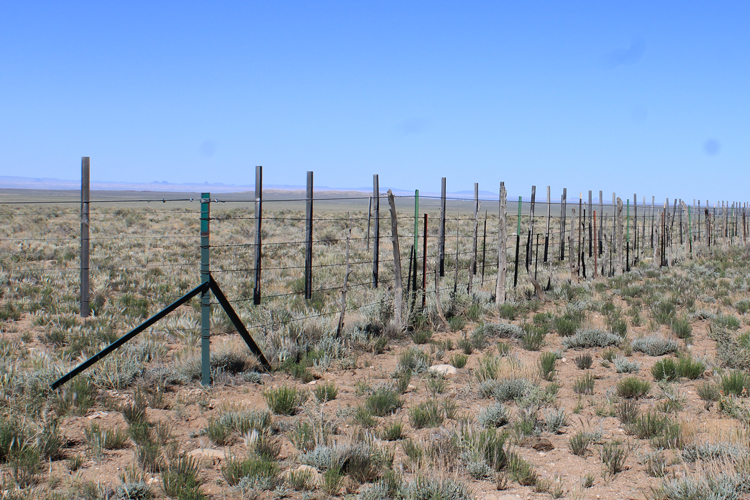
This was the nature of the perimeter fence near the South Gate. There did not have to be any signs to let one know that there was something big and strong on the inside!
 |
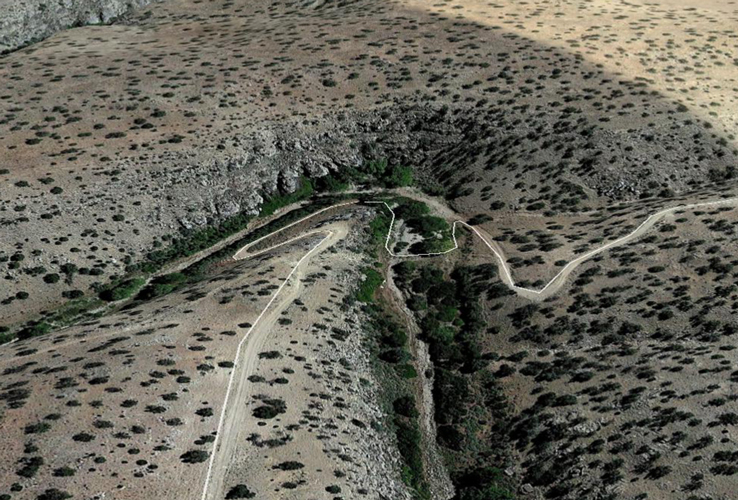
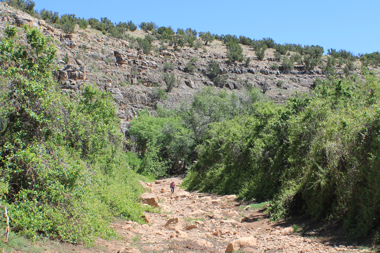
Two highlights of the route across the Flying M Ranch are the road crossings at Grapevine and Diablo Canyons.
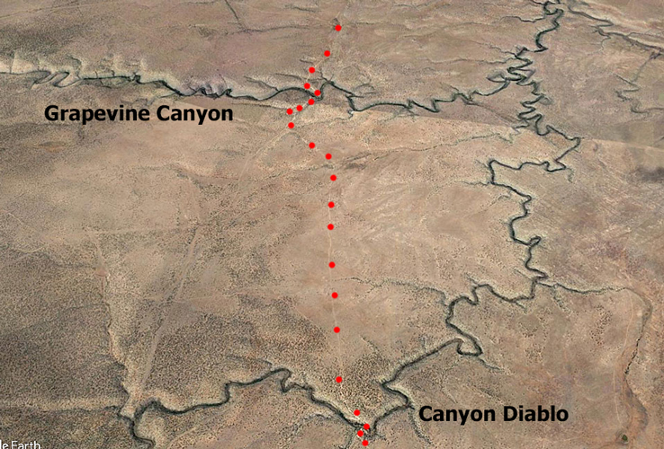 |
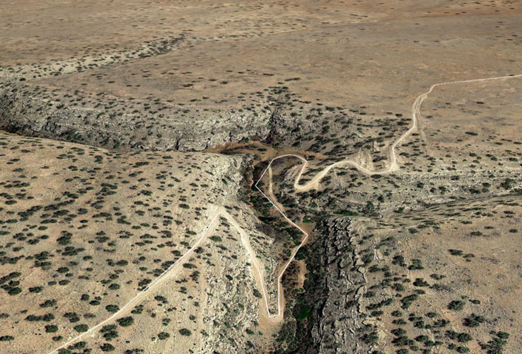
This is the Google Earth View of the road across Grapevine Canyon. We have been told that the road is now in much better shape than it used to be.
 |
 |
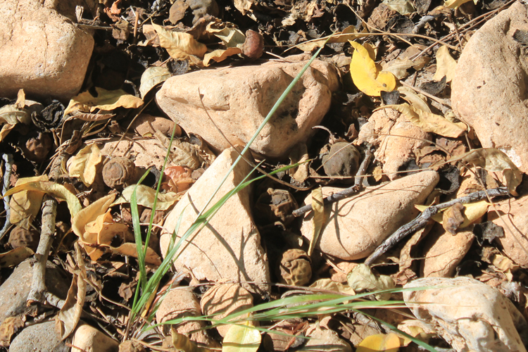
There are very large Black Walnut trees growing in Grapevine Canyon.
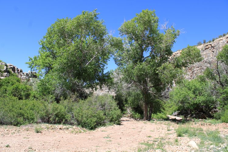 |
The trees provided shade for a quick break and walnuts for a nice snack.
 |
 |
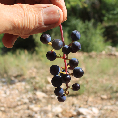
Grapevine Canyon may be the most appropriately named place in the area. Grapevines cover both sides of the canyon for hundreds of yards.
 |
In September, there were still a few grapes on the vines.
 |
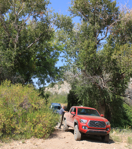
The crossing of Canyon Diablo was a bit more challenging. I used 4wd to be able to more slowly handle the loose material in the road and to be able to ease over several rocky ledges. Downstream, Canyon Diablo is a formidable canyon. The crossing here is one of the few along its length.
 |
 |
 |
As in the bottom of Grapevine Canyon, there were large walnut trees in the bottom of Canyon Diablo.
 |
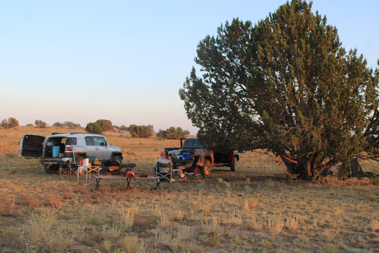
Our trip through the Raymond Wildlife Area and the Flying M Ranch was a part of a longer trip. Since we were on the move every day, our camps were kept very simple. Two of us slept on cots out in the open. Night time temps were in the high 40s.
 |
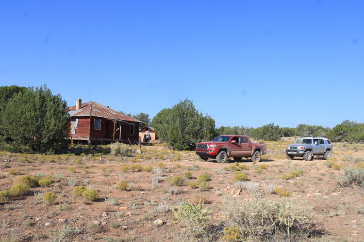
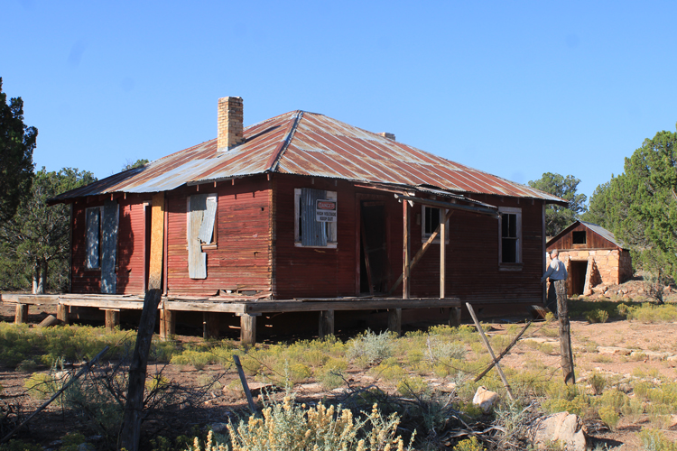
These buildings were once part of an early homestead/ranch. On early maps, this location was known as the "Milburn Place". On more modern maps, the location is identified as "Melbourne Dam".
 |
 |
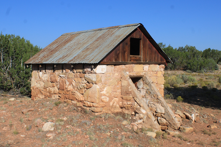
Was this once a root cellar?
 |
From the Milburn homestead, it is not a far distance out to the more heavily traveled Chavez Pass Road. We traveled that road south to eventually breakout on Highway 87 near Clint's Well. That country was filled with hunters and recreationists---very different from the empty country that we had just experienced.