 |
A Backcountry excursion to several coves on Lake Mohave southeast of Nelson Nevada
|
In the fall of 2020, while on a road trip to northwestern Arizona, we spent a day at the northern end of Lake Mohave on the Colorado river. We had been to the southern part of the lake in 2016 and were intrigued by the Google Earth views of the northern half with its many coves. We thought that those might be interesting to explore in our kayaks. The easiest access was from the Nevada side of the lake through the small community of Nelson Nevada.
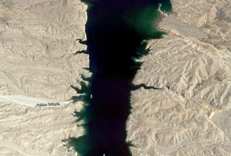
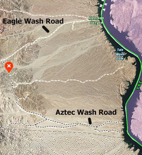
This is a Google Earth view of the lake near Aztec Wash southeast of Nelson Nevada. The wash was one of the points of interest that we wanted to check out.
 |
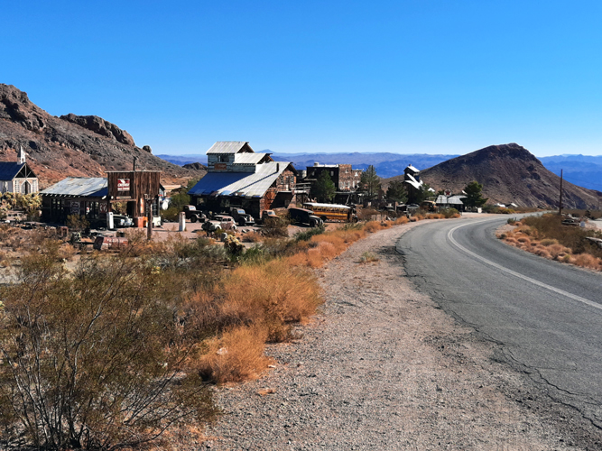
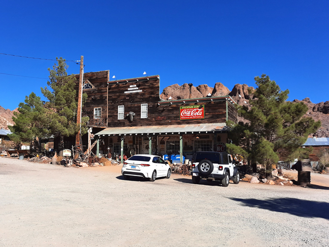
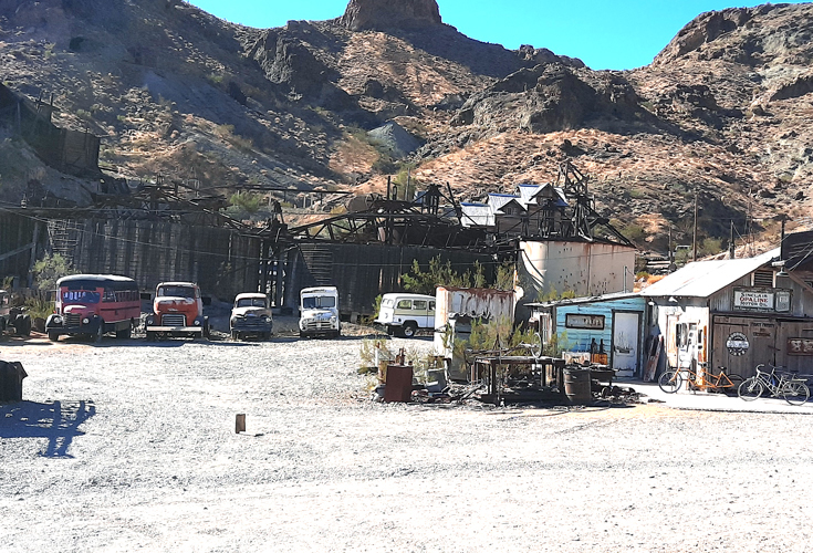
Nelson Nevada is located in El Dorado Canyon approximately 40 miles northeast of Searchlight. It is an old mining town whose history dates back to the 1860s.. One of the most productive gold and silver mines in Nevada history, the Tehatticup Mine was in operation here. Today, it is possible to wander around the ruins of the old mining operation---after paying a fee. Nelson is usually accessed off Nevada State Route 165 from U.S. Highway 95 that connects Searchlight and Henderson Nevada.
 |
 |
 |
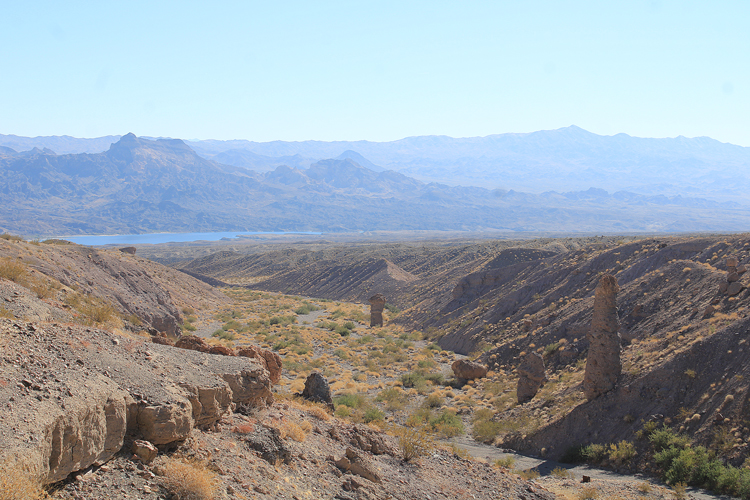
East of Nelson, Route 165 continues down El Dorado Canyon to an overlook above the Colorado River and Lake Mohave. The drive is very scenic.
 |
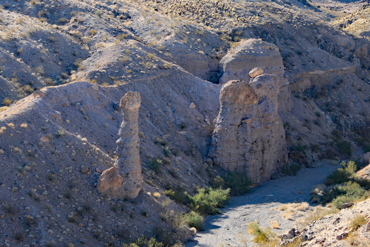
Several interesting rock pillars that are known as "hoodoos" are located along the way.
 |
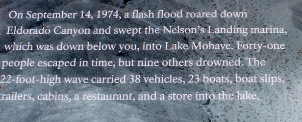
A view down on to the mouth of El Dorado Canyon can be had from an overlook at the end of Route 165. This was once the location of Nelson Landing. In the late 1800s, steam boats that had made their way up the Colorado River off loaded supplies here for the miners at Nelson. In more modern times, Nelson Landing was the site of a marina and other associated businesses. A terrible flood in 1974, killed many people and destroyed those facilities.
 |
 |
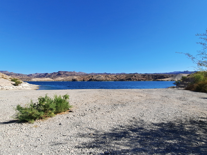
The old Nelson Landing Road drops off Highway 165 and provides access to the lake at Nelson Landing. On the day that we were here, there was not another person around. Apparently, that is not a common situation.... A berm across the wash approximately 1/4 mile from the mouth suggests that vehicles are not supposed to be driven to the water's edge. There was no signage, however, that stated that was the case. It appears that it would be necessary to carry the kayaks a short distance to launch or retreive from this cove.
 |
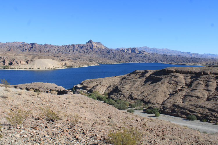
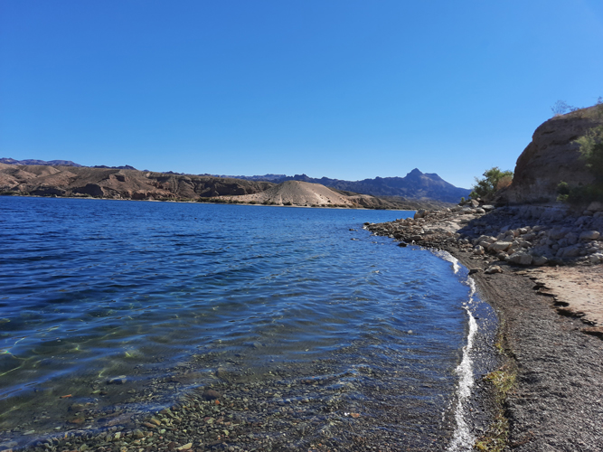
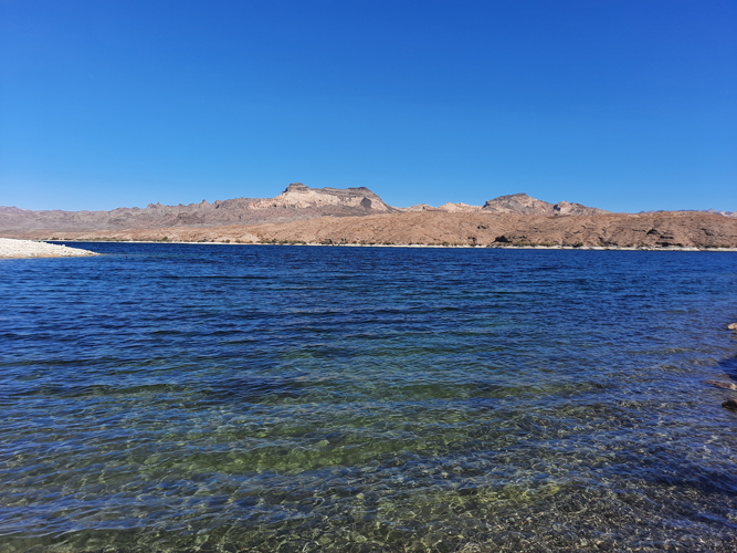
Mohave Lake has very clear water. In this photo, the view is down the lake to the Arizona side. Fire Mountain is the prominent landmark in the distance.
 |
Other coves south of Nelson Landing can be accessed by traveling Eagle Wash from Nelson Landing to the west. Just south of the intersection of the Eagle Wash Road and the Aztec Wash Road, we turned down Montana Wash. In addition to determining access to the lake here, we were interested in locating several large stone wheels from an old ore grinder. Those had been described in Roger Mitchell's book "Great Basin SUV Trails Vol. 1" . The wheels were supposed to be located at the mouth of the wash. The turn-off to Montana Wash is indicated in this photo.
 |
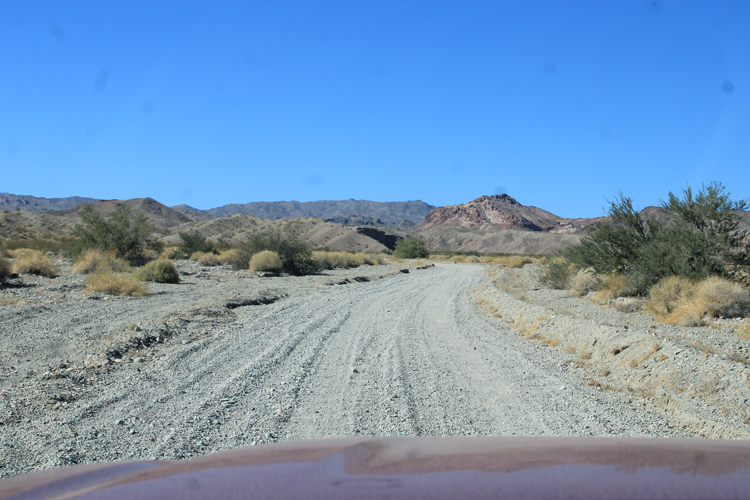
We found the primitive roads to be easy 2wd. The sand to the sides was soft however. 4wd could be needed if one were to venture out of the main tracks.
 |
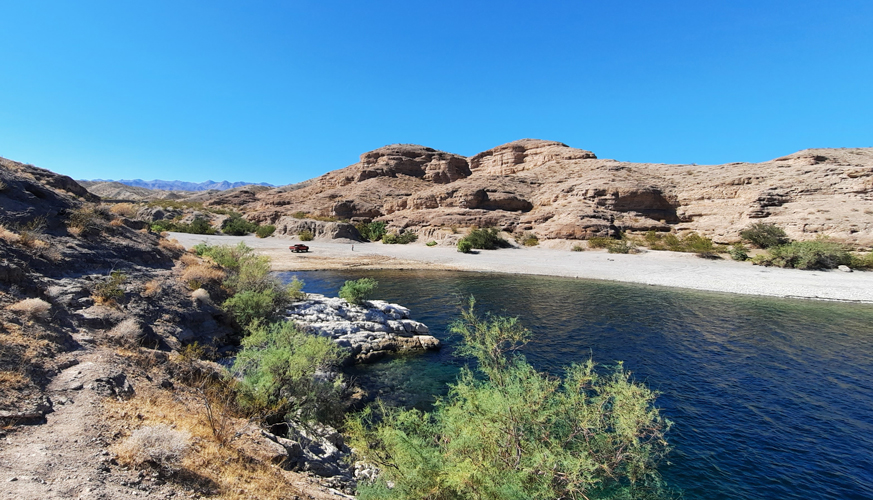
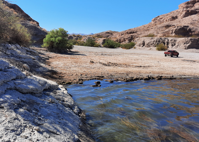
At its mouth, Montana Wash is very wide. This is a very scenic place. The cove here is identified as Morning Star Cove. Access to the lake for our kayaks would be very easy.
 |
The grinding wheels were supposed to have been located along the edge of the wash on the left side of this photo. We did not find them. We do not know if they have been covered over or have been removed.
 |
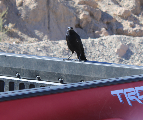
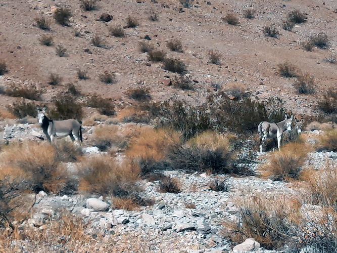
While we were out walking around, there were visitors to our truck. . They were not shy and were not hesitant to check out the inside of the cab. We rolled up the windows up the next time that we went for a walk.
 |
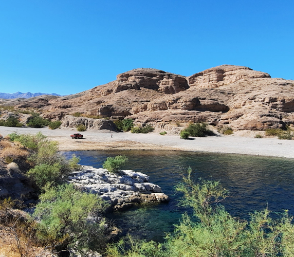
From the cove at Montana Wash, we backtracked to the Aztec Wash Road and followed it to the mouth of Aztec Wash. Several abandoned mine sites were passed along the way. The old Capitol Camp was posted against entry. These fellows were encountered in Aztec Wash.
 |
This was the view across the lake to Fire Mountain on the Arizona side from the cove at Aztec Wash. Once again, hayak access to the lake would be very easy from here.
 |
We had come to this area from a basecamp on Lake Mohave just north of Bullhead City. By the time that we had arrived at the cove at Aztec Wash, it was late afternoon. We had planned on trying to drive on other backcountry roads across the mountains to Searchlight, but it was too late for that adventure. We returned to Nelson and drove the paved roads back to our campsite. We did decide that we would return to this area and the next time we plan on bringing our kayaks and actually get out on the lake.