 |
Several
Old Stone Foundations
And Their Place In The History of Kelvin Az
|
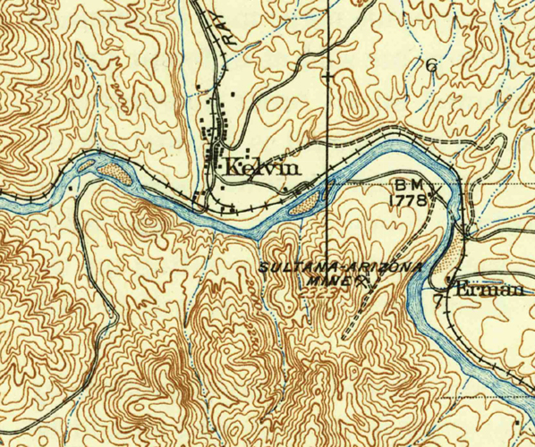
Kelvin is an old mining town located approximately 25 miles northeast of Florence. The town's history officially began in 1899 when an English company, "Ray Copper Mines Ltd." surveyed the town site at the junction of Mineral Creek and the Gila River. This article from the Florence Tribune on October 21, 1899 summarized the early beginnings of the town.
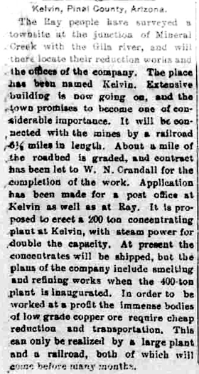 |
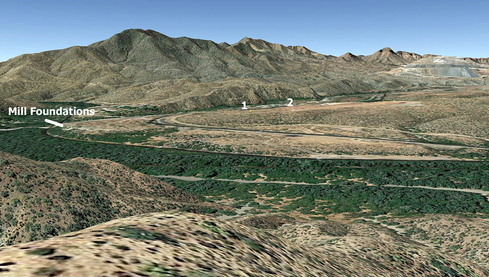
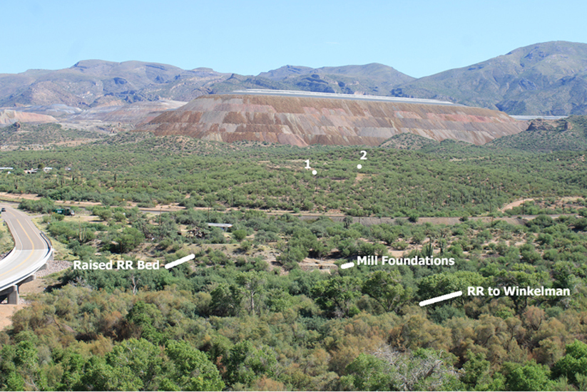
While using Google Earth to "fly over" the old town, two sets of foundations popped into view that looked interesting. GE measurements of the larger set indicated that the building had once occupied approximately 6000 sq ft. of space. After a visit to see the foundations in person, I really became curious about their history. Here is what I found......
The Foundations:
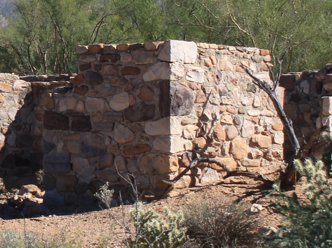
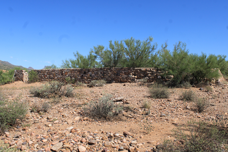
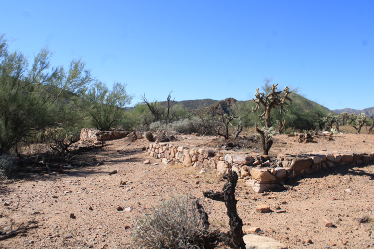
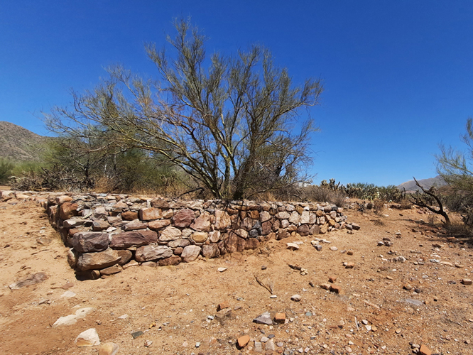
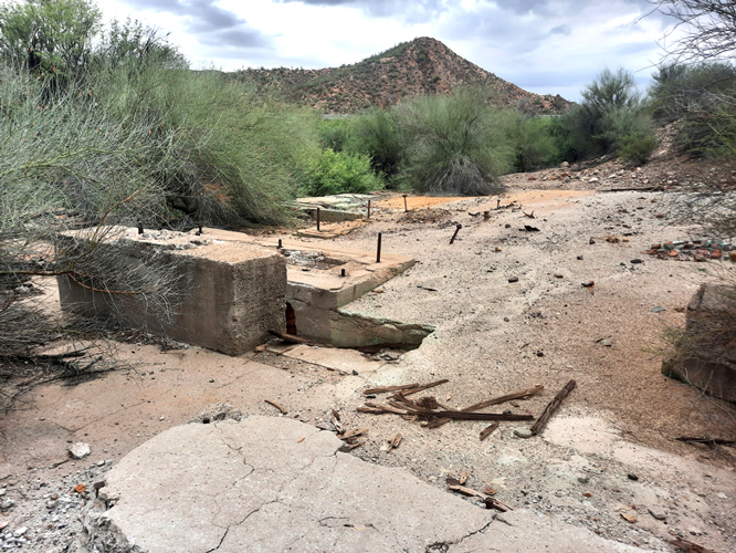
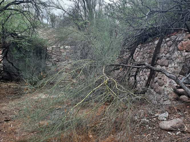
These are ground level photos of the foundations at location "1" on the GE image. These were built using field stones that had been mortared together with cement. Quite a bit of effort had been spent squaring up some of the stones to give the foundations a more finished appearance.
 |
 |
 |
 |
The foundations at "2" were similar in construction but smaller in scale. The building here had been about 1200 sq ft in size.
 |
 |
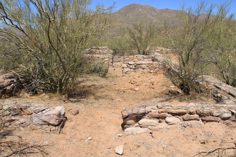
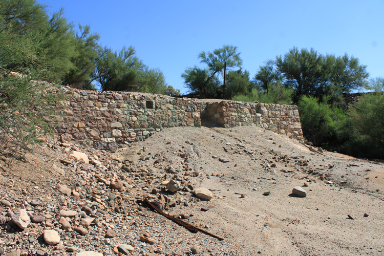
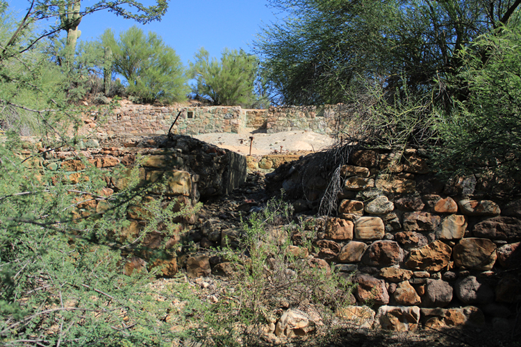
There was a third set of foundations nearby. These were also constructed from field stones, The equipment footings and the stair step arrangement of the walls down the hillside, suggested that this location had once been the site of an ore concentrating facility-- a mill operation. A mill had been constructed at Kelvin by the English company to process the copper ore mined at Ray. Were these foundations the remnants of that operation?
 |
 |
 |
 |
 |
Where the foundations were located in the town of Kelvin:
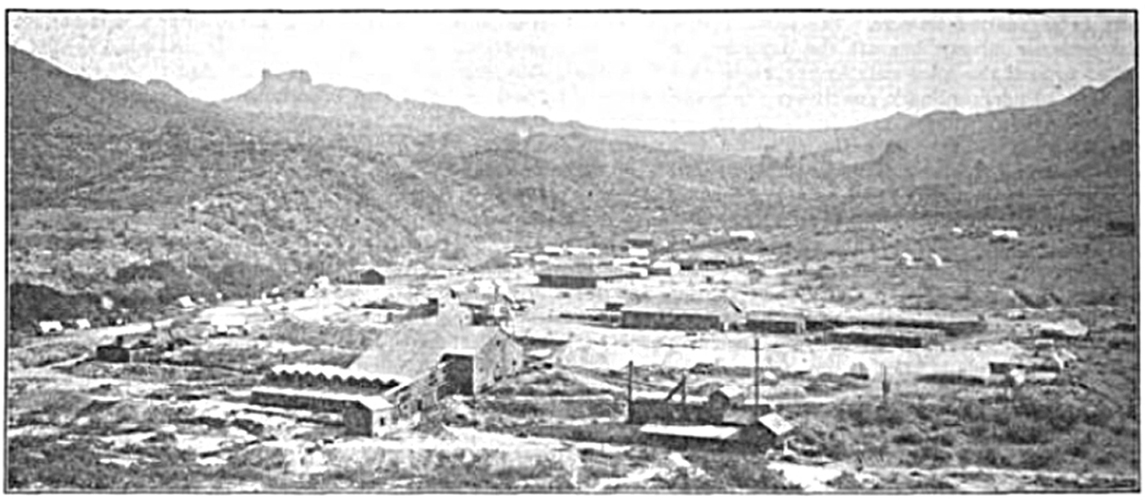
Around 1908, a panoramic photo that included a "birds eye" view of Kelvin was published by the California Panorama Company. The view below is from one section of that image.
With so many physical landmarks visible in the historic photo, we wondered whether a similar view could be created using a Google Earth Image that included the locations of the foundations? Would we then be able to "see" where in the town the foundations had been and could we perhaps use that information to learn more about their history?
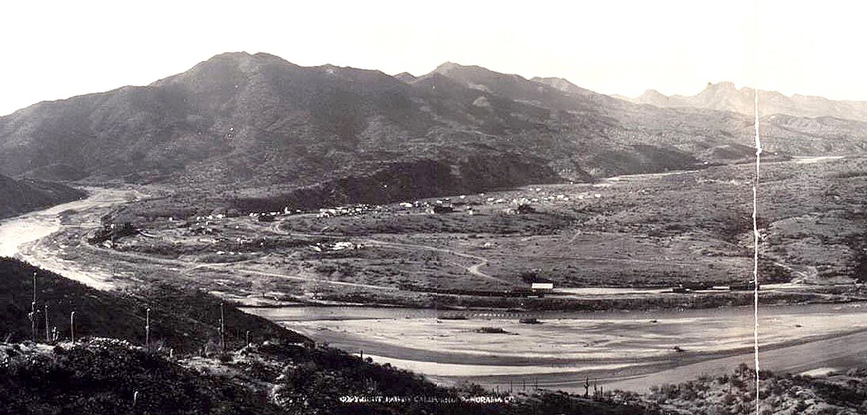 |
This was the view that resulted when the Google Earth image was tilted and rotated so that the distant landmarks were in the same position as those in the historical photo. The foundations seemed to line up with specific buildings in the historic photo. Foundations "1" and "2" appeared to be associated with two large structures in the center of the old photo. The mill foundations lined up with structures at the river's edge to the far left side of the historic photo.
 |
The buildings in historic photos of Kelvin and their association with the foundations:
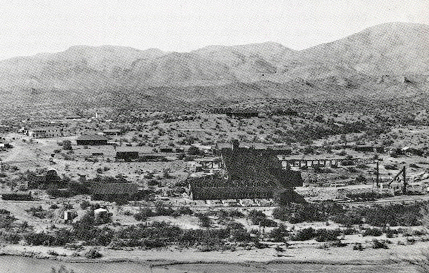
This photo appeared in an article on the Ray Mines operation that was published in the June 9, 1904 edition of "The Mining Reporter". The mill facility in the foreground of the photo was the Kelvin Mill that had been constructed by the Ray Mines Copper Ltd. Company in 1900. Teapot Mountain is the distinctive peak in the distance.
 |
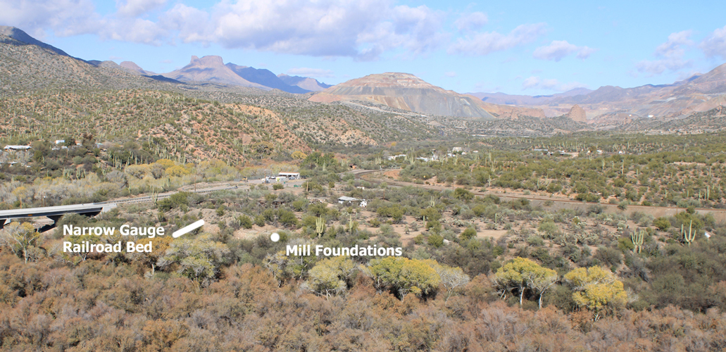
This is a recent view that was taken from a hillside south of the mill foundations that is also in the direction of Teapot Mountain. The foundations seem to line up very closely with the position of the mill facility in the historic photo. The definitive clue that the foundations are of the Kelvin Mill is the section of the old narrow gauge railroad bed that is in both photos.
 |
Another historic photo of Kelvin was used in "Railroads of Arizona Vol II" by David Myrick. The history of the "Ray and Gila Valley Railroad Company", the railroad line that carried copper ore from the mines at Ray 6 1/2 miles to the mill at Kelvin was described in one of the chapters in this book. The caption of this photo included the identification of several of the buildings in the photo: "On the knoll beyond the mill was the staff house and, to its right, the manager's house. The company hotel is the white building with the balcony, to its right is the company office building."
 |
This recent photo that was taken with a similar perspective as the historic photo shows that the foundations at "1" and "2" align pretty well with the Staff House and the manager's house that are identified in the historic photo. The raised section of the old narrow gauge railroad bed that was to the left of the mill facility appears in both of these photos.
 |
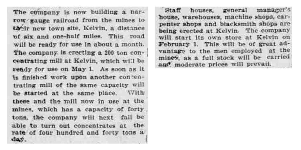
Excerpts from a December 29, 1899 article in the Arizona Republican noted the construction of the concentrating mill, staff house, and the general manager's house. "The company" in the article was the Ray Copper Mines Ltd. Company. These sets of foundations then date back to the earliest days of the town........
 |
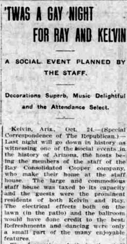
The Staff House was mentioned several times in newspaper articles from the early days of Kelvin. Employees who worked in the offices of the Ray Copper Mines Ltd. Company lived in the staff house. The Ray Consolidated Copper Company continued to use the building after it became the owner of the mining operation in 1907. Traveling speakers and other entertainers would often give presentations and performances there. Tennis matches were held on the grounds. This article, which appeared in the October 26, 1909 edition of the Arizona Republican, described a social event that was held at the staff house.
 |
The performance of the Kelvin Mill was key to the success of the English company. Unfortunately, the mill never lived up to expectations. The operators were never able to process the tonnage of copper ore necessary for the company's operation to be profitable. The ore graded out at 2%, 5% ore had been expected.
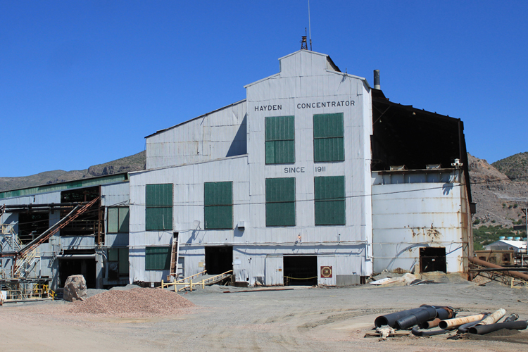
In 1907, the company was sold. The new company, the Ray Consolidated Copper Company. employed engineers who were more experienced with the kinds of ores found at the Ray mines. They soon determined that a newer and much larger mill was needed. The Kelvin Mill was closed in 1909. There was no space available in Kelvin to either construct a new facility, or to dispose of mill tailings. A new site was chosen 15 miles to the east. It was around that replacement mill that the new town of Hayden was established. The new mill opened in 1911.
 |
This map of Kelvin was drawn in 1908. In the early days of the town, in addition to the mill and the other buildings associated with the English run mining company, there was other commercial development-stores, an ice plant, restaurants. That had occurred along the railroad that ran to the mines at Ray.
An interesting note from the map is that the Kelvin to Florence road in those early days had a very different alignment south of Kelvin than it does today. Prior to 1916, when a bridge was built to cross the Gila River at the town site, the road traveled west and then south up a different drainage.
 |
This photo which was also used in the Myrick book, was taken along a section of the town's Main Street. Main Street ran parallel to the narrow gauge railroad line. In this view, the "cottages" that are in a row at the top left of the photo were constructed in 1909 to provide housing for married office workers employed by the Ray Consolidated Copper Company. To their right may have been the Manager's house and the Staff House. The ridge was known as Staff House Hill. Several commercial buildings are visible near the railroad tracks.
 |
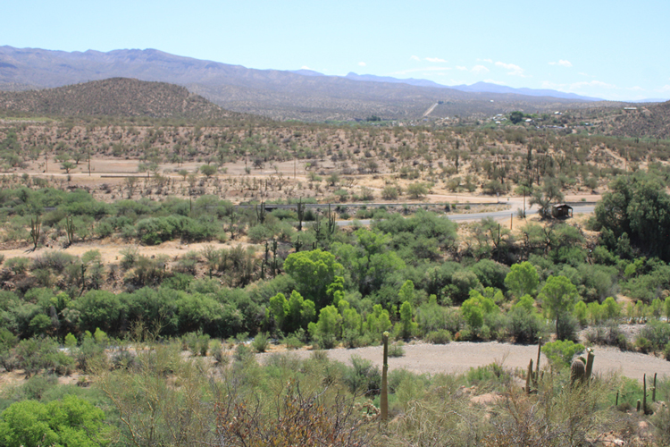
This is the current view of the area once occupied by the Main Street of Kelvin. In 1909, the narrow gauge railroad was torn up and standard gauge tracks were installed. A junction with the Arizona Eastern railroad line that ran to Winkelman was created east of Kelvin and given the name Ray Junction. The development in the distance is the community of Riverside.
 |