 |
A Mine Site in Fourr Canyon of the Dragoon Mountains, Arizona
|
(Click on any photo for larger view)
Fourr Canyon is located in the northwest quadrant of the Dragoon Mountains in southeastern Arizona. My daughter and I recently walked in approximately 4 1/2 miles to an area in the upper canyon where I had spotted the outline of a cabin and several mine dumps on Google Earth. Although the area is on the Coronado Forest and there are Forest Service roads in the area, the ranch at the mouth of Fourr Canyon is apparently able to block access to those roads.
We used Jordan Canyon as our access route to Fourr Canyon and the mine site. There is no established trail in Jordan Canyon, but the route was obvious. Even though we were on a primitive road when it came time to cross over from Jordan Canyon into the Fourr Canyon drainage, the grade was very steep. Overall, there is nearly a 1000' gain in elevation from Dragoon Springs to the mine site.
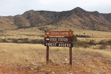 |
In addition to providing forest access, Jordan Canyon is also the site of an old Butterfield Stage Station, and a burial ground for several Confederate Army soldiers who were ambushed by Apaches in 1852.
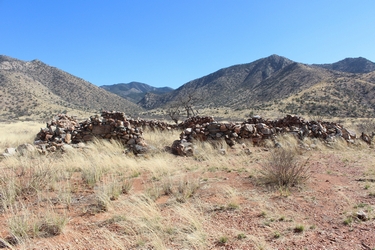 |
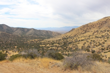
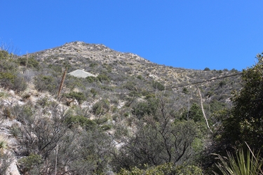
This is the view up Jordan Canyon from the ruins of the old Butterfield Stage Station. The old mine site is in the canyon just this side of the very distant skyline.
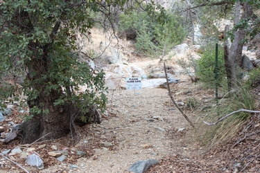 |
This gate provides access to travel in Jordan Canyon.
 |
 |
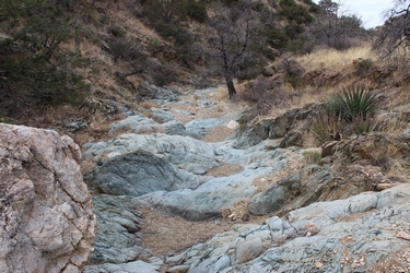
The nature of the rocks forms an interesting contrast in this section of Jordan Canyon.
 |
Not certain whether the remains of this old shed/shack in Jordan Canyon are mine related or associated with early ranching activity. There are a couple of water tanks nearby.
 |
 |
The shafts and dumps of the Rainbow Mine are passed by in upper Jordan Canyon. This old prospect apparently never really developed into a working operation.
 |
 |
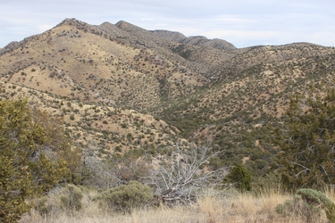
The photos above were taken from the divide between Jordan Canyon and Fourr Canyon. On the left, is the view north into the Jordan Canyon drainage. To the right is the vew southwest toward the mouth of Fourr Canyon. The Whetstone Mountains are in the far distance.
 |
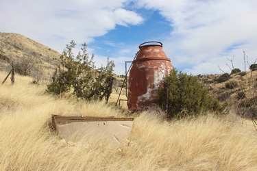 |
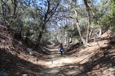
On the walk into Fourr Canyon, the route passes under a canopy of tall oak trees. The photo on the right shows a water tank that may have been the mixer on a cement truck in its previous life. This tank is visible from the pass between Jordan Canyon and Fourr Canyon. It is on a spur road to a small mine site near Fourr Canyon.
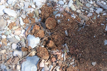 |
There were many piles of scat of very large predators seen along the hike to the old mine site.
 |
 |
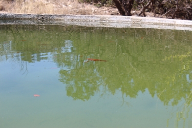 |
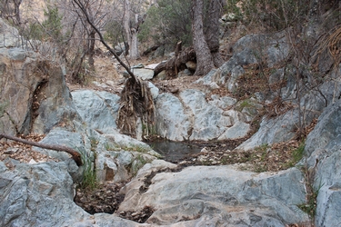
On a spur road south of the main route was a spring fed water tank. It was full and home to numerous gold fish.
 |
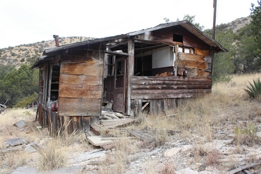 |
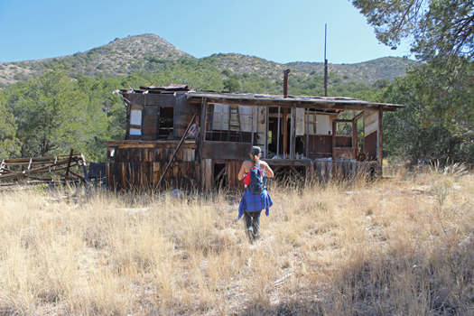
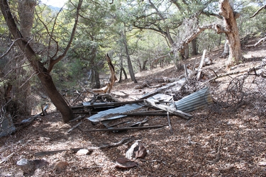
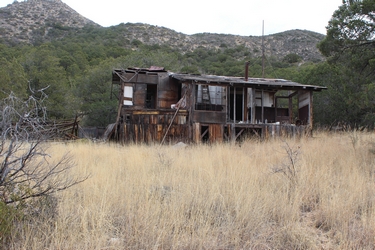
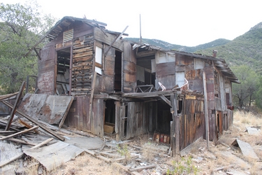
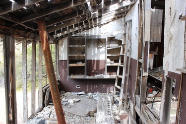
This building was much more than a mine cabin. If it were located in a town, it would have been a house/home. The building was quite large. Today, its condition is not good. The dwelling had not been constructed when a mining engineer's report was written in the mid 1970's. At the time of the report, the miners were camped near the water tank shown above. A trip report to this location in 2008 shows several vehicles and quite a few pieces of mining related machinery. None of that equipment remains today. Google Earth views of this area from 2010 seem to indicate that all of the equipment was gone by that year. With access so tightly controlled at the mouth of the canyon, it would be interesting to know the circumstances that led to the removal of those old vehicles and the machinery.
 |
 |
As can be seen in
the photos above, there was electrical service to the building.
Electricity came from a generator stashed in a shed nearby. There
was a large
storage area under the floors of the building.
 |
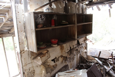 |
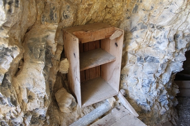
The utensils on the shelves appear today pretty much as they did in the trip report done in 2008.
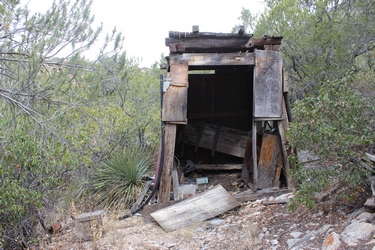 |
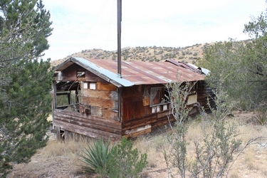
This shed once held the generator that provided electrical power to the house. In a 2008 photo, there was a water tank mounted on the roof. A flexible water line appears to have run over to the house to provide running water.
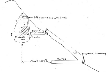 |
This sketch done
in the mid 70's shows what a mining engineer found upon his
investigation of the mine property. There were three entrances.
The two lower adits
were classified as "barren" as far as mineral content.
A tramway was proposed from the middle level down to the road at
the lowest level. It was thought that the mine could be a source
of lead and silver. It was proposed to extend the length of the
lower adit to perhaps intersect the ore body.
 |
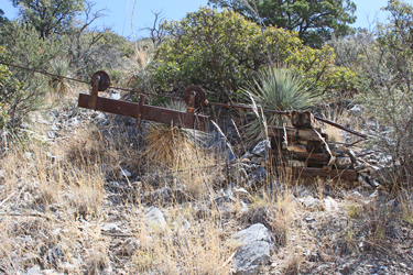 |
It appears that
at least the basic parts of the tramway were constructed. The
photo on the left shows the cable run from the mid level dump.
The carrier for the cable car
can be seen to the right at the lower end of the cableway .
 |
 |
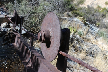
The roller mechanism seems to have been "homemade". It appears that automotive type axle hubs were re-purposed as the rollers for the cable car.
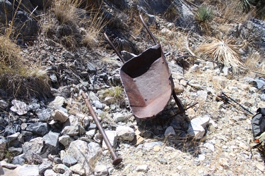 |
This old wheel barrow is at the lower end of the tramway. Was this going to be the transport vehicle between the cable car and a truck?
 |
 |
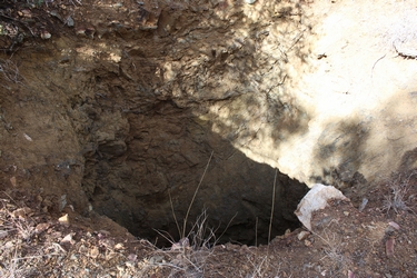
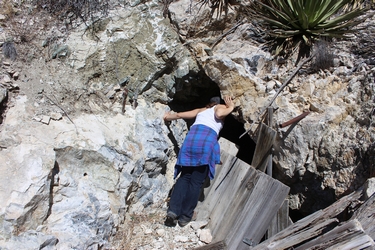
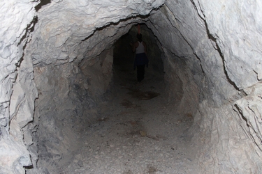
Is there anybody home? The photo on the left is the portal to the lower adit. The photo on the right is a collection of drill steels and pipe decorating the entrance.
 |
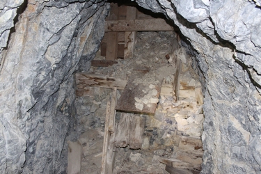
 |
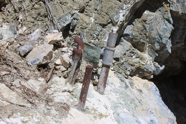
The lower tunnel may have been used for tool and equipment storage. The piping that is there today is a small diameter ventilation pipe.
 |
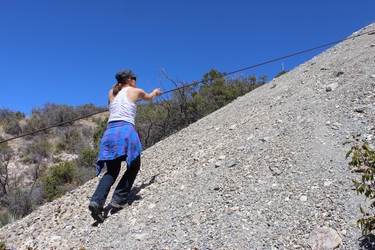 |
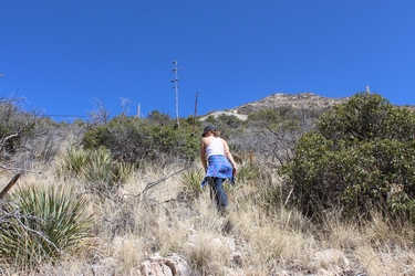
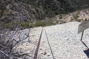
There was no obvious trail or path from the road to the upper mine workings.
 |
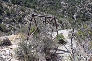 |
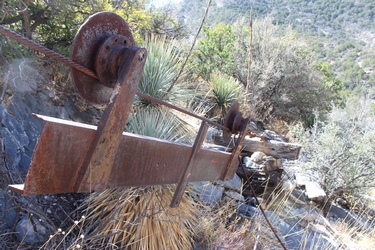
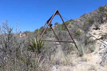
The upper end of the cable was supported by an A-Frame structure on the middle mine dump.
 |
 |
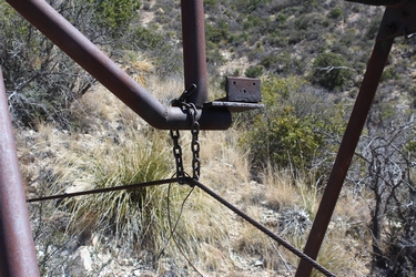
It appears that the tramway may not have ever gotten to operational status. I doubt that a chain would have been the permanent support mechanism for the cable. The cable would have had to have been attached to the A-Frame at a much higher position if the cable car was going to clear the edge of the old dump....
 |
The upper end of the cable was anchored to an assembly of mine timbers wedged into the opening of the mine tunnel.
 |
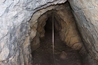
 |
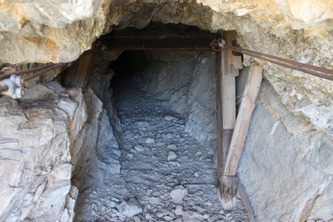
The photo on the left shows the current condition of the middle adit. The right hand photo was taken at the back of the adit. It shows blasted ore material that is being held in place by chute boards. The material has come down through the vertical shaft.