 |
The
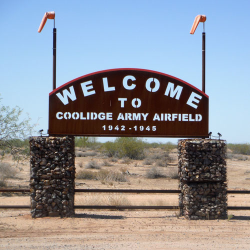
Coolidge Army Airfield and the Lt. James Hart Crash Site Monument
|
The Coolidge Municipal Airport, is located 6 miles southeast of the town of Coolidge. It was originally an Army Airfield, one of many that were constructed across the state during World War 2. The remnants of the old base, which are east of the current facility, are interesting to look over. In the desert, a few miles south of the airfield, is the Lt. James Hart Monument, the scene of a T-37 plane crash in the 1970s.
The Cochise Army Airfield:
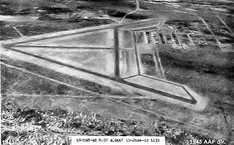
Constructed with three runways, the Coolidge Army Airfield was first designated as a site for pilot training. In 1944, the role of "ferrying station" was added. Ferry stations were described as truck stops for airplanes. They provided fuel and maintenance for aircraft that were in transit to other locations. The airfield, staffed by the soldiers of the 572nd AAF Base Unit, provided services for Army, Navy, and Marine aircraft and crews.
This was a view of the airfield as it appeared in 1943. Apparently, the runways of army airfields were often arranged in triangular patterns, while navy runways were criss-crossed X's. The support facilities for the base were located in the upper right quadrant of the photo.
 |
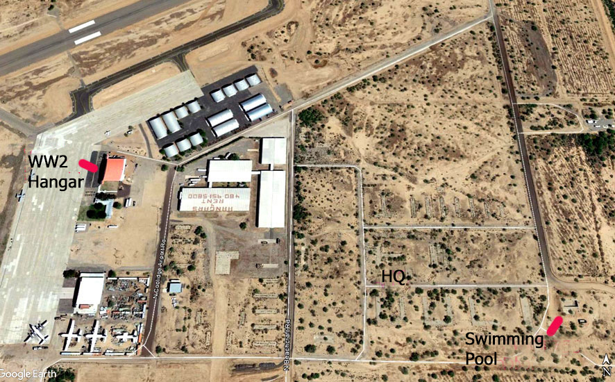
The airfield was de-commissioned in 1945 and became a municipal airport operated by Pinal County. In the late 1950s, the City of Coolidge took over the operation of the airport. The current facility occupies the western portion of the old base. A supply building and the hangar have survived from the days of the airfield and are still in use. While the other buildings are long gone, many of their foundations still remain.
 |
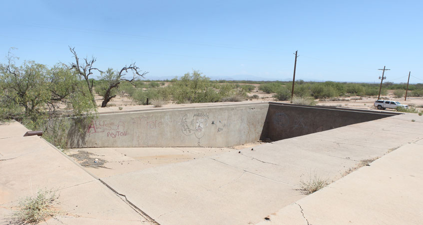
Alongside the dirt road that runs south to the mountains is this mound of dirt and a concrete slab. This was once the army airfield's swimming pool.
 |
 |
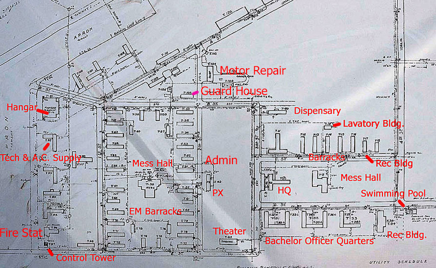
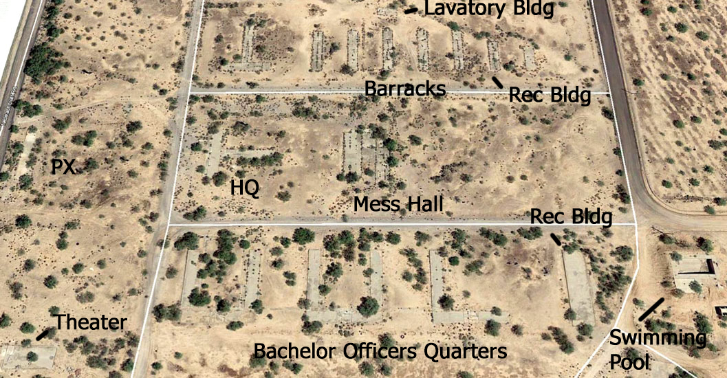
What about the rest of the base? A 1944 Corps of Engineers Map showed its layout. More than 60 structures were constructed to support the airfield operations. Although there was a guard house there were no chapels. The swimming pool was located in the southeastern corner of the base.
 |
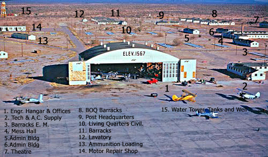
Photographs of the early airfield are pretty scarce. In these two photos, taken in 1949, it can be seen that many of the buildings had already disappeared. With the use of the 1944 COE map, it was possible to identify the structures that were still in place.
Of those buildings, the hangar at "1" and the supply building at "2" are the only ones that have survived. Their current views can be compared to these.
 |
 |
It was no coincidence that the buildings of the airfield were so similar in appearance. They were constructed from a set of standardized plans that had been developed by the Department of the Army after WW1. Thought of as "Temporary Construction", the 700 series of buildings were simple wood frame designs that could be erected quickly and inexpensively.
Thousands of the 700 series buildings were constructed at army posts across the country. Two locations, where examples of these structures have been preserved, are the Presidio at San Francisco , and the National Infantry Museum at Fort Benning Georgia. Originally designed to last only until the end of the war, many of these structures were still in use decades afterward.
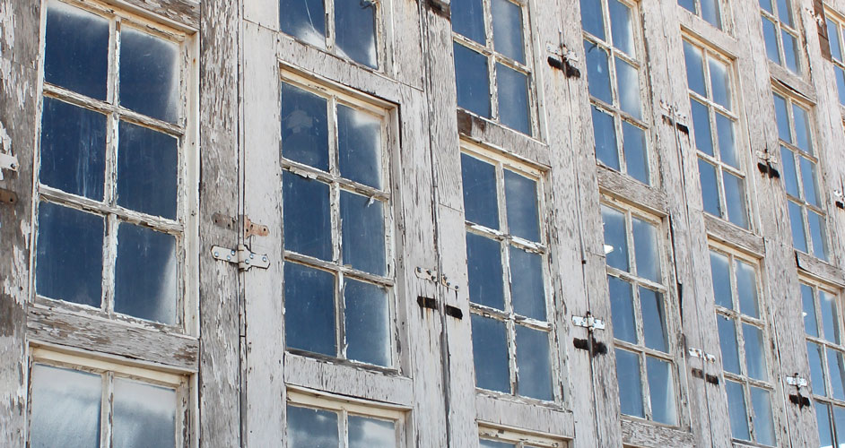
Except for the sheet metal roof, this side of the supply building appears pretty much as originally constructed. The rectangular shape and gable roof were typical of the 700 series buildings. While these exterior walls are covered with asbestos cement siding, the more common material for this series was horizontally oriented shiplap.
The wooden vent at the end of the building was another feature associated with the 700 series structures. Apparently, those were not used in the earlier 600 series of WW1. The location of the large service/supply door is still visible. While the windows appear to be multi-paned, they are single-pane windows with faux dividers.
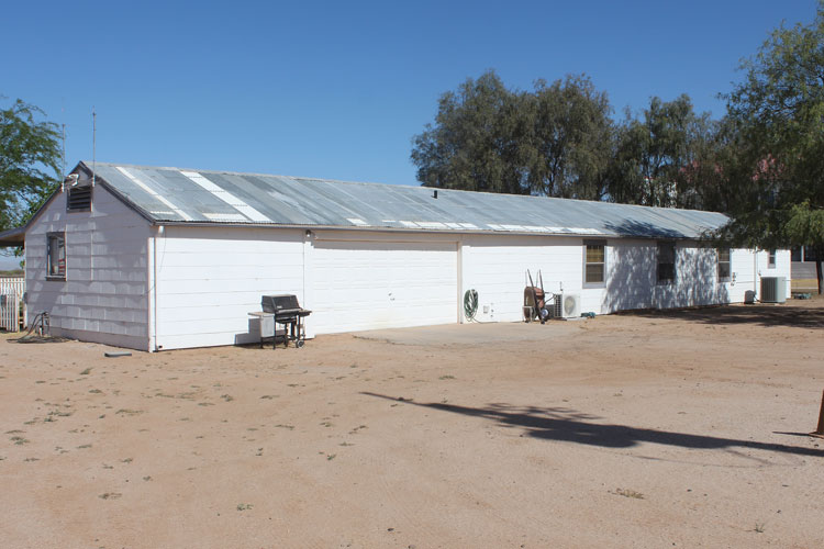 |
The opposite side of the old supply building has been more seriously modified. The porches and the entrance to the left do not appear in the vintage photos.
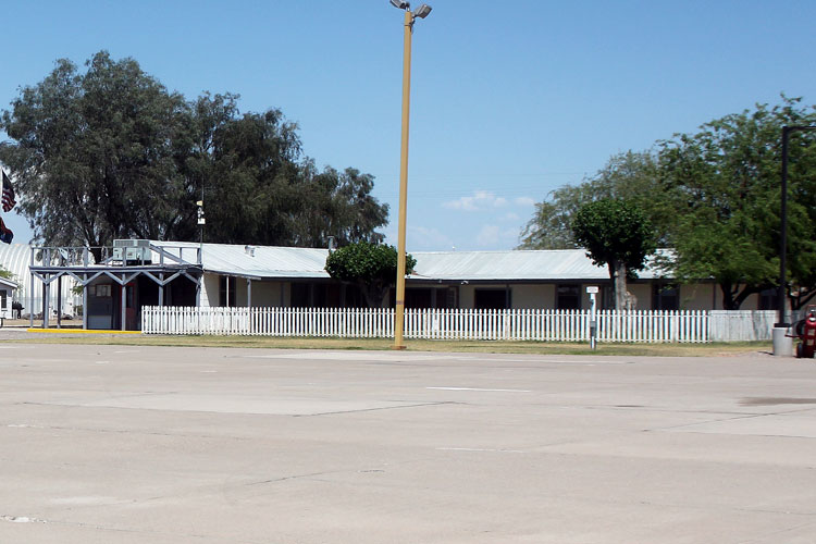 |
The "Temporary" wood framed hangar has been standing now for 70 years. In this photo, taken in 2018, the hangar looks very similar to its appearance in the vintage photos posted above.
 |
In a photo that was taken in 2008 and posted at: http://www.ruudleeuw.com/usa08-coolidge.html , the appearance of the hangar was very different. The exterior siding that is currently on the building seems to be similar to the cement asbestos siding that is on the supply building. That did not appear to have been the case in 2008.
The 3rd row of windows has been restored on the hangar. Like those on the supply building, the new windows only simulate the original multi paned ones.
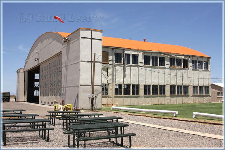 |
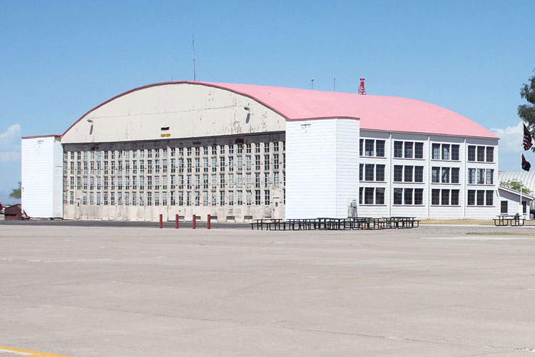
The front of the hangar with its large folding doors has not been renovated. The windows have maintained their original configuration. More than 700 pieces of glass were used in the construction of these hangar doors. There appears to have been issues with the hinges. Many have been reset.
 |
The Corps of Engineers Map allowed names to be put to the concrete slabs that are in the desert east of the current airport facility.
 |
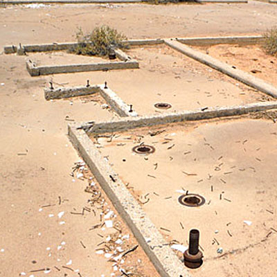
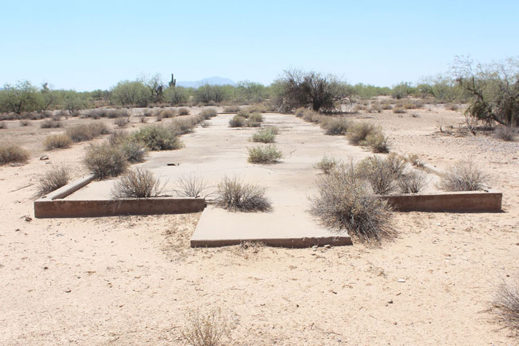
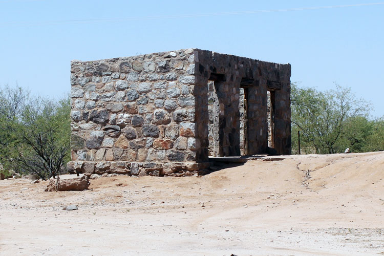
This "T" shaped slab was the site of the Post Headquarters. Except for the location of pipes in the floors, there are few clues as to how the interiors of the airfield buildings were organized. For each of the buildings identified on the COE map the number of the blueprint plan was provided. The search for those plans has not gone well.
The HQ building seems to have been one of the few that offered a restroom that was "private".
The many nails suggest that the buildings were dismantled and the materials salvaged. At more recent disposals of similar buildings, the salvaged lumber was found to have been of very good quality.
 |
 |
Standing out front of the headquarters building was the post's flagpole. A rock border that once defined a space around the flagpole and the front of the building is still visible. A distant view of the HQ building and the flagpole can be seen at "9" in the vintage photo posted above.
 |
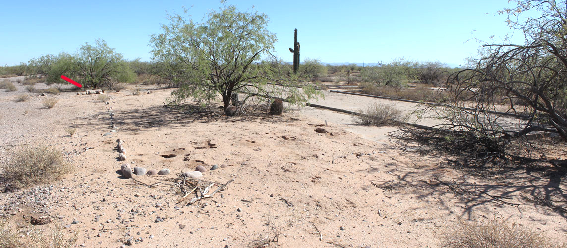 |
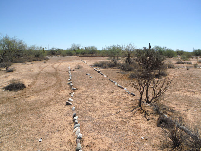
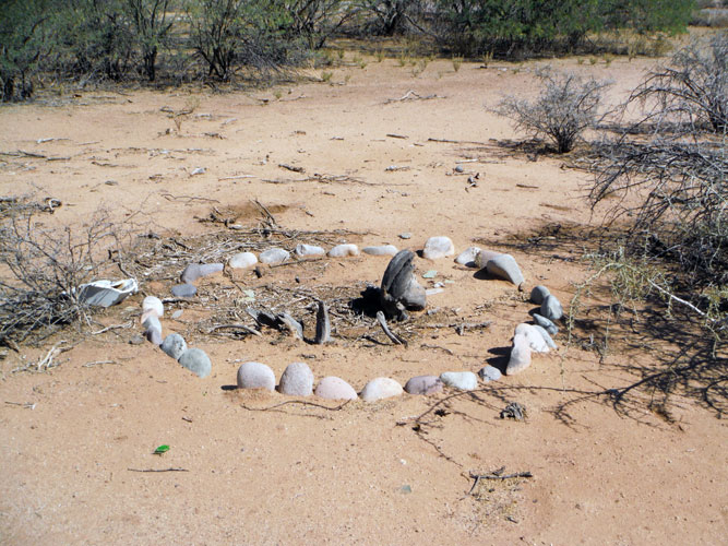
Rock borders were used elsewhere to mark walkways and landscape features. These rounded stones do not appear to have been sourced from the immediate area.
 |
 |
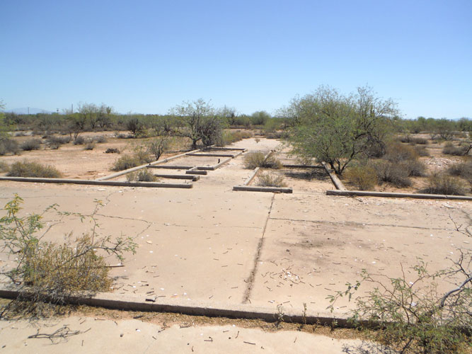
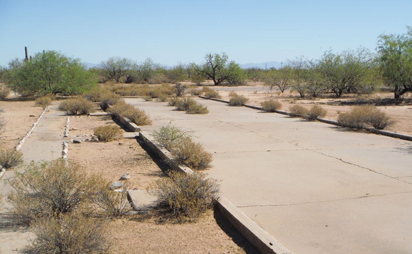
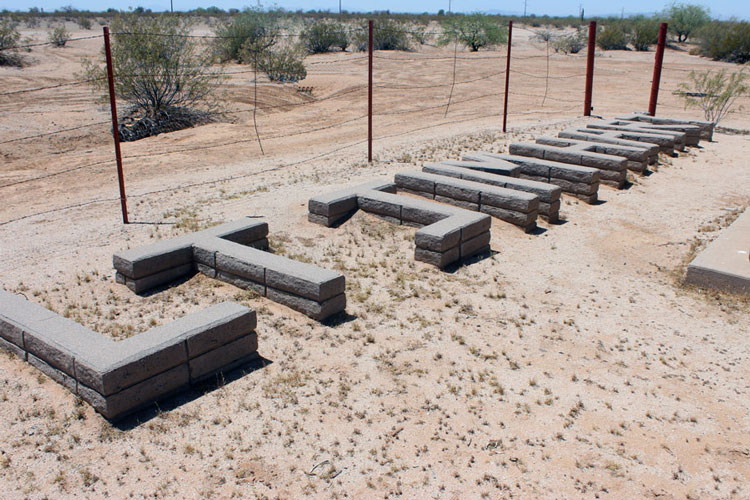
More than 20 of the buildings at the airfield were barracks. This slab supported one of several that were located northeast of the HQ building. The group appears at "11" in the vintage photo. At many army bases, barracks were two-story affairs. All of those at the Coolidge Airfield appear to have been single story.
There were no toilet facilities in these buildings. A separate lavatory building served the barracks. From the count of floor flanges, there were 10 toilets in the facility. I wonder how long the lines would be to use the facility?
 |
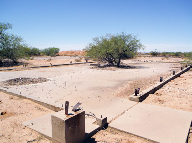
This was a slab for one of the "Bachelor Officer Quarters" buildings. There were 8 of these buildings that were clustered together into two "U" shaped and one "L" shaped units. Each building had four entrances. Those may have led to dormitory like rooms. Each unit had shower and restroom facilities.
There were no structures on the COE map that identified housing for the base commander or married officers.
 |
This was the foundation for the base theater. In the vintage photos, the theater appears to have had the height of a two-story building. The heavy strap anchors suggest that posts larger than standard wall studs were used in the construction of this building.
 |
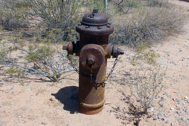
Fire presvention/safety must have been a priority. The Corps of Engineers map showed the placement of several fire hydrants along each street. Quite a few of those have survived. They were manufactured by the "American Foundry Manufacturing Company in St. Louis MO. The date cast into each of the hydrants was 1943.
 |
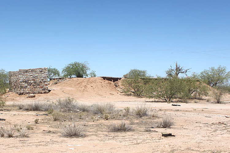
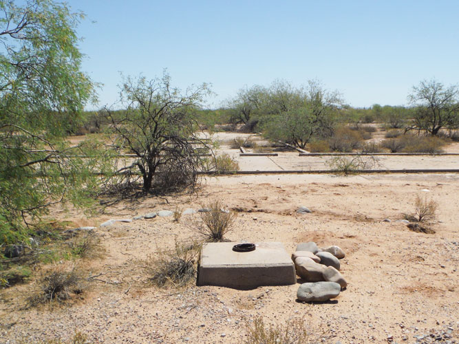
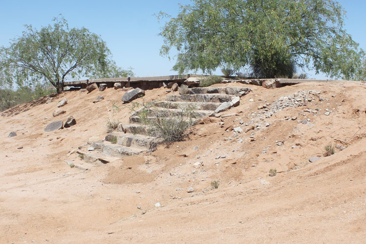
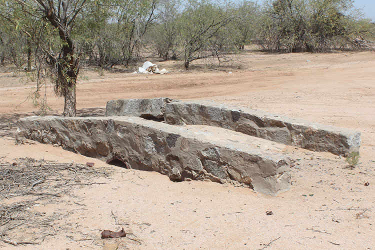
Near the swimming pool are the ruins of this stone building. It does not appear on the map of the airfield. The steps up to the pool and a small bridge nearby were created from these same materials. Why was this part of the base constructed differently? Was this building used as a changing room?
 |
 |
 |
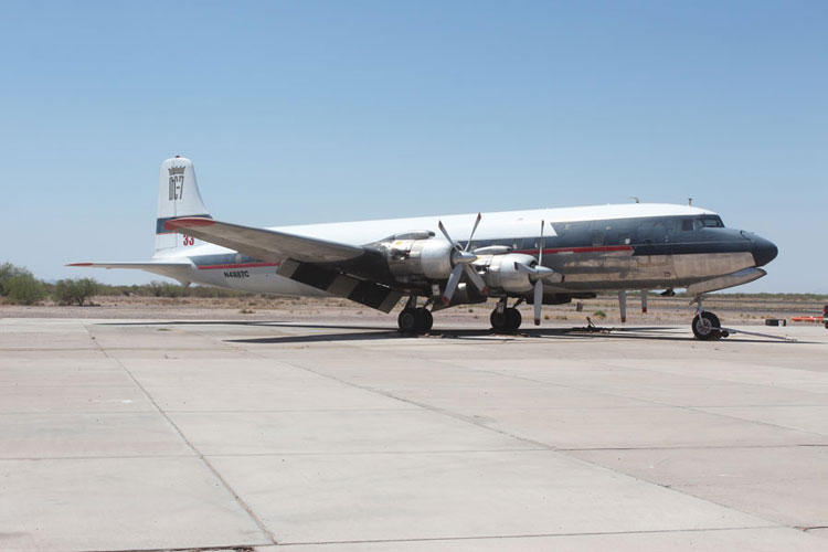
Current activity around the airport is pretty interesting. These were some of the aircraft that were seen when I was here.
 |
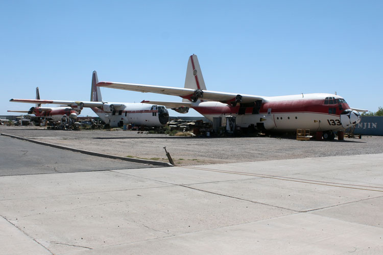 |
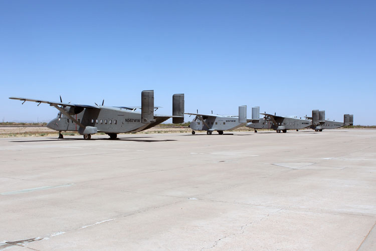 |
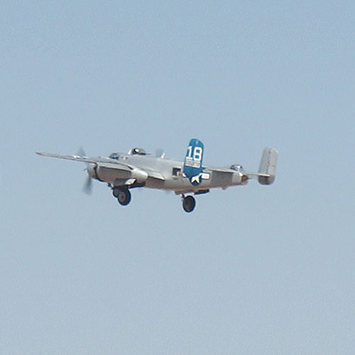
This flyby of the airport by a B-25 was especially interesting. A sighting like this would have probably been pretty common back in the days of the early airfield.
 |
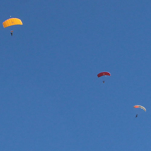
Parachute jump training occurs at the airport. The road south into the desert from the airfield crosses the edge of the skydivers' landing zone.
 |
Approximately 1/2 mile south of the swimming pool, a sign reminds folks that State Trust Land recreation permits are necessary to continue. Ruts in the road suggest that travel may sometimes be challenging....
It is approximately 3 miles to an intersection with a cross-country natural gas line and its road.
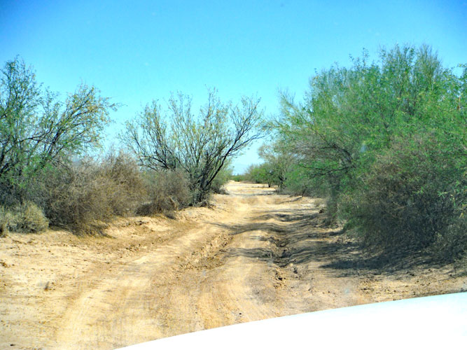 |
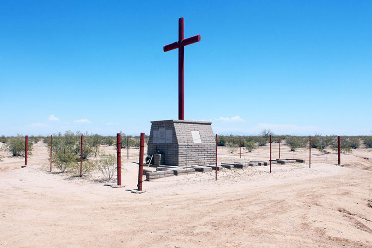
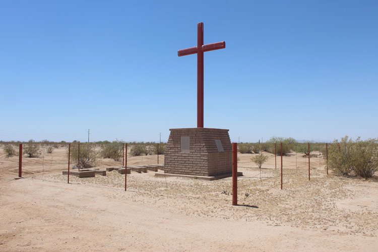
At the intersection, a turn to the east on the gas line road leads to the site of the Lt. James Hart Crash Site Monument. The monument is less than a mile from the intersection and sits off to the south side of the road a short distance.
James Hart Crash Site Monument:
This monument was created to commemorate the life of a young Air Force pilot whose plane crashed here in 1975.
 |
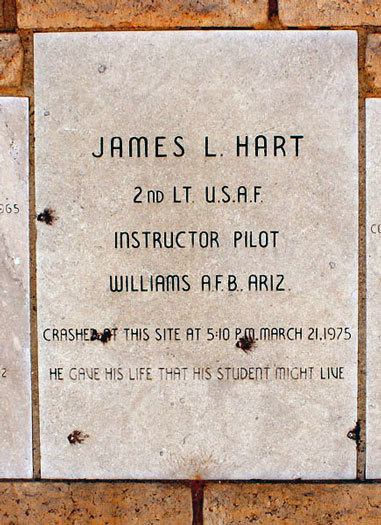 |
The newspaper article below is from March 22, 1975 and provided a bit more information on the incident. From 1962 until 1992, the Coolidge Airport leased their facilities to the Air Force for T-37 training. Whether Hart and his student were operating from there at the time of the crash is unknown.
| COOL1DGE (AP)-A former Vietnam war hero was killed and his student pilot injured when their T-37 jet trainer crashed about seven miles south of here. Williams Air Force Base officials said. 2nd Lt. James Hart, 27, of Scottsdale, Ariz., an instructor pilot, was killed in the crash. A student pilot. 2nd Lt. Larry Brown of Sylmar, Calif., suffered burns on his neck and a sprained ankle. The two were on a routine training mission when the crash occurred. Hart, who was an infantryman in Vietnam in 1968-1969, became a sergeant while serving with the 25th Infantry Division and the 2nd Armored Division. He was an intelligence operations specialist. While in Vietnam Hart was awarded numerous awards, including the Bronze Star with valor device, three Purple Hearts, and the Vietnamese Cross of Gallantry with Palm |
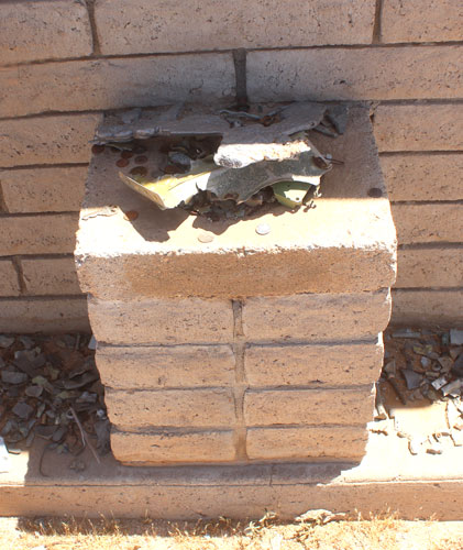
Shards from the aircraft that have been recovered since the crash have been placed at the base of the monument. The coins are a notification that visitors have been here to show their respect.
 |
There is an inscription on each side of the monument. One is a poem, "Because I Fly", written by Lieutenant Hart.
 |
 |
From the Hart Crash Site Monument, one can continue eastward on the gas line road several miles to the paved Deepwell Ranch Road where a left turn leads to Highway 79.
If one returns to the intersection of the Coolidge Airfield road and the gasline road, a primitive road, just west of the intersection provides access to the petroglyphs and stage stop near the Picacho Mountains.