 |
A Stone
House, a Couple of Wagon Roads, and the Earliest History
of the Cochran "Coke" Ovens
|
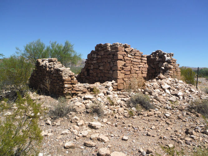
Local legend has it that an old rock ruin on the Gila River, east of Florence, was once a stage station. I am not sure that is its history, but the old building does seem to have a connection to the story of the Cochran "Coke" Ovens which are approximately a mile away.
In the early 1880s, two roads converged at the stone house to cross the river to a smelter and several silver/lead mines. Men and supplies passed by the rock structure headed north while ore and bullion came back across the river on its way south.
From information presented in several maps and newspaper articles of that era, it appears that the smelter was located at the site that is now known as the Cochran "Coke Ovens". If that is the case, then the beehive shaped structures that are found there were not coke ovens at all. And Cochran, the camp established in later years, would have had little association.
 |
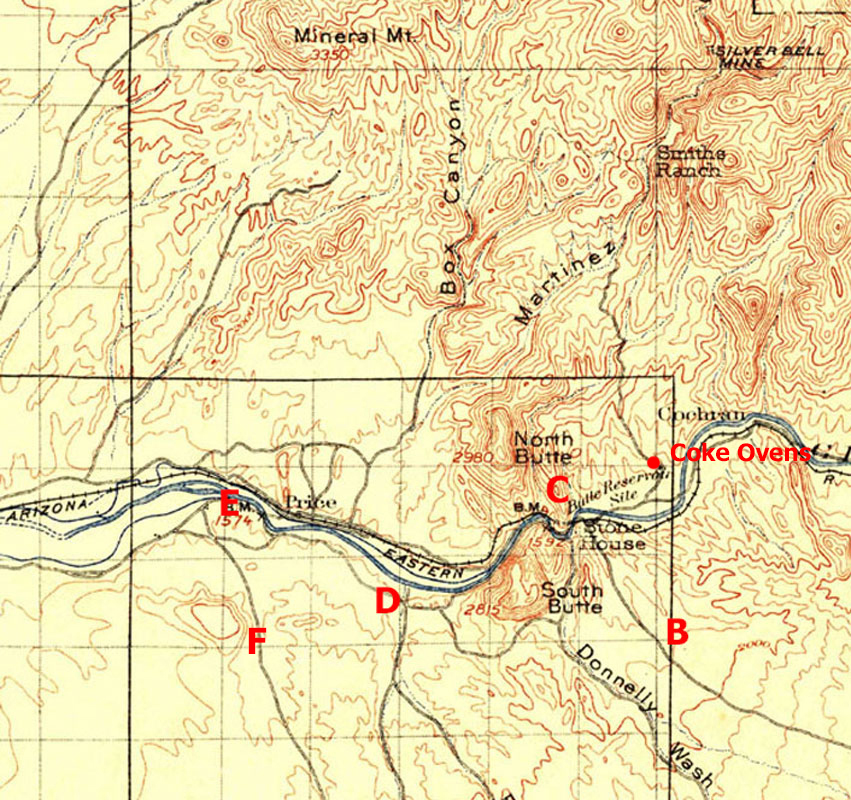
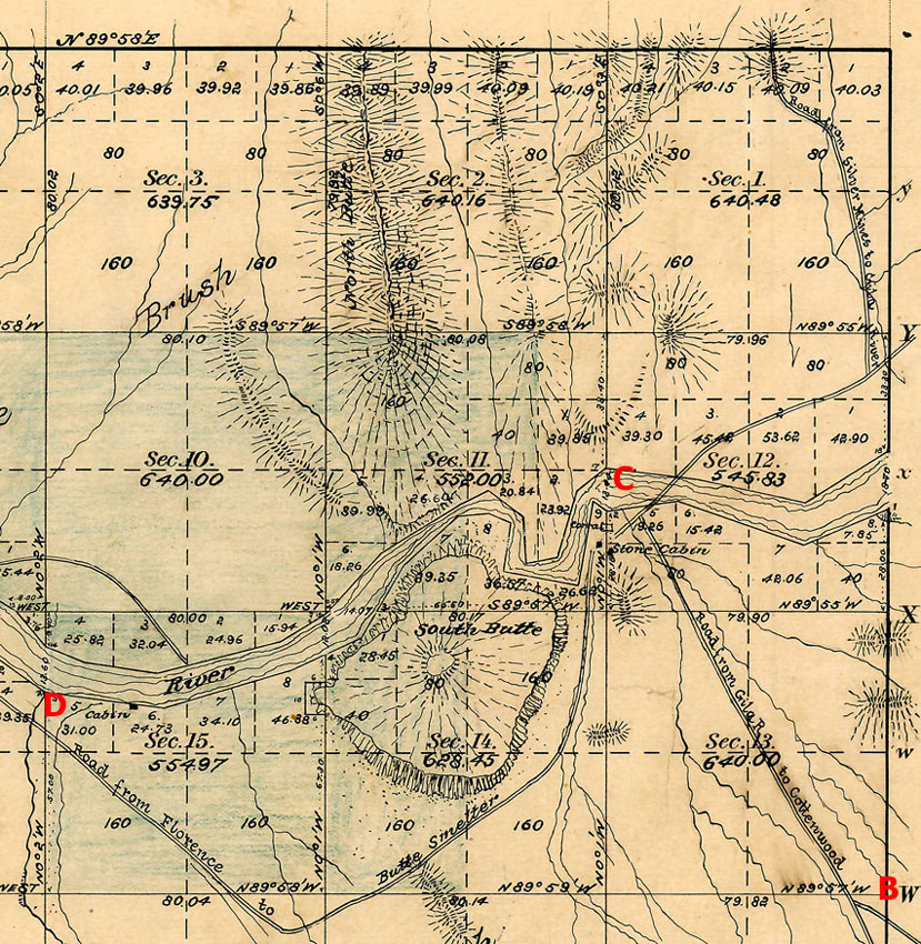
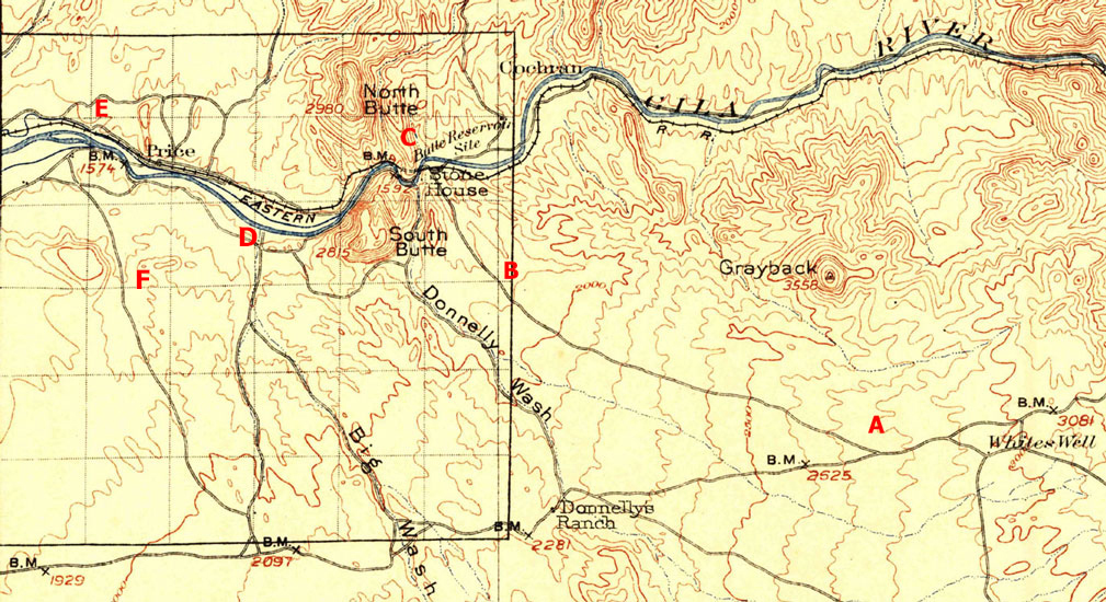
"Stone House" marks the location of the old ruin on the 1912 topographic map below. Today, Donnelly Wash is used by fourwheelers and ATV riders to access the ruin and a scenic beach at the mouth of the wash.
The waypoints mark the route of a 4 x 4 drive through the area that is on the two roads that were the original access to the "coke ovens" and the mines beyond.
 |
 |
 |
The History:
The rectangular grid that overlays the area of the Stone House on the map above is the outline of a Township Survey that was done in 1892. The northeast quadrant of that grid is shown below. Here, the rock ruin is labeled as the "Stone Cabin". The roads nearby have been identified. Segment B-C was the "Road from Gila R. to Cottonwood" and the segment C-D was the "Road from Florence to Butte Smelter". A 3rd road was the "Road from Silver Mines to Gila River".
So what were these roads about and where was the Butte Smelter?
 |
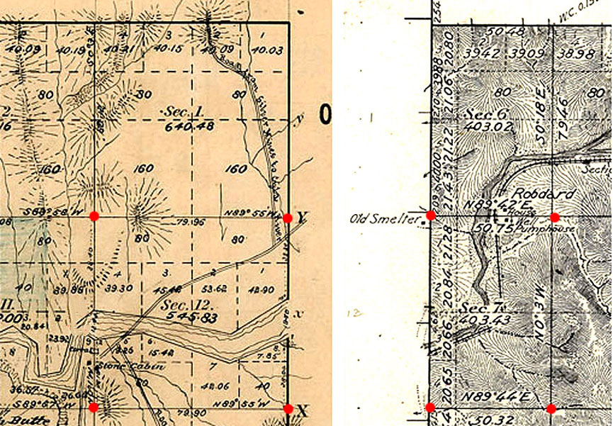
In the photo below, the image to the left is from the 1892 survey. The image to the right is from the adjacent survey to the east which was done in 1926. An "Old Smelter" was identified in the margin of the 1926 map. If the edges of the two surveys are placed together, the old smelter would be located inside Section 12 on the 1892 map near the intersection of the "Road from Silver Mines to Gila River" and the Butte Smelter Road. I think that the "Old Smelter" was a reference to the Butte Smelter.
Why was the smelter not correctly located on the older map? The most likely explanation would seem to be "Surveyor Error".
 |
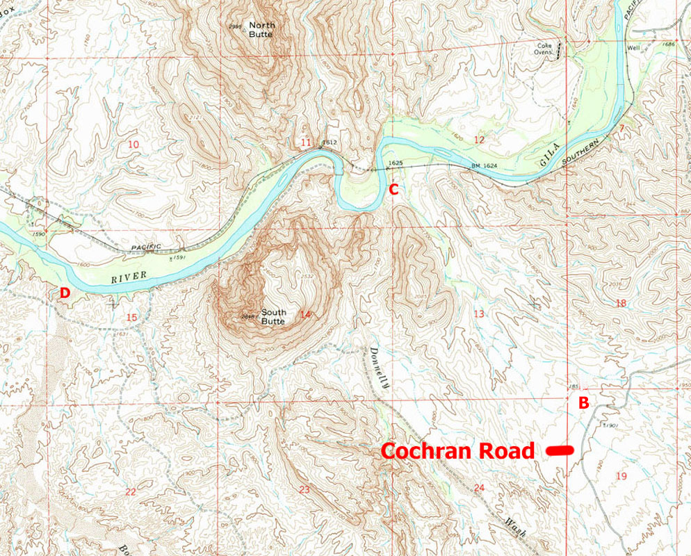
This is a modern topographic map of the area around North and South Buttes. In the northeastern corner, the "Coke Ovens" are identified. If their location is noted with respect to the perimeter lines of sections 12 and 7 and then are compared to the location of the old smelter on the map above, the two places would seem to be one and the same. Were they?
 |
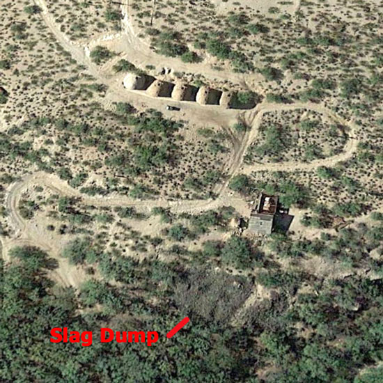
This Google Earth View of the Coke Ovens shows that there was more to the site than the kilns. The slag dump is one indicator that this was also a smelter site.
 |
Articles, from the early 1880s, that were published in "The Arizona Weekly Enterprise", a Florence newspaper, provide context to the places and roads noted on the early maps.
Nov. 26, 1881:
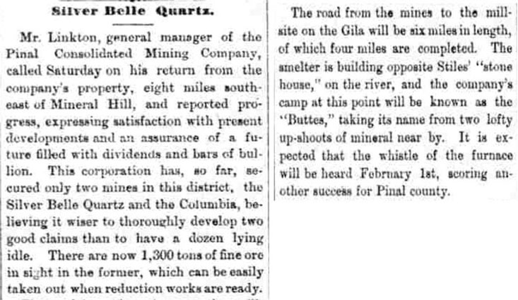 |
December 3, 1881:
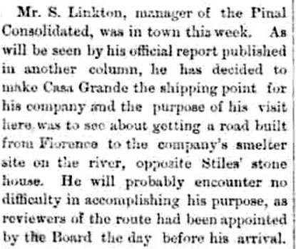 |
December 17, 1881:
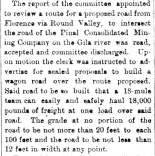 |
In the articles above, the stone house on the Gila was described as "Stiles' Stone House". The 1880 census and other newspaper articles identified Stiles as M.L. Stiles(Martin Styles). Mr. Stiles was a prominent farmer/rancher who was chosen as a county supervisor when Pinal County was first formed in 1875. Stiles was murdered by a step-son, Robert Bible, in June of 1881 at the age of 47. During the probate of the Stiles' property, the cabin on the river was described as a ranch. In the early 1900s, another of Stiles' sons, Billy Stiles, lived a notorious life, as both an outlaw and as a deputy sheriff.
Newspaper coverage of the activity at Butte continued in February of 1882.
February 11, 1882:
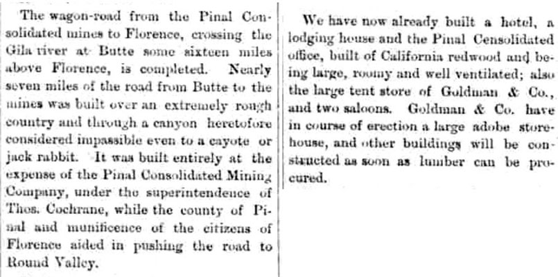 |
 |
The road through Round Valley was the road identified in the 1892 township survey as the "Road from Gila R. to Cottonwood". Cottonwood was a stage station on the wagon road that connected Florence to Riverside. That station was not far from Round Valley.
There was a stage service that did pass by the stone house. But, was the house ever a part of the stage operation? That is unknown.
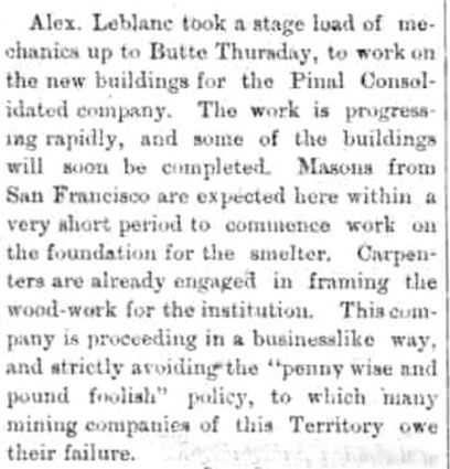
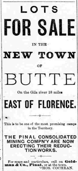
From the volume of construction described, it is apparent that a substantial camp at Butte was established. The exact location of the camp was not clearly described, however. In the listing for "Butte", in "Arizona Place Names", it was noted that the location of Butte was unknown. The camp did acquire a post office in 1883.
 |
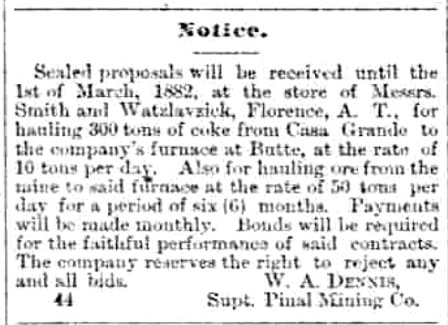
This notice in the Arizona Weekly Enterprise announced that sealed bids were being accepted for the delivery of 300 tons of coke to the Butte Smelter from Casa Grande. The Butte Smelter was not into producing its own coke.
March 4, 1882:
 |
The Arizona Weekly Enterprise reported in May of 1882 that the smelter had been completed, and was in the process of being steamed up.
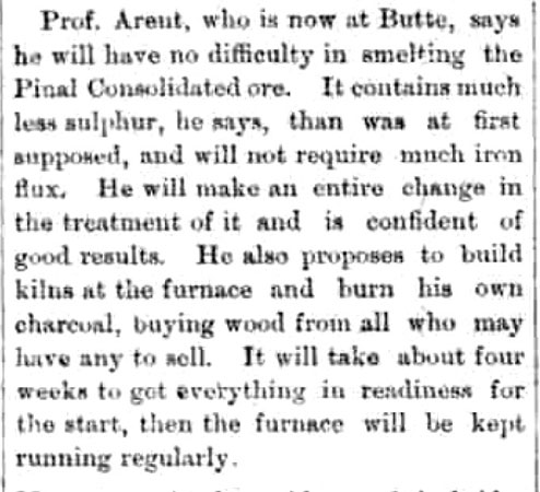
By July, things were not so rosy. The smelter had been shut down. Other newspaper articles noted that the company contracted to provide the charcoal for the furnace had not been able to deliver. The charcoal was not used as a fuel, but was a necessary ingredient in the furnace to ensure the reduction of the silver ore. Sacks were then ordered, and the raw ore was shipped to Casa Grande. From there, it was transported by train to smelters near San Francisco.
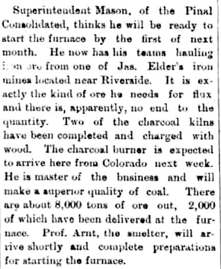
In its September 9, 1882 issue, the Arizona Weekly Enterprise announced that the company would be getting back into the smelting business. Charcoal Kilns would be built at the furnace site.
 |
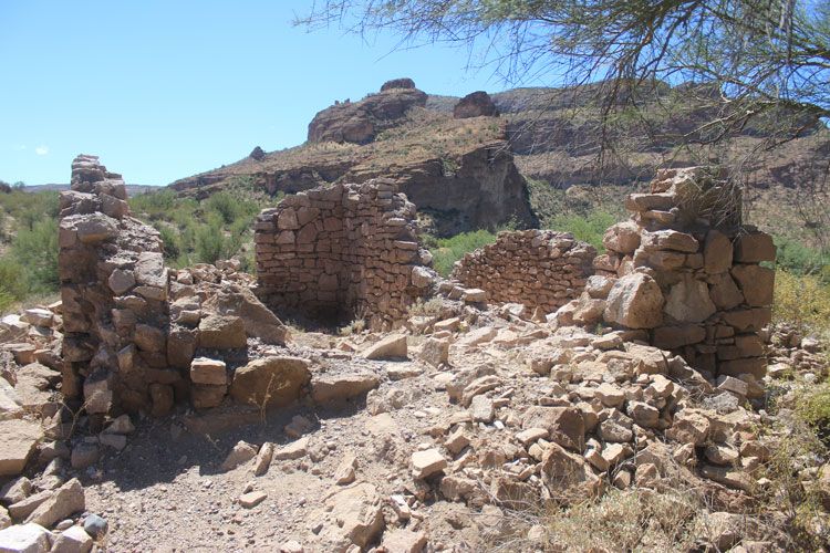
The announcement was made, in the November 18, 1882 issue of the Arizona Weekly Enterprise, that the smelter was nearly ready to go back online. Two of the charcoal kilns had been completed and were charged with wood. I think that it is those charcoal kilns that are seen at the "coke ovens" site today.
 |
The smelter seemed to work for a while into 1883 and more bullion was shipped. Then, in 1884, the mine operation was closed down. One explanation for the closure was that the company's stock values had been manipulated and the resulting litigation was too much for the company to survive.
Wagons and mules were the first of the assets to be sold. The Goldman Company, one of the businesses at Butte, moved to the Phoenix area. In 1886, the post office was closed. A new owner did re-open the mines in Martinez Canyon, but the smelter equipment stood idle until it was sold in 1888. The furnace and the smelter building were eventually removed in the summer of 1889 and were taken to a new mine south of Casa Grande.
In November of 1889, the stone house was connected to another historical event. A few miles west of Riverside, the Apache Kid and 7 other Apaches, who were being transported by stagecoach to the prison at Yuma were able to overpower their guards and escape from custody. The two guards were murdered and the stagecoach driver was seriously wounded in the attack. A non-Indian prisoner was able to escape by running into the brush nearby. He was later reported to "have made his way to the stone house at the Buttes", where he was given aid and then transported on to Florence by a Charles White.
The area around the old smelter(coke ovens) was transferred into private ownership, in the 1920s, through a Homestead Entry Patent. There is no record of such a grant being awarded at the stone house. The current owner of the acreage at the smelter site(coke ovens) has declared that property to be off-limits to public access.
The Drive:
The first leg of the trek on the old roads that once serviced the Butte Smelter and the mines beyond, begins where the "Gila River to Cottonwood" road crosses the Cochran road approximately 8 miles north of the Florence/Kelvin highway. This is at Waypoint B. The gps co-ordinates at the turn are: N33° 04' 26.40" and W111° 09' 41.68". A windmill and corral are across the Cochran Road from the turn onto the old route.
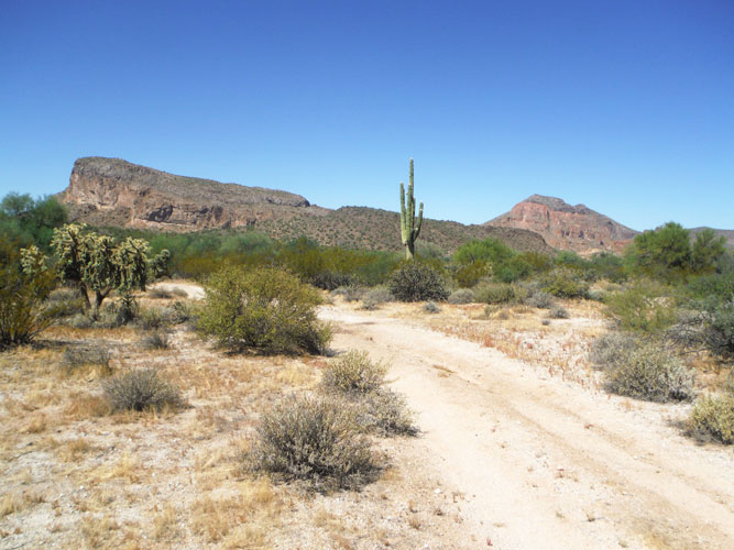
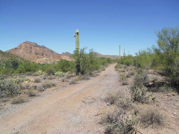
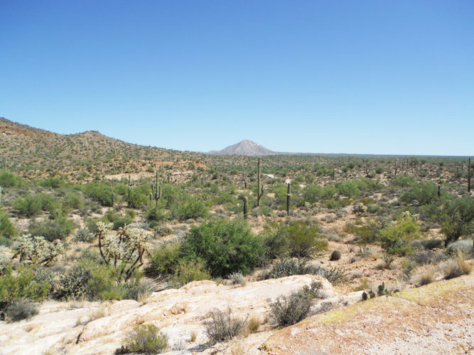
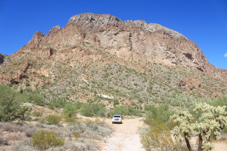
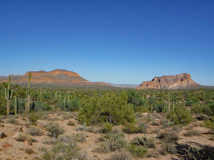
The gentle terrain traversed by this road segment is a reminder that this road was engineered for very heay freight traffic. In the photo below, South Butte is directly ahead and North Butte is to the right.
 |
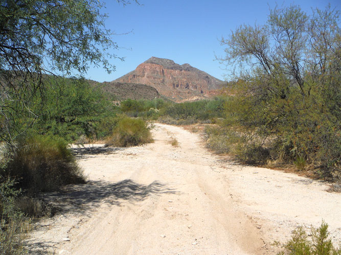 |
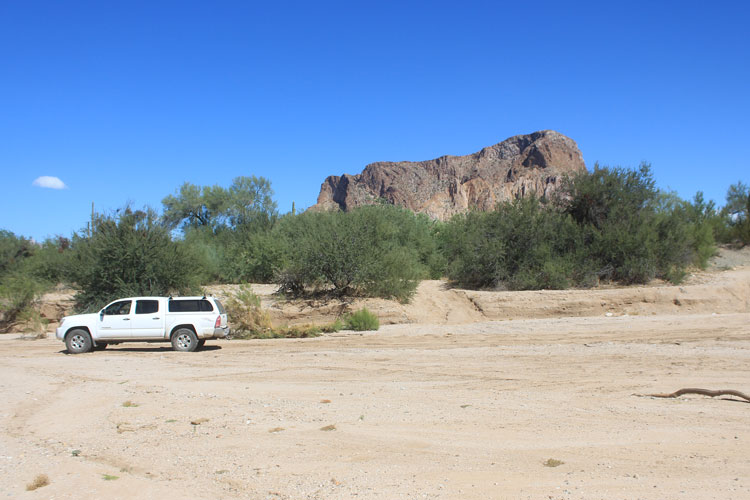
At N33° 05' 07.31" and W111° 10' 26.44", the road leaves the wash and climbs up onto a rocky ridge to continue on towards the river.
 |
 |
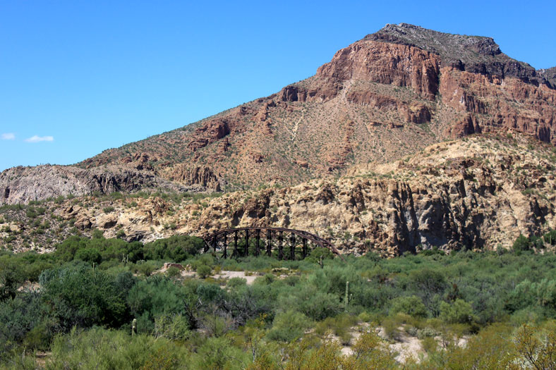
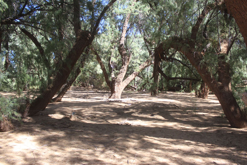
As shown on the early township survey map, the road from Cottonwood did not go directly to the stone cabin, but passed by to the east. Here the walls of the cabin can be seen in the distance with the interesting old railroad bridge and North Butte in the background.
 |
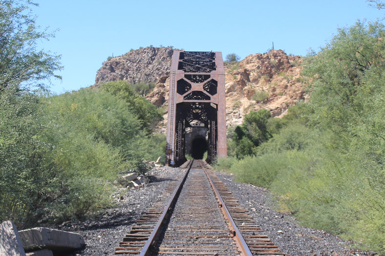
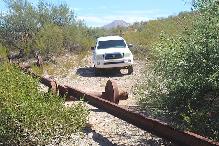
The access roads to the mines and the smelter north of the river were cut off in the early 1900s when the railroad tracks to Kelvin were laid down. Access to those areas is now from farther west or down from the north. Perhaps to discourage "track jumping", other barriers have been installed along the railroad to keep vehicles away.
 |
 |
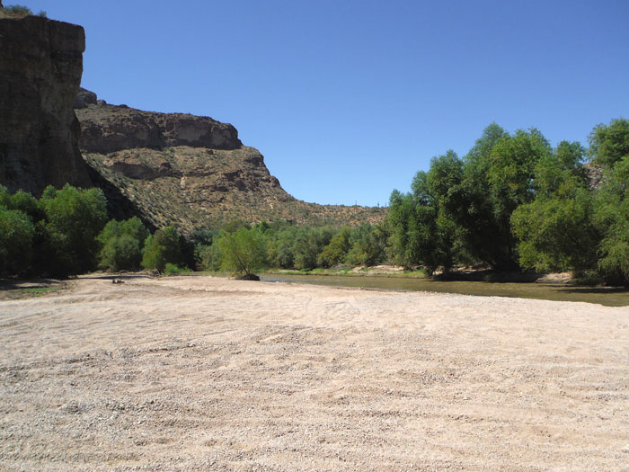
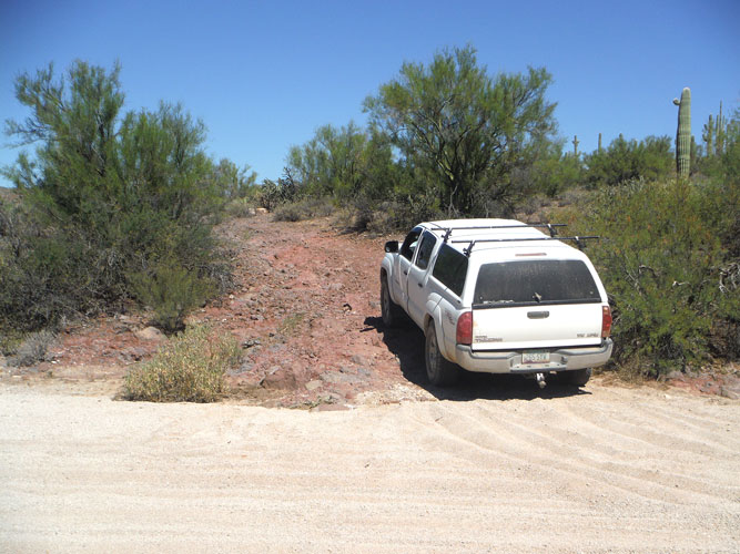
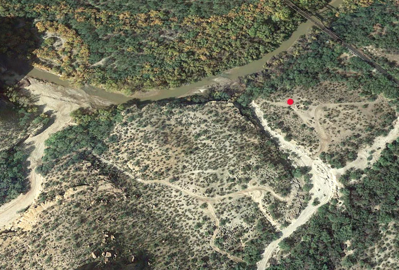
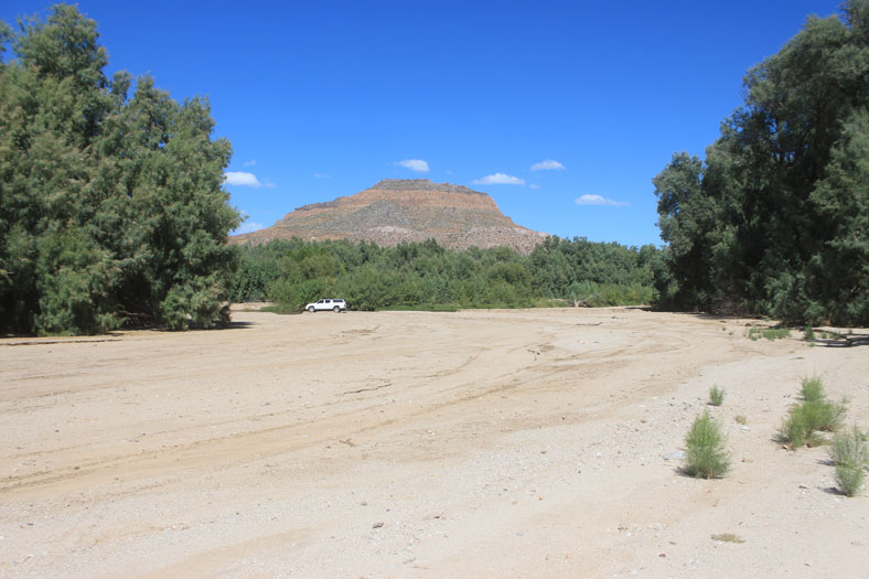
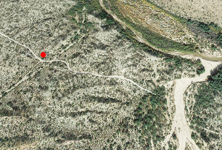
In this Google Earth Image, the red dot marks the location of the stone ruin. The mouth of Donnelly Wash is to the left. A crossover to the wash from the ruin can be seen. There are several options to access it. The choices are not equivalent in difficulty. This next leg of the trip, C-D, is more challenging than the first. The sand is deeper, and the roadways are more rutted and rocky.
 |
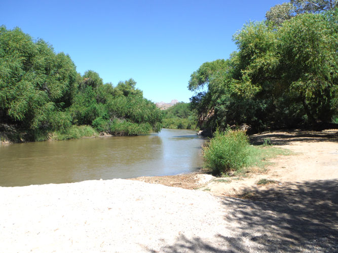
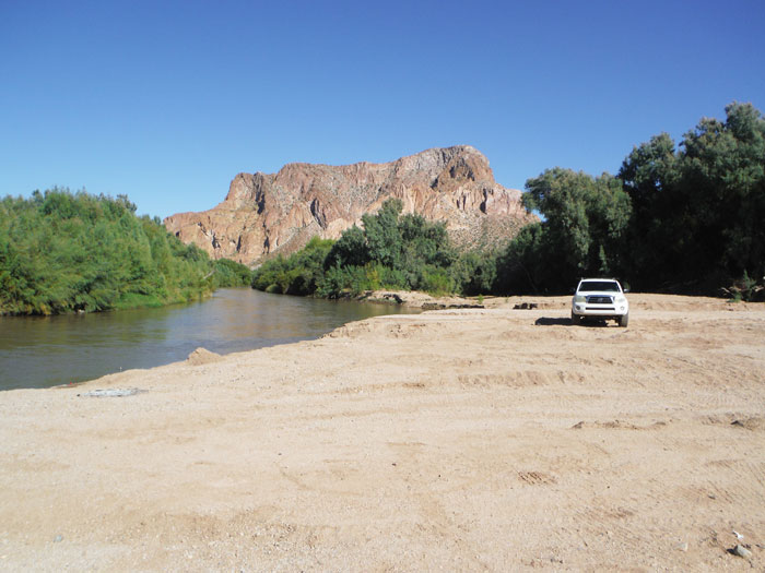
The previous photo of the beach on the Gila was taken with the view downstream. This is the upstream view. When water levels are very low, it is often possible to enter the river bed here and drive upstream to pass under the railroad bridge.
 |
The sand in Donnelly Wash is very deep. Heavily loaded wagons would not have had an easy time negotiating this section of the road. It is not the easiest travel even in modern vehicles.
 |
At N33° 04' 45.91" and W111° 11' 05.69", the route leaves the wash to the west and begins the turn around South Butte.
 |
This is the view to the east. Grayback Mountain is in the distance. The surveyor in 1892 described the vegetation as "Dense Palo Verde Brush". There was no mention of any saguaros.
 |
The handwork that was involved in the construction of the old road can be seen along the way. A rock retaining wall at the edge of this wash, still keeps flood waters away from the road bed.
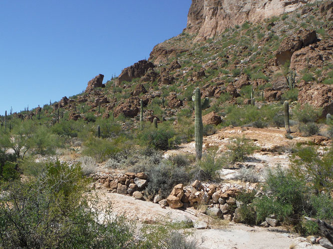 |
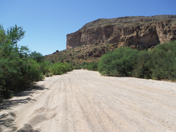
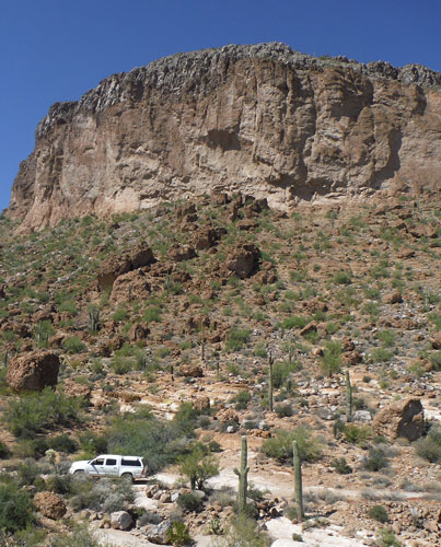
The south facing slopes of South Butte are scenic but imposing.
 |
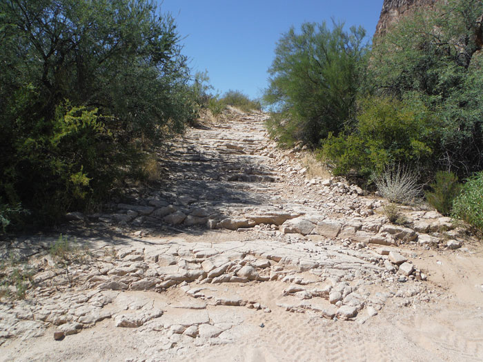
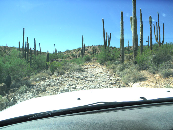
There are stretches of the road that are very rocky. If the original road surface was similar to this, that would have been an uncomfortable ride in a stagecoach or a wagon
 |
 |
In approximately 2 1/2 miles, the trail drops into Big O Wash. From here, it is a short distance down to the river and another scenic beach at Waypoint D. This wash has had several name changes in its history. At the time of the 1892 township survey, it was known as Grant Wash. When the 1912 topographic map was published, the wash's name was Big Wash. Why the change to Big O Wash is unknown.
 |
 |
 |
 |
This Google Earth view of the Gila River at the mouth of Big O Wash shows the continuation of the old road to the west of the wash. In the past, it has been possible to continue on to the Diversion Dam at Waypoint E and then travel to the southwest into Florence. On my most recent trip, I found the vegetation along those sections of the road near the river to be too dense and overhanging for my Tacoma. ATVs may not have an issue. If the attempt is made to drive to the diversion dam, be aware that the dam has been fenced off and it no longer possible to access that immediate area.
I was able to backtrack to a faint trail just west of Big O Wash and follow it out to the Whitlow Ranch Road near Waypoint F. The co-ordinates for the turn west of the wash are: N33° 05' 5.11" and W111° 13" 13.25". The co-ordinates for Waypoint F are: N33° 04' 38.14" and W111° 14' 33.01". This ranch road was not on the original route from the diversion dam. From Waypoint F, it is approximately 7-8 miles south on the Whitlow Ranch Road to the Florence-Kelvin Highway.
 |
This is the view to the east of North Butte on the left and South Butte on the right from the Whitlow Ranch Road.
 |
So where was Waypoint A in this report? The easiest access to the old roads is from the Cochran Road at Waypoint B. The ride can be extended several miles by starting at Waypoint A to the southeast. Getting to Waypoint A requires a bit more planning. While the intersection at Waypoint A is shown on modern maps, the road through to Waypoint B is not. The co-ordinates for Waypoint A are: N33° 02' 44" and W111° 05' 38.57". White's Well on the map below was likely the site of the Cottonwood station. On modern maps, it is shown as Peg Leg Well. It may be a good idea to fly the route in Google Earth before hand.
 |