 |
The Buttes Dam Site on the Gila River
|
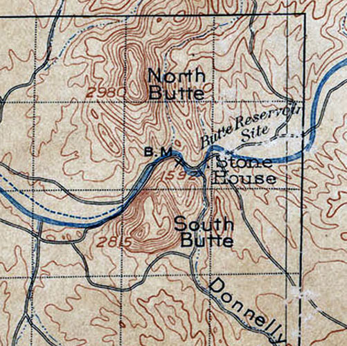
North Butte and South Butte are two prominent landmarks on the Gila River approximately 15 miles east of the town of Florence. In 1899, a major project was initiated there by the U.S. Geological Survey to test whether the narrow gap between the two buttes was a suitable site for the first dam on the river. The notation "Butte Reservoir Site" on this 1902 topographic map was a reference to the project. The field work that was accomplished by the Survey crews was detailed in a report "Water Storage on the Gila River" published in 1900.
Both the scenery and the history associated with the dam site location make it a worthy destination for a walk or ride. I have been back several times.
 |
A Brief Summary of the Site's History:
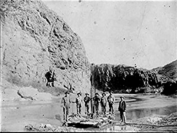
In January of 1899, the field work began at the Buttes. A wagon road was built to the site and diamond core drilling equipment was borrowed from the Nicaragua Canal Commission. Twenty-five drill holes were then put down on five different lines across the river channel. This photo shows a six man crew driving a pipe for one of the diamond core drills.
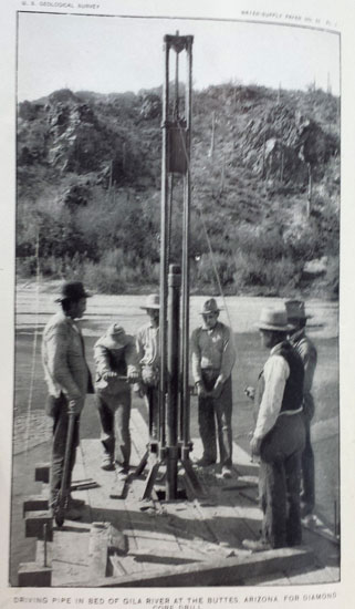 Driving Pipe in Bed of Gila River |
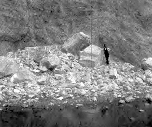
Quarry tests that involved drilling and blasting the rock outcrops adjacent to the site were also conducted. The results of one of those tests is shown in the photo below. Giant powder(dynamite) and black powder were the blasting agents used to break the rocks loose.
 |
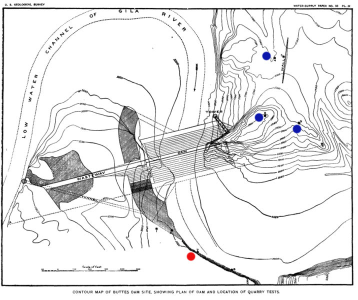
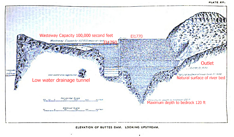
So where was the actual dam site? The description of the 1902 map's "Benchmark 1592" provided a clue: "The Buttes, face of cliff, westside of river, 4.25 feet above surface on axis of proposed dam; bronze tablet stamped "1592 Phnx"........1,592.808" \
This contour map, included in the water storage document, was more definitive.
 |
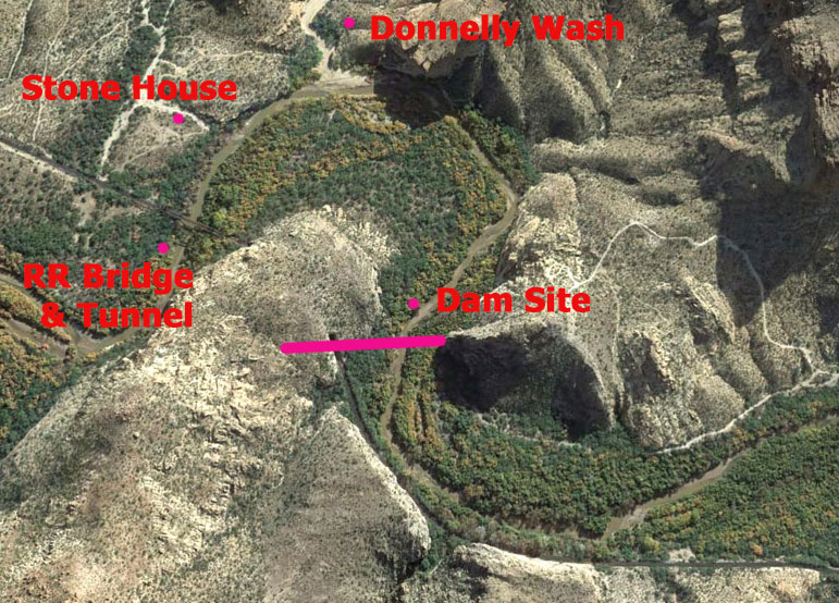
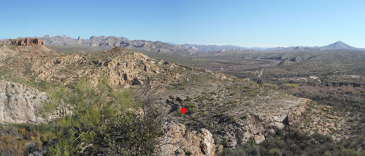
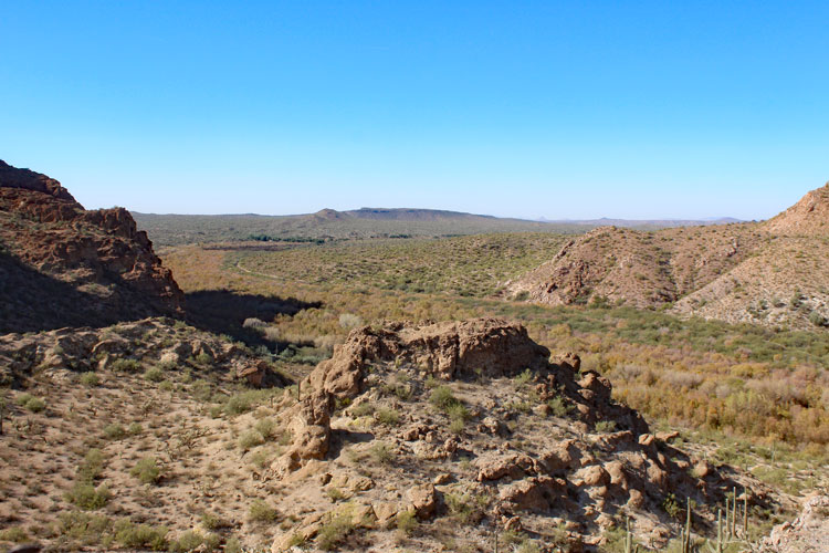
In this Google Earth View of that section of the river noted by the benchmark and the contour map, it is easy to spot the location that the dam was to be built. The roads to the right side of the image are the ones that I used to explore the area. Access to the site from upstream near Donnelly Wash would be difficult. The railroad company has their property posted against trespassing.
 |
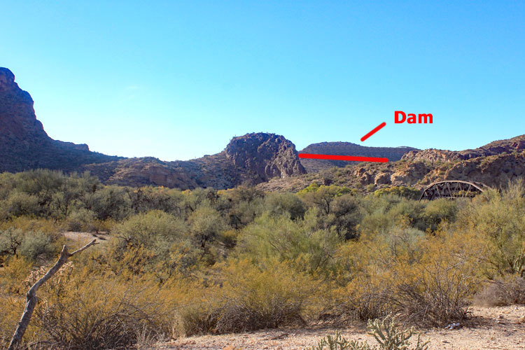
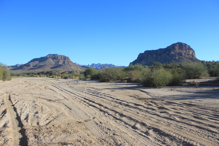
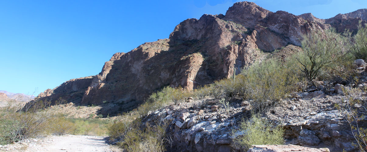
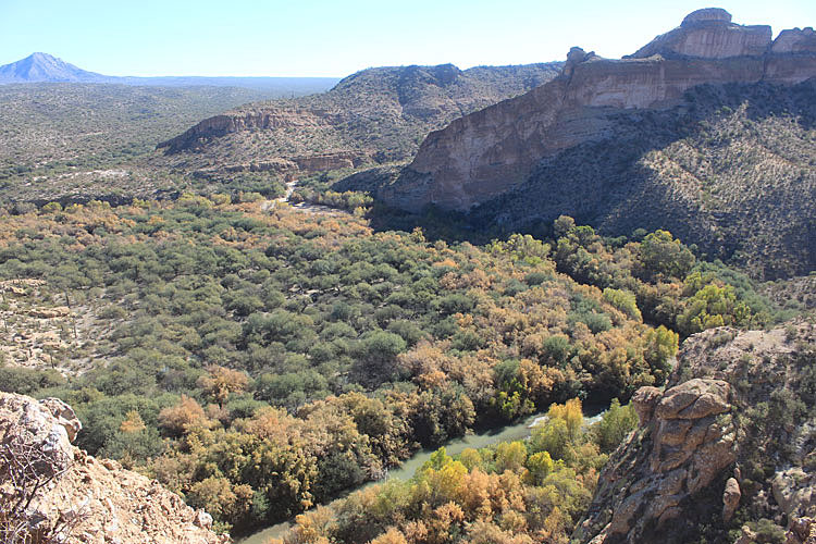
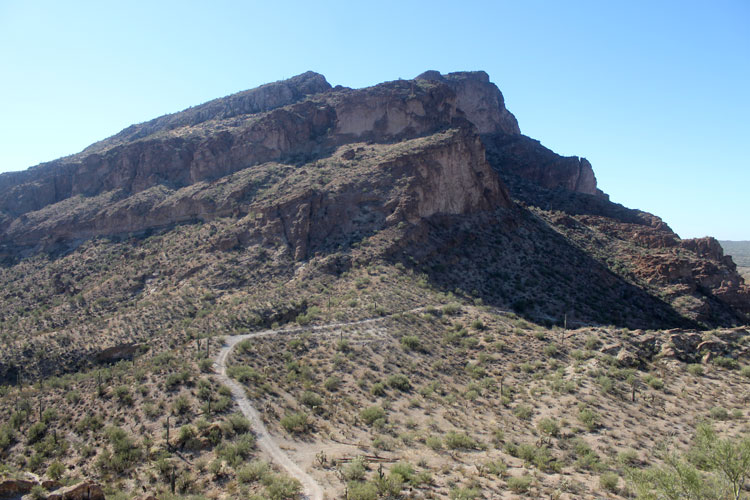
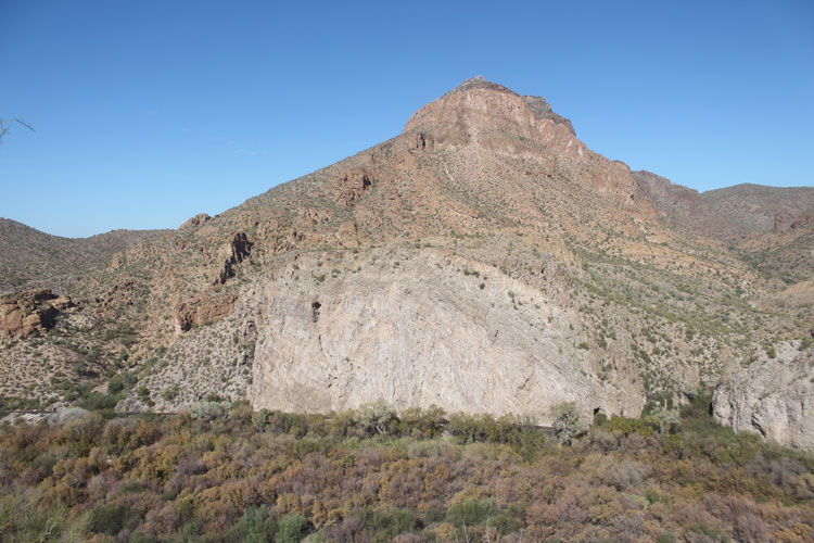
From near the ruins of the Stone House, the rocky knob that would have been the westside abutment of the dam stands out. At a height of 170', the dam would have had the potential to back up a lake of 4000 surface acres. Apache Lake, on the Salt River is about 1/2 that size.
 |
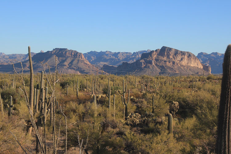
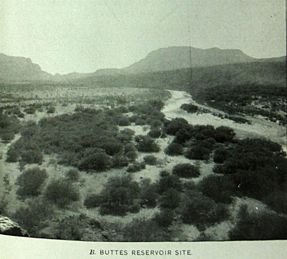
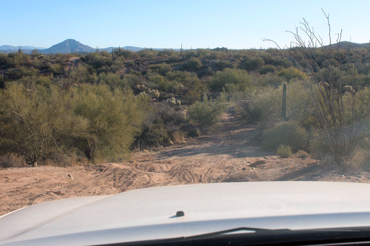
The photo that was used in 1899 to show the lands that would be flooded by the Buttes Reservoir was taken approximately 3 miles above the dam site. The view was to the west across the flat that would later become the location of Cochran, a community of approximately 100 persons that was established in the early 1900s. In the distance, South Butte is to the left and North Butte is to the right. The rocky "dome" at the dam site is visible just to the right of South Butte.
 |
Early in 2018, this was the view across the Cochran Flat . A GLO map from the 1920s shows a railroad section house near the location of the tamarisk trees in the center of the photo. There are several foundations there. To the right, the appearance of the river channel is quite different from what it was in 1899. The grove of mesquite trees in the foreground seems to be pretty similar.
 |
The results of the field work at Buttes were disappointing. It was a real surprise to the Survey's engineers that the bedrock in the river channel was so far beneath the surface. Depths to 122' had been recorded. To further complicate matters, the bedrock, which was primarily made up of volcanic tuff and "pearlite" did not seem to have the strength necessary to support the weight of a concrete dam.
The design of the Buttes Dam was modified and instead of a concrete construction, it was decided that the dam should be built as a "rock-fill" type. Steel plates embedded in a 5' thick layer of concrete would have formed a "skin" on the dam's upstream surface.
The eastern end of the dam was designed at a slightly lower elevation to allow floods of 100,000 cfs to spill over. There had been a flood of that magnitude that had occurred here in 1891. If the dam had been built and had ever reached a level to overflow, the lake would have extended to the A Diamond Ranch approximately 10 miles upstream.
 |
While the conditions at the Buttes Dam site were not completely disqualifying, the engineers felt that alternative sites should be investigated. The field equipment and crews were moved to the "Dikes"--four miles upstream. That site was quickly condemned. The next site tested was "Riverside"--12 miles upstream. This site met the technical requirements for a dam, but it was determined that the project did not have enough money available to compensate landowners upstream for their properties. And there was another issue. The planning for a railroad line into Ray was in the works. The Geological Survey people felt that they should not interfere with that development. So the crews moved on to a site on the San Carlos Indian Reservation, 60 miles upstream from the Buttes.
The San Carlos site tested well for its environmental conditions. There, the bedrock was 48' below the surface and was composed of rock types that were strong enough to support a concrete structure. The government also "owned" the land that the dam and reservoir would occupy. The construction of the Roosevelt Dam on the Salt River delayed the project for several years, but Coolidge Dam was eventually constructed at the San Carlos site in the 1920s.
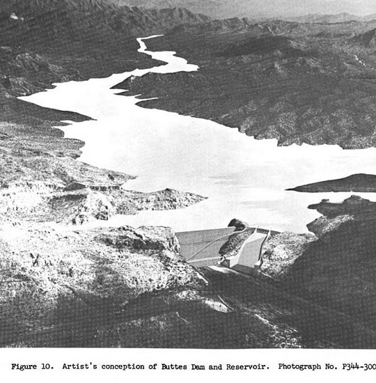
What is really interesting, is that the possibility of a dam at the Buttes did not end with the 1890s project. In the 1960s, serious thoughts were given to construct a dam there in conjunction with the Central Arizona Project.
The photograph below is an artist's conception of how that dam and reservoir would have looked. The rocky butte that would have been the westside abutment for the original dam was incorporated into the new design. This dam would have been constructed of concrete and there would have been a separate spillway.
 |
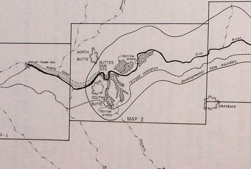
In the 1970s, three archaeological surveys were conducted in the area as part of the preliminary work for the new dam project. This map is from a report published after that work had been completed. It shows that a canal would have been constructed from the dam site to supply water to the canal system at the Ashurst-Hayden dam. The railroad would have been relocated from the north side of the river to the south side. In the developmental zone to the sides of the new lake, roads, campgrounds, boat launches and other recreational facilities were planned.
In 1976, local mining officials felt that there was little doubt that the dam would be built. It was thought that construction would begin in 1980 and the lake would begin to fill in 1983. Despite all of this preliminary work, the dam was not built........
 |
Visiting The Site:
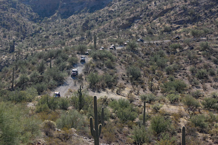
The easiest access into the area of the Buttes Dam Site is from the west side of South Butte by the way of Big O Wash (Waypoint A). The "road" beyond Waypoint B is more suitable for atvs than full-sized vehicles. It is much more interesting beyond Waypoint B to be able to look around at the surrounding countryside than to have to concentrate on getting a vehicle through the dense vegetation and the heavily rutted sections of the trail. Each time, that I have been to the dam site, I have parked at B and walked in from there. The dam site is at Waypoint C.
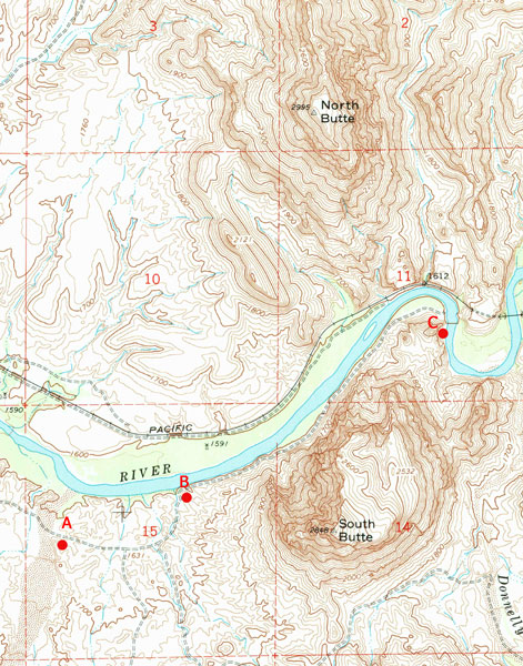 |
Big O Wash can be accessed from the North Whitlow Ranch Road off the Kelvin/Florence Highway. In approximately 5 miles, as the road turns to bypass a ranch building, (N 33° 02' 53.49" W 111° 13' 39.27"), a turn is made to the east on a primitive road that parallels a cross-country powerline. In approximately 3/4 of a mile, at a "T" intersection, a turn to the north is made and in a few yards, the route turns back to the east down into a wash. The bed of the wash is the route downstream to intersect the Big O Wash in approximately 1 1/4 miles. Once in Big O Wash, it is a bit less than a mile to the turn at Waypoint A.
 |
 |
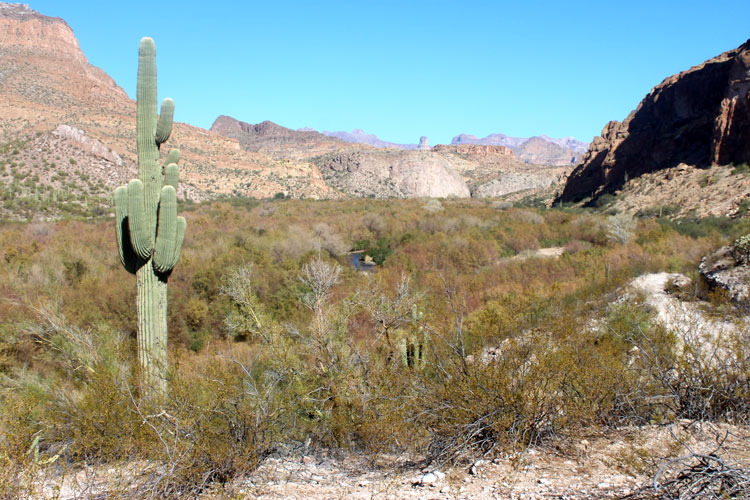
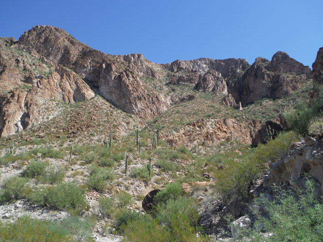
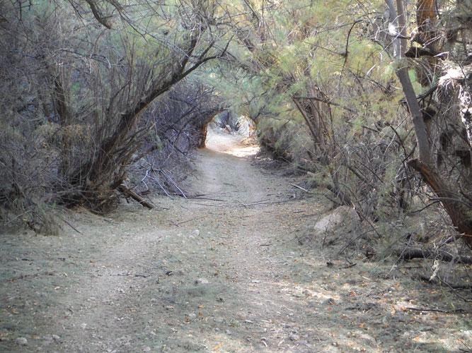
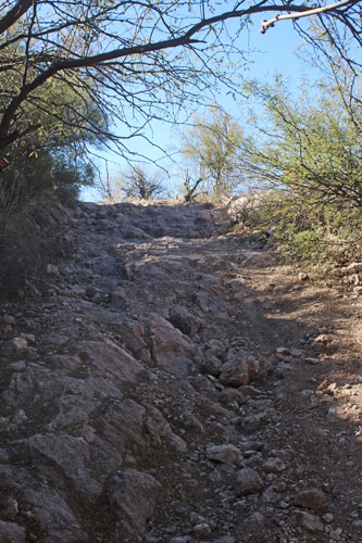
I do not know if the road segment from B to C is a part of the road constructed by the Geological Survey in 1899. It does not appear on an 1892 GLO map, but is shown on the 1902 map above. Tamarisks, mesquites and other vegetation are so dense along the river channel, that if the road were not here, travel, even on foot, would be very difficult. Several "tunnels" have been cut through the vegetation to keep the roadway open. Even so, there is not room for vehicles much larger than an UTV.
The walk along the old roadway is very scenic. I would recommend this as a hike even without its connection to the early dam site explorations.
 |
 |
 |
This photo was taken on my second trip into the area. Someone had been through here and trimmed back the brush to open up the tunnels. The walking was so much easier the second time through.
 |
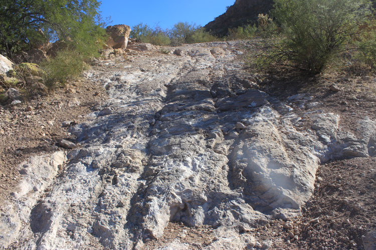
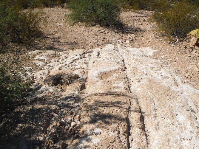
In approximately .8 miles, the spur road to the top of the rocky knob that would have been the westside dam abutment splits off. Where the road crosses an outcrop of volcanic ash, ruts from iron-wheeled vehicles can be seen.
 |
 |
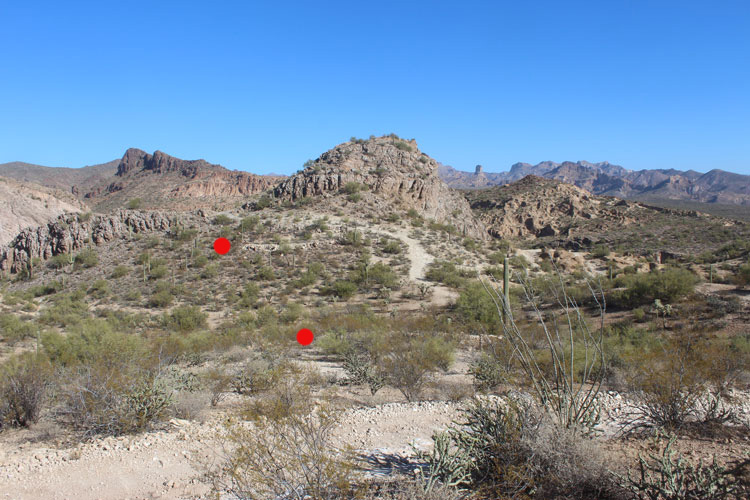
From the top of the spur road, this is the view across to the "backside" of the abutment. In the 1960s dam design, the spillway would have occupied this space. The 1899 contour map shows a "wall" constructed across this low area. The red dots mark the location of two terraces. With which dam design were they associated? Galvanized pipes driven into the ground at each site suggest a more modern activity.
 |
 |
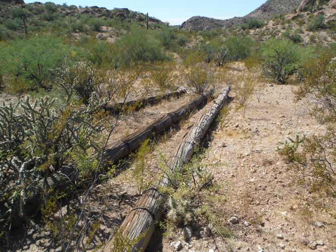
In the low area between the terraces, there are 5 utility type poles. These poles have been re-enforced with metal bands at approximately 2' intervals. Their function, or relative age, is unknown. Do they even have a connection to the dam site explorations? There are no power lines anywhere near this area.
 |
 |
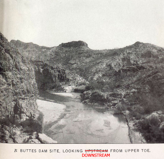
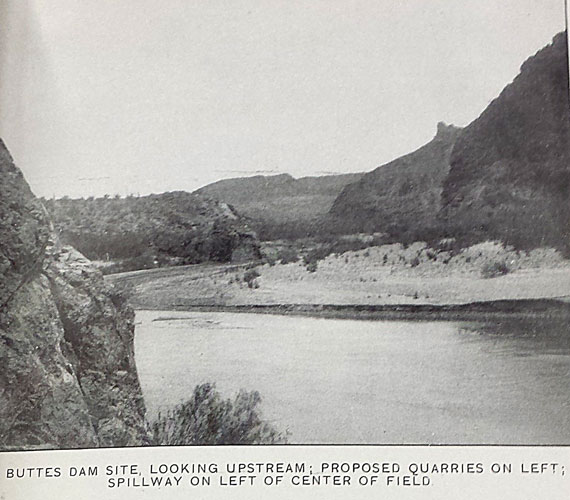
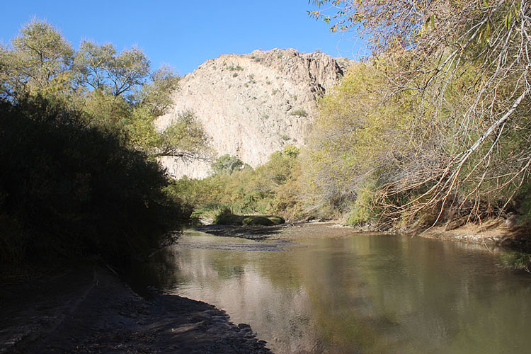
The caption of this photo from 1899 states that the view is looking upstream from the upper toe at the dam site. The "upper toe" is the location where the upstream face of a dam hits the ground.....The edge of the butte in the left foreground was to be the west abutment for the dam. As it turns out, this view is looking downstream.
 |
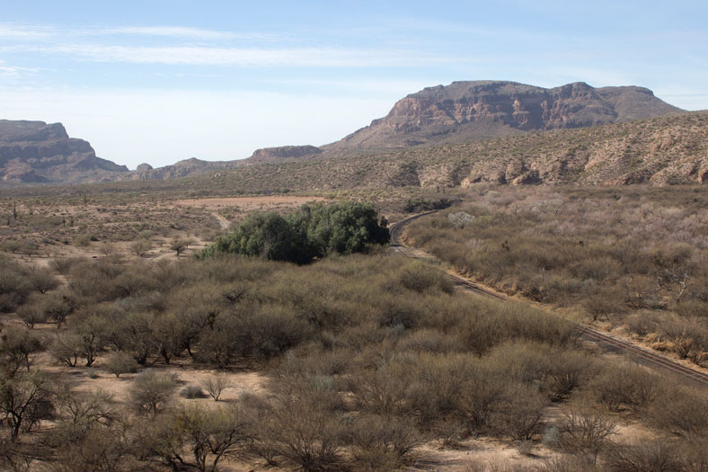
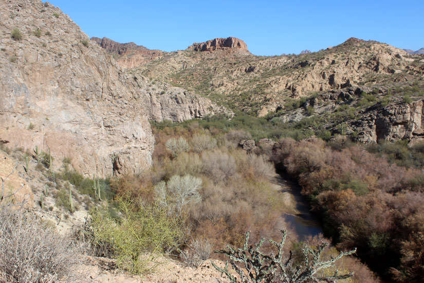
In 2018, this is the view looking downstream at the Buttes Dam Site. We have not cropped the photo as narrow as the original. Once again, the river channel is very different from what it was in 1899. The explanation is that the Gila River no longer floods like it used to. The likely reason.......Coolidge Dam.
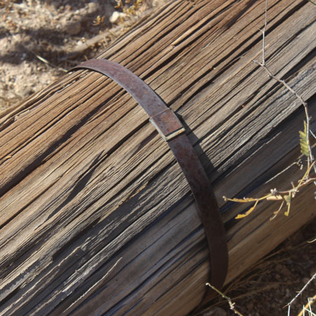
Somewhere on the slope in the left foreground, there may be a "gad" sticking up out of the ground. Apparently, the term "gad" was used for a type of prybar. In this case, the gad was used to mark one end of one of the lines of drill holes put across the river. I tried looking for the gad, but did not find it....
 |
This photo was also taken during the 1899 survey, but was not included in the Water Storage report. Its caption is "Seven Men at Buttes, Gila River Arizona". The background in this photo, when compared to the photos above shows its location. The men are standing on the pipe rig shown at the top of this report. In that earlier photo, the hillside behind the men, seems to be much lower in height than the locations in this section of the canyon.
 |
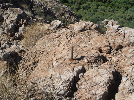
The early contour map shows that a quarry test was conducted just west of the summit of the dam site butte(blue dot on that map). Could this have been that site? A piece of square rebar nearby seems to mark the location. I came across another one similar to this just south of the butte.
 |
 |
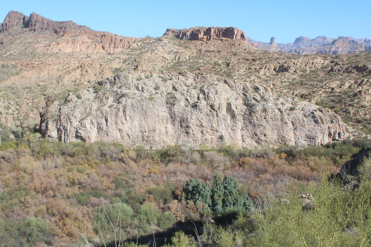
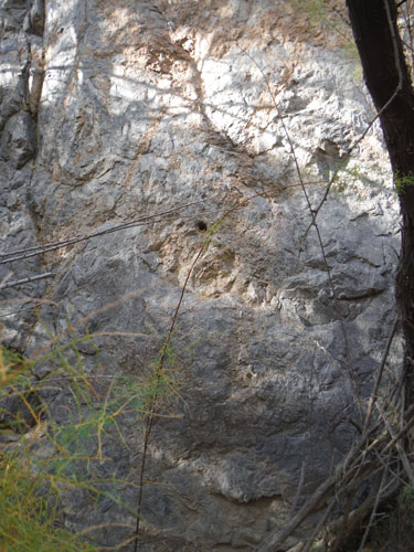
The quarry testing done by the Survey crews in 1899 was very well documented in the Water Storage report. From the information presented there, it was possible to determine that the photo of the rockfall, posted above, was taken at the base of this cliff on the north side of the river. Those rock materials were probably incorporated into the railroad bed a few years later. If the dam had been constructed, tramways would have been built to carry the blasted rock materials to the dam site.
 |
It is a short scramble to the top of the butte from the westside.
 |
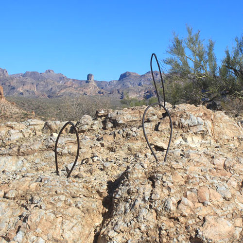
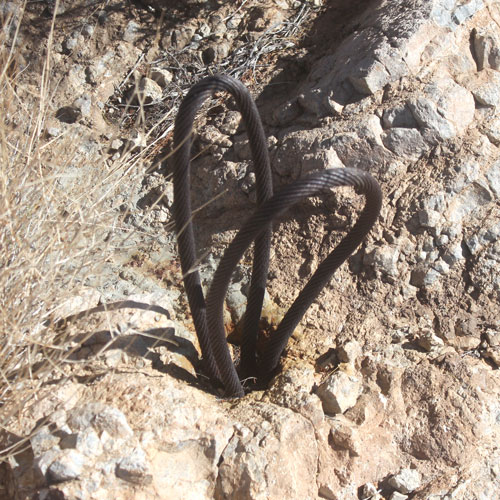
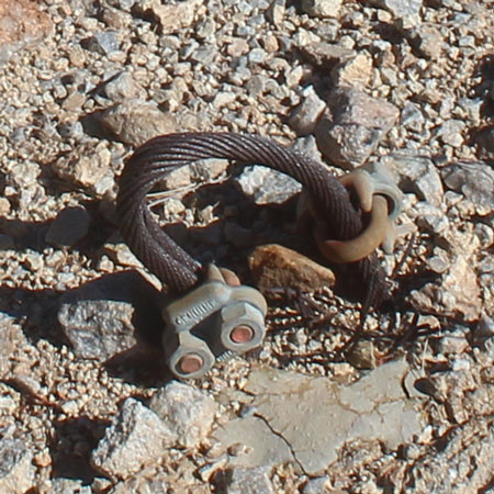
On the summit are loops of cable anchored to the rock outcroppings. There are single loops and double loops. I really have no idea what their function was or to which dam project that they were associated. I cannot explain the purpose of the modern cable clamps seen on one of the sets of the loops.
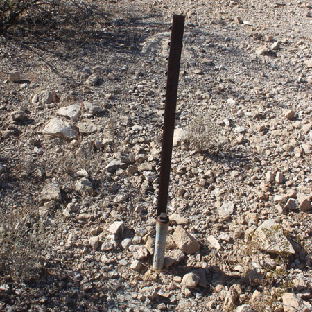
The contour map shows that a quarry test was done off the edge of this summit area. A piece of rebar like those seen elsewhere was not found. There was another galvanized pipe with a cap that had been driven into the rock outcrop.
 |
 |
 |
The views from the top of the butte are really nice. This is towards the northeast. The shadow adjacent to the red dot is the opening to the westside portal of the railroad tunnel that curves inside the hill to connect to the bridge over the Gila. Grayback Mountain is on the skyline to the right.
 |
The complete 180° turn in the river channel is clearly visible in this view to the southeast. Donnelly Wash, where it meets the river, can be seen in the distance.
 |
To the southwest is the massive South Butte. On one of my walks, a group of winter visitors out of Florence drove up to the dam site. It was this group who had trimmed the brush from the tunnels several weeks earlier.
 |
 |
The farmers, out in the Florence Valley to the west, would have been the primary beneficiaries of the dam projects and their associated irrigation systems. In the 1960s project design, a canal would have replaced the railroad tracks seen here.
 |
North Butte is the other dominant landmark in this area.
 |
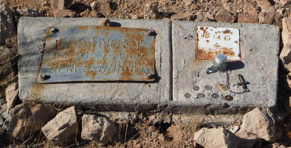
Down off the top of the butte, and back where there are views to the east and west, is this memorial marker. I wonder if this place was one of Renee Warner's favorites?
 |
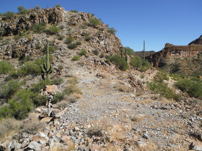
The section of road that continues on past the turn-off to the top of the dam site is more challenging for vehicles. .
 |
The north side of the dam site butte is not as shear as its east side. In the 1960s design, it appears that the dam would have attached to this side.
 |
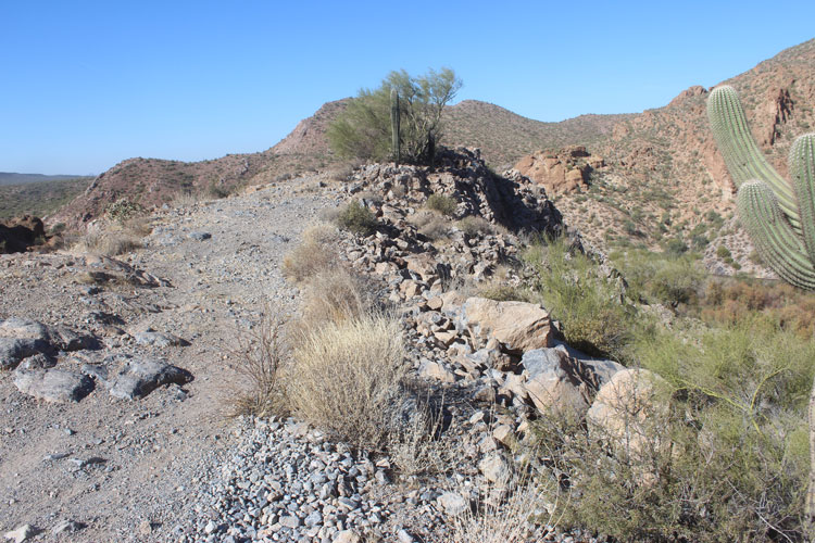
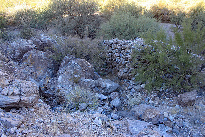
This wall/mound of stones is along the road near the base of the butte. I do not understand its purpose.
 |
Above the rock mound/wall are the remains of an old prospect. It was never very deep and there is essentially no dump.
 |
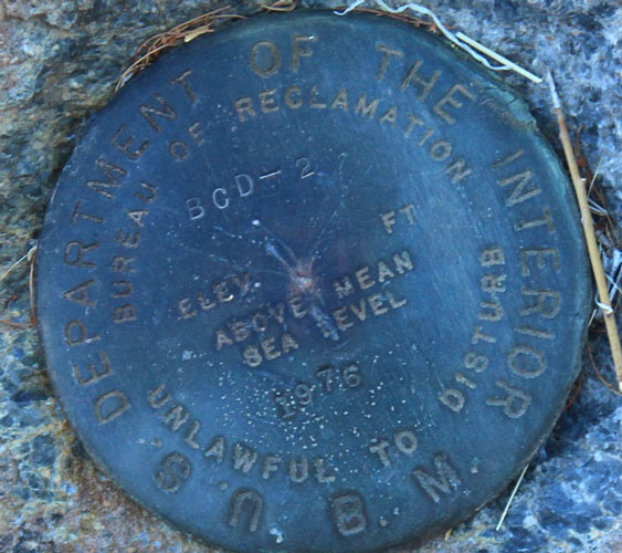
Next to the old shaft is this Bureau of Reclamation bench mark that was set in 1976, the era of the new Buttes Dam project. It would be interesting to know what it marks.
 |
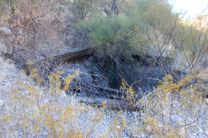
My ultimate reason for walking the old road to the base of the dam site was the hope that I would find the Benchmark 1592. On two different occasions, I was able pick my way through the growth along the base of the cliff to inspect the area where I thought the mark might be. I did see a couple of old drill holes, but that was it. I have since wondered whether the benchmark may have once been attached to the cliff at one of those places.......
 |
This vintage photo was taken from the north side of the river. Today, railroad tracks occupy the photographer's position. The Google Earth view shows so much vegetation along the railroad and up through the river channel that I am not sure that this early view could be recreated even if access were allowed. The use of a drone might be the best opportunity to capture the modern version of this scene.
 |
The road no longer goes to the river's edge, but there are a few small openings in the brush where one can make their way to nice views like this. This is a good place to "turn-around". From here, it is approximately 1 1/2 miles back to Waypoint B.
 |