 |
A Hike to
a Historic Railroad Bridge
near Kelvin
|
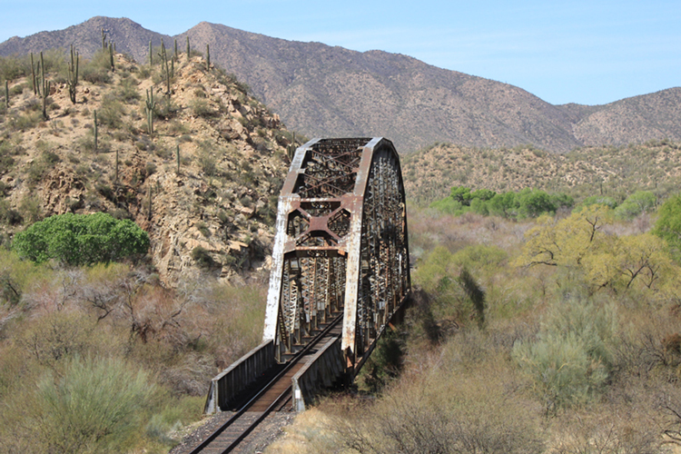
West of Kelvin, in central Arizona, is a very interesting old railroad bridge that was constructed across the Gila River in 1906. The bridge is a worthy destination for those folks who are looking for a day hike in this part of the state.
Access to the bridge is accomplished by walking a scenic 3 mile section of Passage 16 of the Arizona Trail.
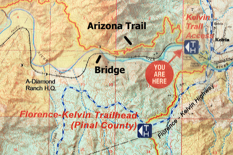 |
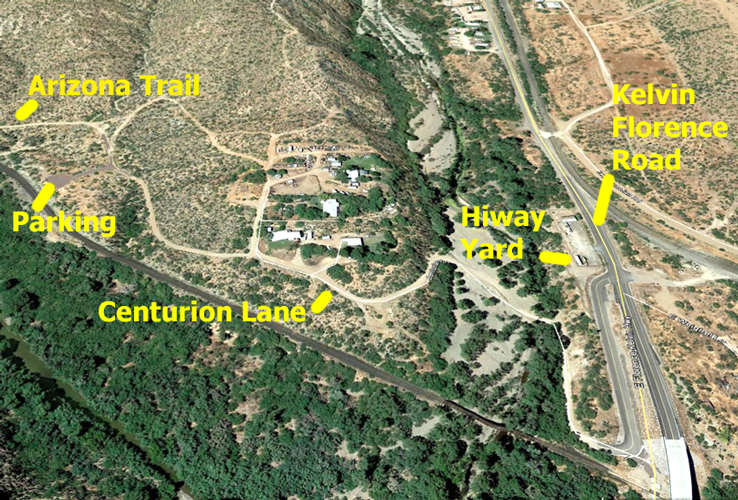
The "Kelvin Trail Access" trailhead is located on Centurion Lane off the Kelvin Florence Highway. The turn onto Centurion Lane is just north of the new highway bridge that crosses the Gila River.
 |
From the parking area, the outline of the Arizona Trail can be seen in the distance.
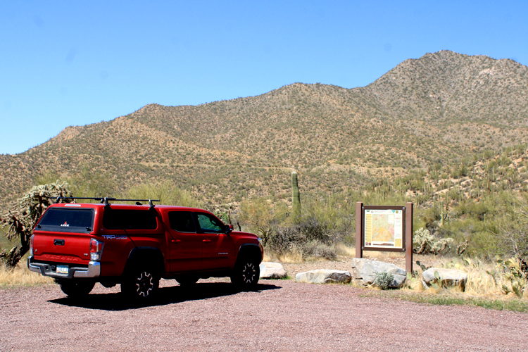 |
The trailhead is located just north of the parking area. For a short distance, the trail follows an old road.
 |
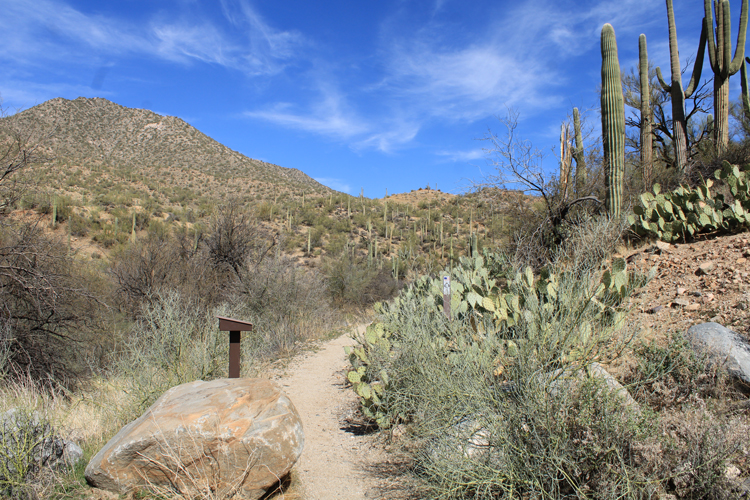
The single track section of trail begins at a registration box a quarter mile or so from the trailhead.
 |
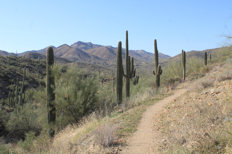
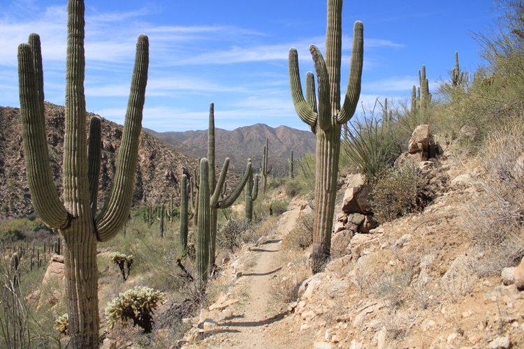
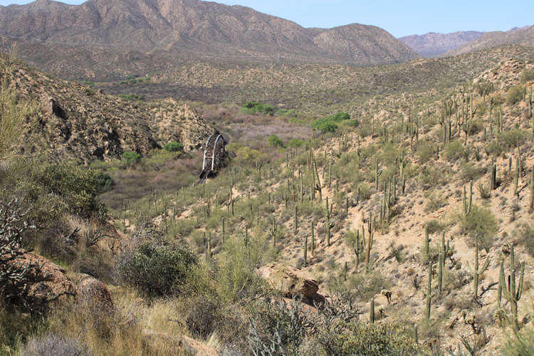
The path is well constructed and is at a moderate grade. At its high point, the trail is several hundred feet above the river.
 |
The trail is used by hikers, mountain bikers, and those who travel by horse or mule.
 |
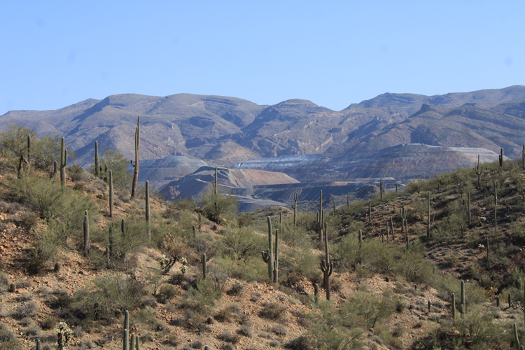
These views to the North are of the Ray mine, a huge, open pit, copper mine. The majority of people who live in this area have a connection to this mining operation.
 |
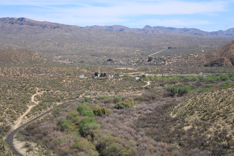
The communities of Kelvin and Riverside appear in these views to the east. The railroad line is still active and is owned by the Copper Basin Railway, a subsidiary of ASARCO, the company that operates the Ray Mine. The tracks parallel the river for many miles.
 |
In the early days of the railroad, both passenger and freight traffic were important. The railroad was key to the success of the mines along its route. Today, the primary customer is the ASARCO Company.
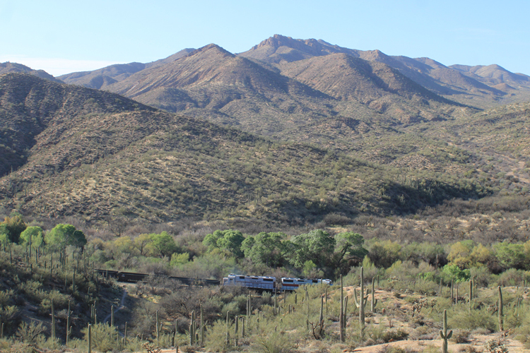 |
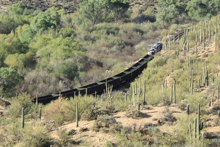
Passenger traffic on the railroad was discontinued decades ago. These railroad cars are carrying copper concentrates that were produced at the Ray Mine. The concentrates are being transported to Guaymas Mexico where they will be shipped overseas for further processing.
 |
The large stands of saguaros and the other Sonoran Desert vegetation all contribute to a very scenic landscape.
 |
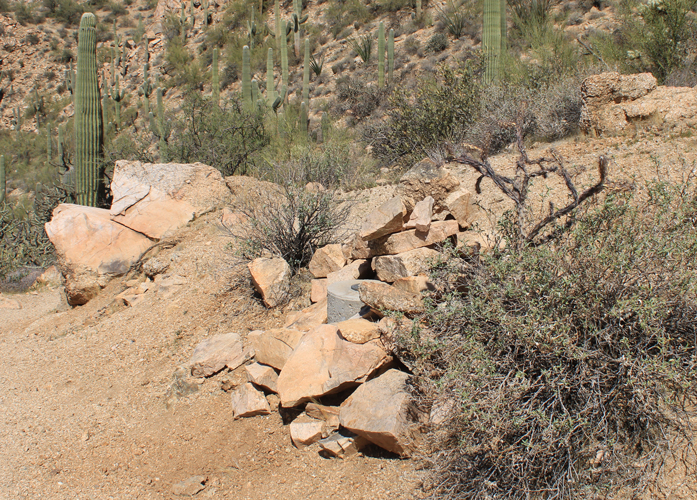
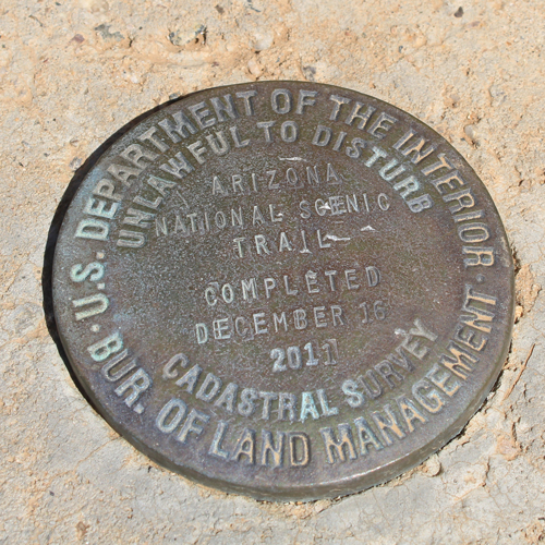
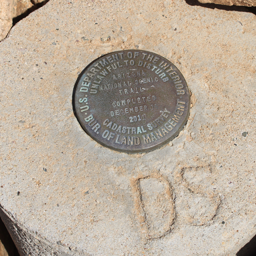
An interesting landmark along the way is a benchmark that commemorates the construction of this section of the Arizona Trail, This was the final piece of the 817 miles long trail to be built. The initials "DS" inscribed in the concrete acknowledge Dale Shewalter, who was the driving force behind the creation of the trail.
 |
 |
 |
The last half mile or so of the trail to the bridge is a bit steeper. Switchbacks moderate the grade.
 |
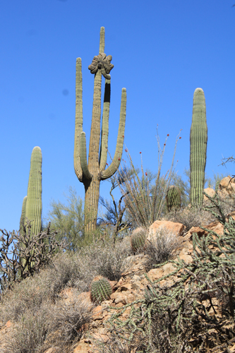
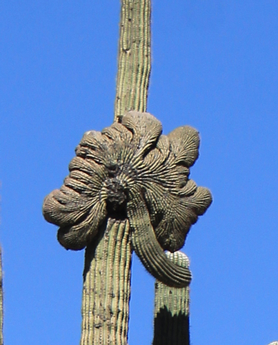
There is an interesting crested saguaro alongside this section of the trail.
 |
 |
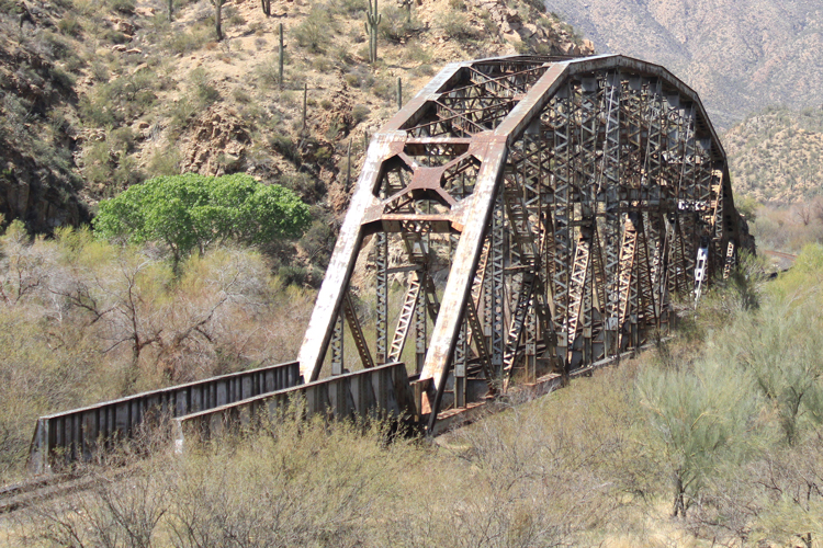 |
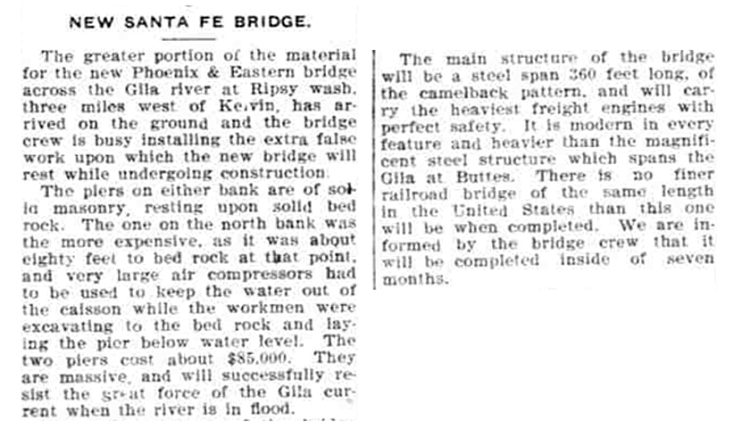
The Phoenix & Eastern Railroad Company was organized in 1901. Its mission was to construct a railroad line that would connect Phoenix to Benson. Tracks were laid southeast from Phoenix to the north side of the Gila River near Florence. At Buttes, fifteen miles east of Florence, a bridge was constructed to allow the line to switch over to the south side of the river. The original plan was to remain on the south side of the Gila to Dudleyville where the line would turn up the San Pedro River Valley to Benson. As the line was being constructed above Buttes, the plan was changed. The decision was made to move back to the north side of the river. It was also decided that the final destination would be San Carlos east of Globe, not Benson east of Tucson. A second bridge was required to cross over the river to the north side. This is the second bridge.
Both of the bridges were constructed by the American Bridge Company, an enterprise of J. P. Morgan. The construction of the Kelvin Bridge was described in an April, 1906 issue of the Bisbee Daily Review. Prior to the construction of this bridge, a temporary crossing of the river had been in use.
 |
The history of the Phoenix & Eastern Railroad Line is documented in David Myrick's "Railroads of Arizona Volume II". The railroad line never made it to San Carlos. For a variety of reasons, construction ended at Winkelman approximately 20 upstream from this bridge.
In Myrick's write-up, the Kelvin Bridge is described as a "pinned through pass truss bridge". It took some research for me to understand what this meant. I have since learned that truss bridges are those in which the supporting girders and beams are arranged in triangles. The triangles direct the forces exerted onto a truss bridge outwards to its ends. A through pass truss bridge is one in which the trusswork surrounds all sides of the travel deck. The term "camelback" that was used in the early newspaper article referred to the curved shape of the bridge.
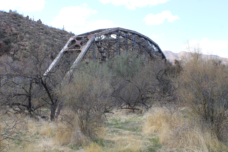 |
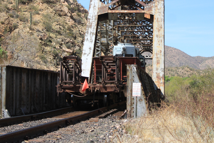
I believe that the portion of the bridge to the left is a newer addition. The date of 1961 is scribed into its supporting pier. Flooding through the years has played havoc with this bridge. Perhaps, it was one of those events that was the reason for the extension.
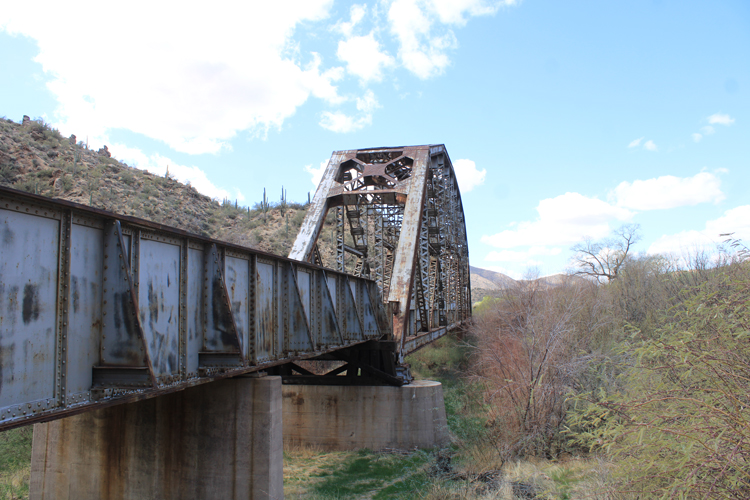 |
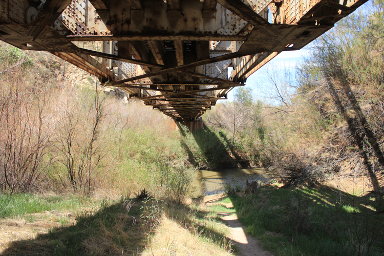
This is the view to the west through the bridge. The sign says that the tracks and the bridge are private property and access is prohibited. There are no other signs in the area.
 |
It would be very dangerous to be on the tracks/ bridge. There is no room to stand aside when there are trains
 |
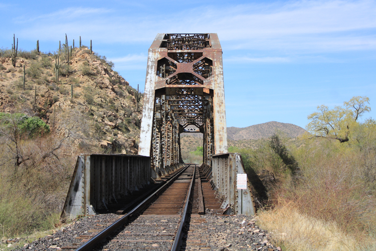
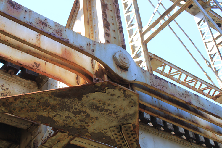
The bridge girders were joined together with steel pins. This is the origin of the term "pinned" in the description of the bridge. This technique is not used with modern bridges.
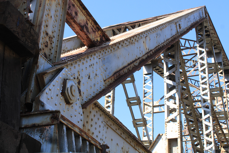 |
This is another example that shows how the girders were pinned together. The open girders with the alternating "V" bracing were developed to save weight.
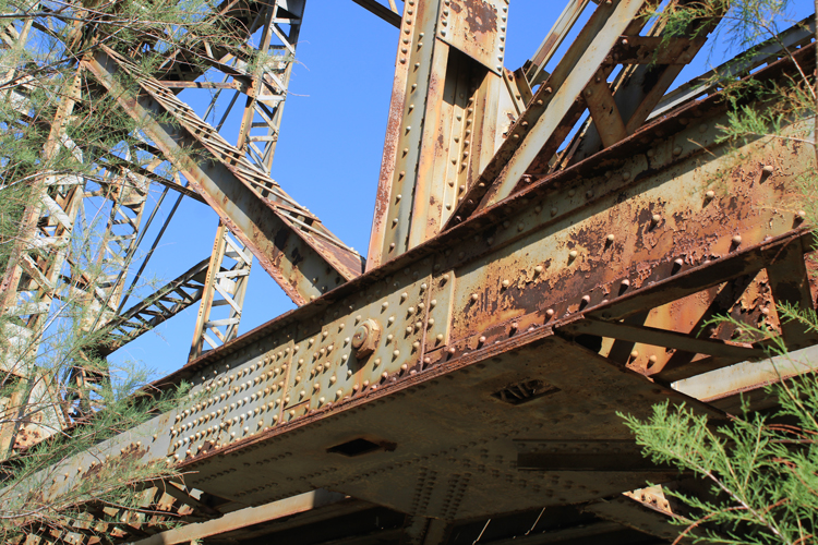 |
Thousands of rivets were used in the construction of this bridge. Today, bridges are put together with bolts or the pieces are welded together. Two or three men were required to set each of the rivets in this bridge.
In the early 1900s, steel mills were not able to produce large beams having an "I " cross section. Angle irons were riveted to flat lengths of plate to create that shape. Today, the construction of one piece beams is not an issue.
 |
Eyebars were also used in the construction of older steel truss bridges. These long lengths of steel plate with "eyes" were pinned together to provide structural support. Eyebars were used to save weight.
 |
The view of the under portion of the bridge. Cross-bracing lessened the "sway" in the bridge.
 |
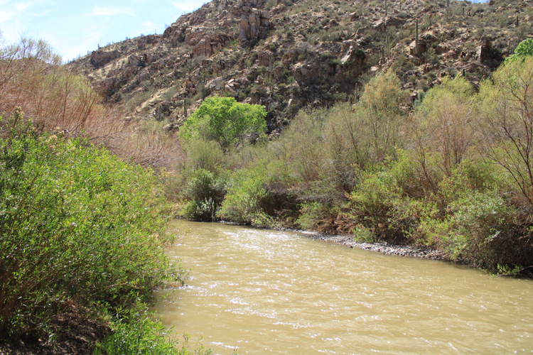
The Gila River in March/April of 2021
 |
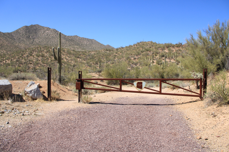
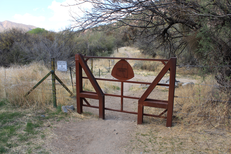
For those wishing to continue their trek on the Arizona Trail beyond the old railroad bridge, the route is through this gate.
 |