 |
Bears Ears National Monument Utah
|
In the fall of 2023, while out on an extended road trip through southwestern Colorado and southeastern Utah, my wife and I traveled to Bears Ears National Monument to see what it was about. We originally planned to be in the area for two days, but ended up extending our stay to twice that.
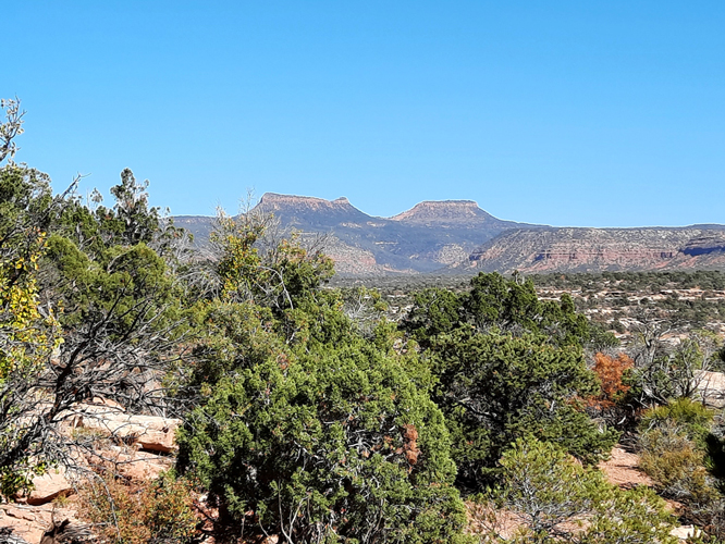
Barack Obama created the Bears Ears National Monument in 2016 to preserve Native Americal cultural sites and the natural landscape features that covered a sizeable portion of southeastern Utah. Two prominent buttes that were known as the Bears Ears contributed their name to the new monument.
 |
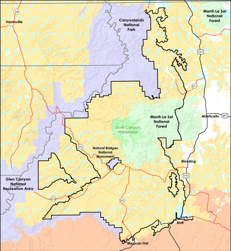
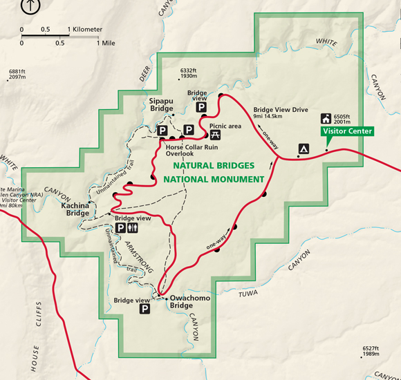
This map, which is from a Department of Interior website, shows the extent of the monument. We used Blanding Utah as our base of operations and supply point. In our research done prior to arriving in the area, we knew that there were no gas stations, stores, or restaurants in the monument. It was necessary to be prepared before traveling there.
 |
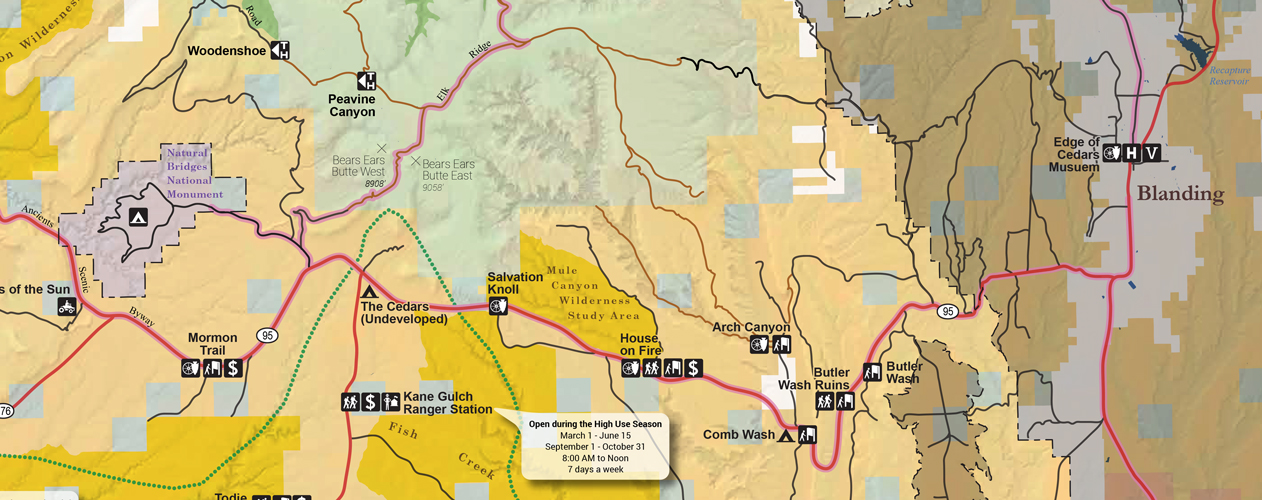
Our introduction to Bears Ears came while on a drive along Highway 95 west from Blanding to visit some of the sites that were located along the highway. We used this map to help with the navigation. It can be found online here.
 |
Butler Wash Ruins:
Our first stop was at the Butler Wash Ruins. There, we found a short trail that lead across the desert to an overlook on the rim of Butler Wash. The trail was approximately 1/2 mile in length. Of the sites that we visited during our visit to Bears Ears, this trail was the most developed. At the other sites, the paths were not as distinct. From the overlook, several cliff dwelling ruins could be seen in the alcoves across the canyon.
This was the view of the cliff dwellings from the overlook. More info on the site can be found here. At the link, it is stated that although there is no trail to the ruins, hikers are allowed to find their way there for a closer look.
 |
 |
House on Fire Ruin:
One of the cultural sites in the monument that is mentioned very frequently online is the "House on Fire" Ruin. This ruin is one of the few sites that are shown on any of the offical publications produced by the Forest Service or the Bureau of Land Management, the two agencies that manage the monument. Although the ruin was identified on the map above, there were no directions or signs provided to guide visitors to the trail that led to the ruin. Fortunately, we had downloaded directions from websites that we had looked at prior to our trip.
Websites that we had found useful were: https://www.gjhikes.com/p/utah_12.html and https://www.hikingwalking.com/destinations/ut/ut_se/blanding/
While there is no fee to enter the national monument, there are day use fees and permits required to access some of the sites on the monument. The "$" symbol on the map indicated those areas for which permits are required. Federal Recreation passes cannot be used to cover the fees. The permits, which can be purchased for a day or a week, were $5 per person for the daily permit or $10 for a weekly permit. The permits can be obtained at the self-pay kiosks at the sites. A permit is required to hike to the House on Fire Ruin.
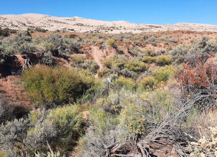
There was no developed parking area at the trailhead for the hike to the House on Fire Ruin. This is what we found when we got close to the trailhead. We were here the weekend in October of 2023, when this area was ground zero for a solar eclipse. There may have been more people in the area than usual.
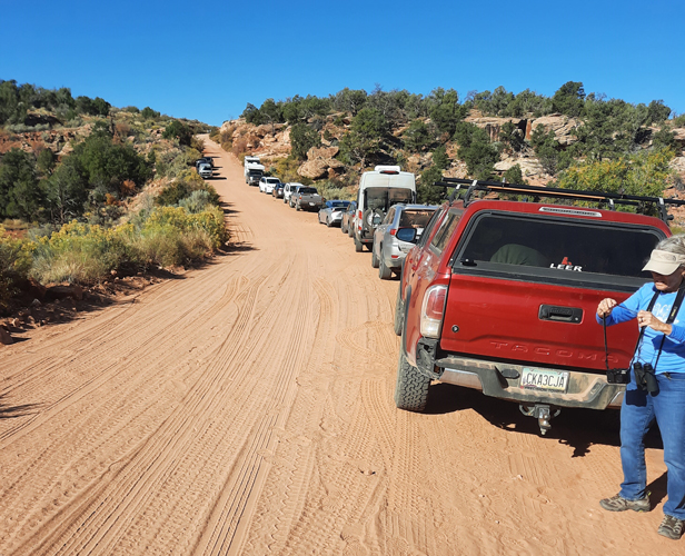 |
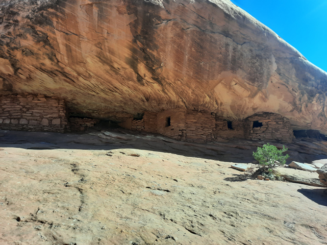
The trail to the House on Fire ruin was essentially in the bottom of the wash. It was just under a mile from the trailhead to the ruin. As indicated by the number of cars parked along the road near the trailhead, there was a steady flow of people both going and coming....
 |
The ruin site is composed of 5 structures that have been identified as granaries that were used for storage. They have been associated with the Anasazi culture.
Although there were quite a few people at the site when we arrived, we were able to snag several photos with no one in the view.
 |
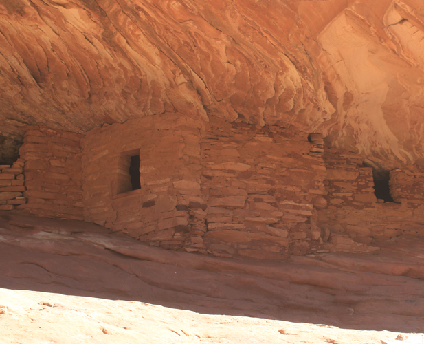
The ruin is named for the colors in the rock formations above the strutures. There are times when those formations are lighted in such a way that they appear to be flames emanating from the roofs.
 |
Natural Bridges National Monument:
We concluded our 1st day's adventure with a drive over to Natural Bridges National Monument. We were surprised to learn that this was one of the oldest sites in the National Parks system having been established in 1908. The park was created to protect those areas associated with three natural bridges. We did the normal tourist thing by taking the loop drive through the park to view the bridges.
The infrastructure at this monument was quite different than what we had seen at Bears Ears. Here there was a visitor center, paved roads, developed parking areas and groomed or paved trails to take visitors out to the overlooks to view the sites.
 |
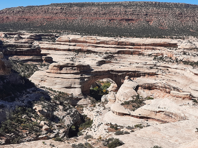
This was the view down to the Sipapu Natural Bridge from the overlook on the rim.
 |
A view of the one of the cultural sites, Horse Collar Ruin, that could be seen down in the canyon.
 |
Our drive through Natural Bridges National Monument completed our exploratory drive along Highway 95. The next task was to find other sites to visit in Bears Ears that were away from the main road.
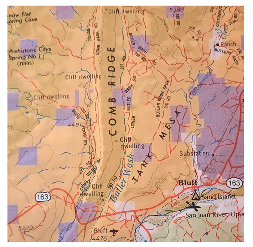
We were using a Delorme Atlas and Gazetteer as another one of the guide books for our travels through Utah. On the page which covered a portion of Bears Ears, we could see cliff dwellings identified that were not indicated on the official maps of the monument. Those were located along both sides of Comb Ridge in the southeastern portion of the monument west of Bluff. We decided to try and locate those on the east side of the Ridge that looked to be accessible from the Lower Butler Wash Road.
 |
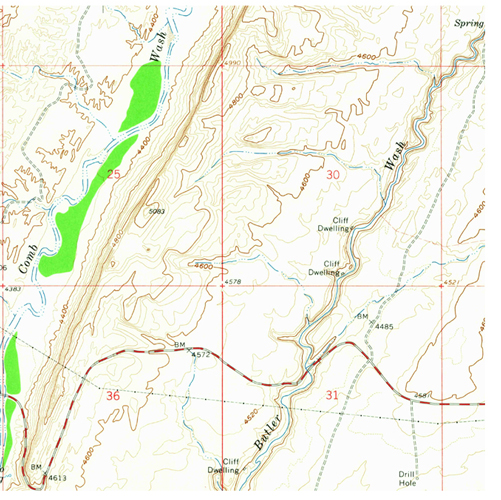
We were able to use the Wifi at our hotel to download topograhic maps of those areas with the cliff dwellings. These provided more detailed information than the DeLorme map.
 |
Butler Wash Road:
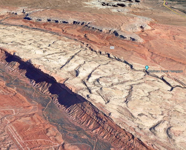
In order to get a better feel for the terrain along the Butler Wash Road, we used Google Earth to provide us with a view of the area. A pin appeared in the image that identified the location of the Wolfman Petroglyph Panel. This was near one of the cliff dwelling symbols on the topo map. After doing a bit more research online, we decided to see if we could find the panel. Our thoughts were that if we were not able to find it, it should still be a nice drive to follow the Butler Wash Road as it made its away along the east side of Comb Ridge.
 |
The Butler Wash Road is an unpaved road that runs for approximately 23 miles on the eastside of Comb Ridge. It connects to Highway 163 at its southern end and to Highway 95 to the north. We accessed the road from Highway 163 southwest of Bluff to visit 3 of the sites on the east side of Comb Ridge.
This was an informational sign along the road that described the area.
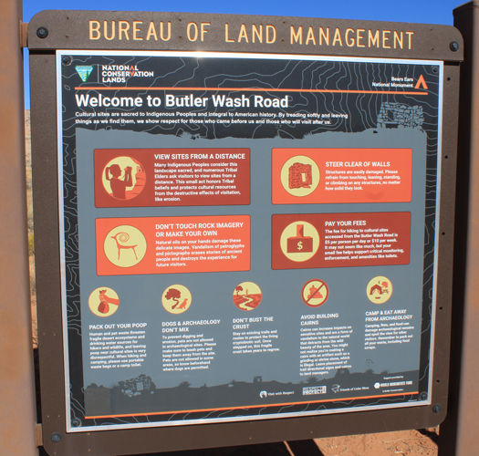 |
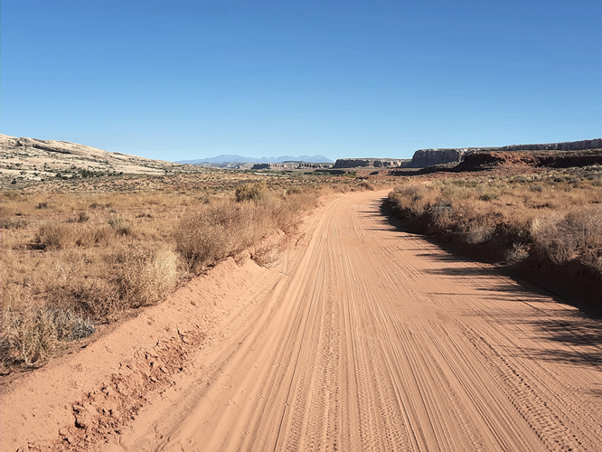
When we were here, the Butler Wash Road was in pretty good condition. Several people told us that the road can be impassable when it is wet. Dispersed camping is allowed along the road. Needless to say, there were a lot fewer people in this part of the monument than there had been along Highway 95.
 |
Wolfman Panel:
With the information on the Wolfman Panel that we had gathered, we drove to the location along the Butler Wash Road, where we thought that we needed to be to begin the walk to the rim of Butler Wash. As expected, there were no signs to indicate that we were in the right place. There was a portapotty and a couple of cars parked to the side of the road and that was it. One useful bit of information that we had picked up on while doing our research was that although there are usually no signs identifying the trailheads to many of the sites, there very often are portapotties located nearby...
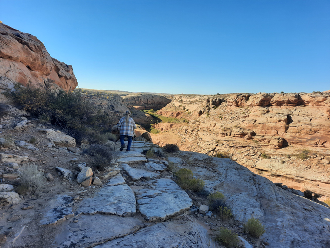
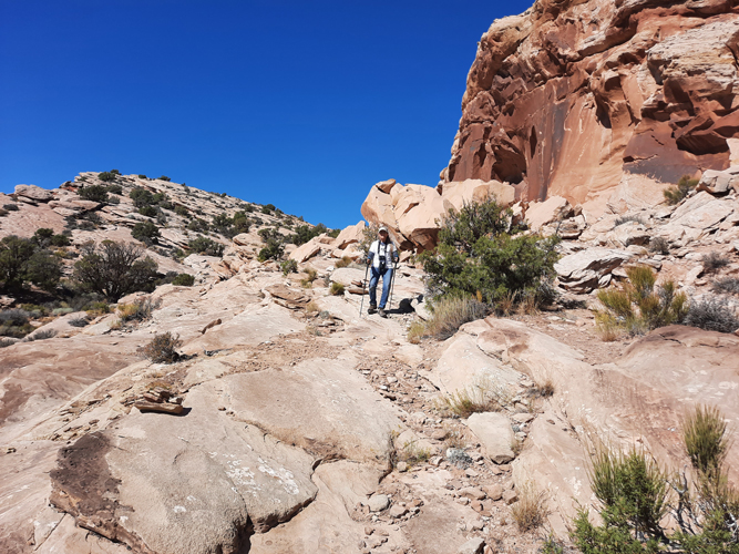
The directions that we had found online were to follow an old jeep road for a short distance and then look for the cairns that marked the route to the rim of the canyon.
One of the rock cairns can be seen in the center of the photo. Those rock piles were very important to our route finding, not only here, but at the other sites that we would visit.
 |
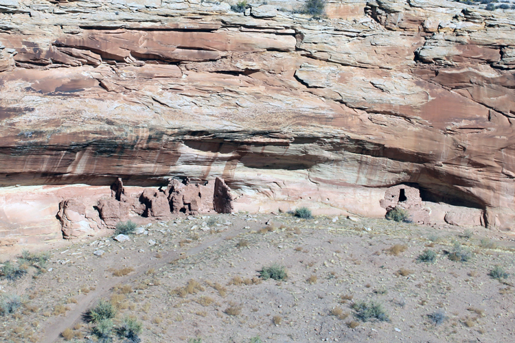
At the rim, this was the view of the most northern of the cliff dwellings that had been identified on the topo map that we were using.
 |
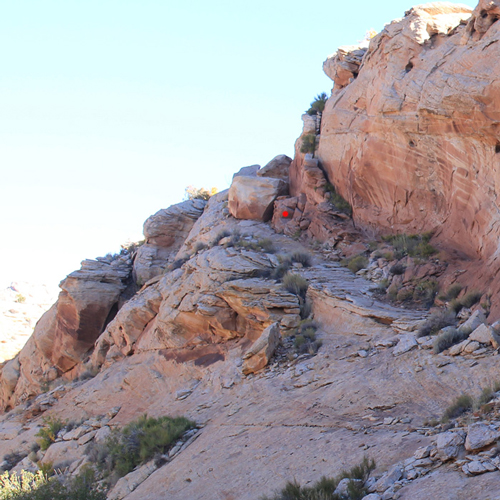
The Wolfman Panel was located down in the canyon. The route was along a ledge formed by a tilted rock layer. There was not a developed trail.
 |
A large boulder(red marker) that had fallen onto the ledge had to be climbed down to continue the descent.
 |
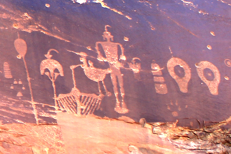
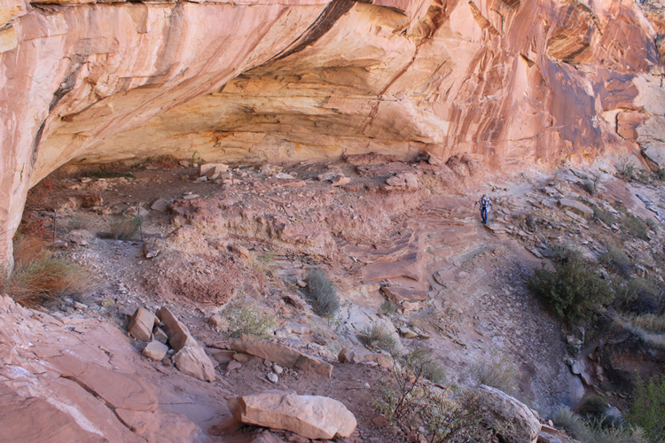
The Wolman Panel was etched into the dark, mineral stained cliff face in the distance. A chain blocked access to the shelter cave.
 |
As with many of the petroglyph panels, you are left to wonder how their creators were able to reach the places where they placed their artwork.
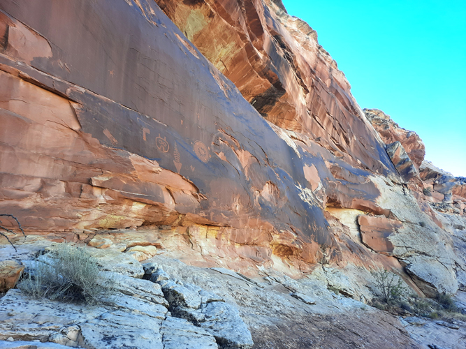 |
The petroglyphs were described as being from the Anasazi culture. There are many speculations as to the meaning of the figures. Could the face-like figure be the representation of an owl's head? As we had seen at the Sego Canyon Petroglyh Site, the symbols here, at some point in time, have been used for target practice.
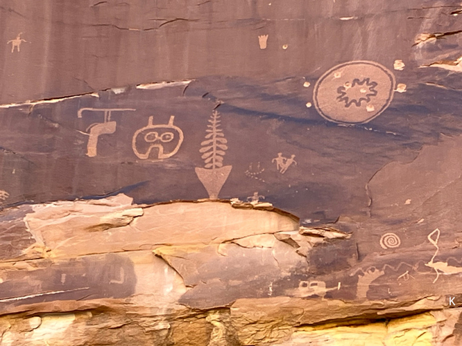 |
Some of these figures were reminiscent of the "alien" figures seen at Sego Canyon. Representations of birds are apparently common in the petroglyphs at Bears Ears. What kind of bird was represented here by the figure with the outstretched wings? Perhaps a crane or a heron? There are two canine prints depicted. Are those of wolves? We missed seeing the petroglyph of a human-like figure with claws for hands and feet that is supposed to have given the panel its name.
 |
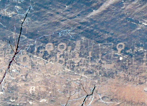
Many years ago, while on a float trip on the San Juan River south of Bluff, we passed by a petroglyph panel that had several "orbs" that were identical to those here on the right side of the Wolfman Panel. What was being communicated by these figures? Was the message the same at both sites?
 |
Procession Panel:
On our next excursion, we traveled a bit further north on the Butler Wash Road to access a second petroglyph panel site known as the Procession Panel. The trek involved crossing Butler Wash and then hiking approximately 2 miles west to the panel which was near the crest of Comb Ridge.
This photo shows the nature of Butler Wash where the trail to the Procession Panel crosses. At this location, the wash was very different from what it had been downstream.
 |
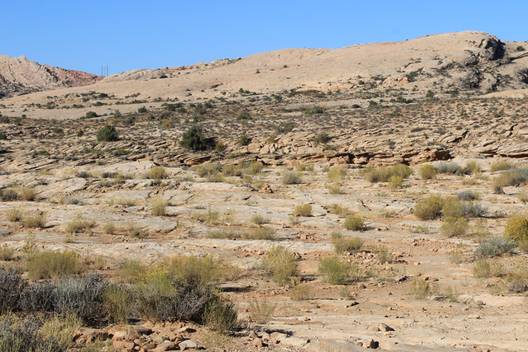
The majority of the hike to the panel is on the slickrock of Comb Ridge. The route was marked by rock cairns. Having good boots made the walk across the rock surface pretty easy even when the path was steep.
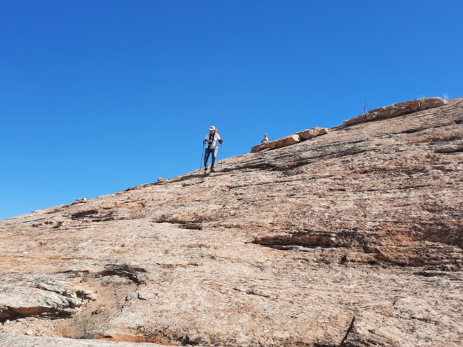 |
The route here is one of the few that the early people could use to travel completely through the steep terrain of Comb Ridge from one side to the other.
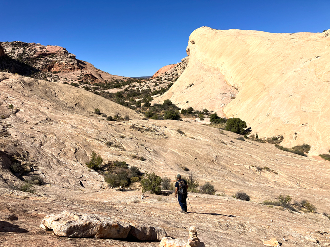 |
The Procession Panel is located on the stained cliff in the distance. This is very near the crest of Comb Ridge. Once again there is no developed trail. Cairns marked the route.
 |
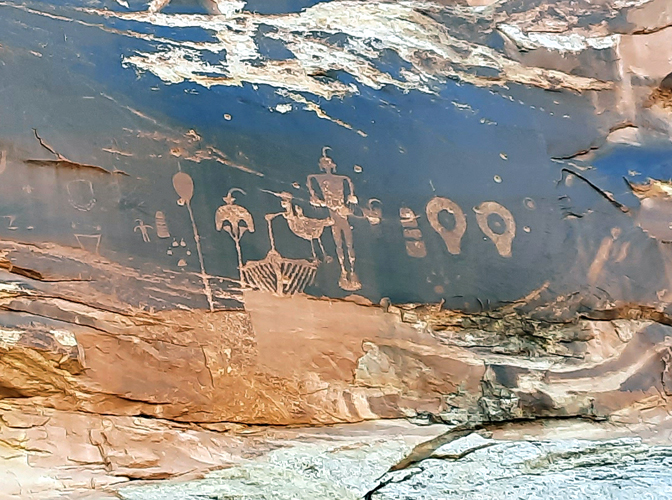
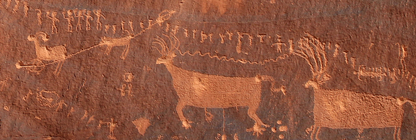
The name of the Procession Panel comes from 3 lines of human like figures that seem to be associated with a circular figure. It is unknown whether the lines are converging towards or dispersing from the circle. The horizontal line to the right extends beyond the edge of the photo. One report stated that there are more than 190 figures in the lines.
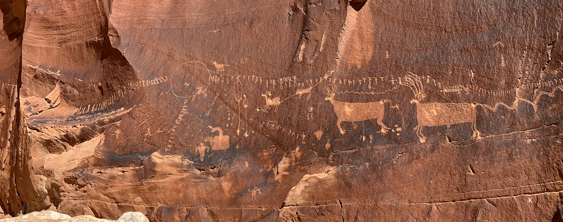 |
In this close up view, it can be seen that in the line of the human figures, not all were created with the same level of detail. What is the story of the five figures to the left who have their right arms raised? To the right in the line of figures, there appears to be a bird sitting on the head of one of the persons. What is the significance of that? What was the item held by the figure to the far right? Was it a tool or a weapon?
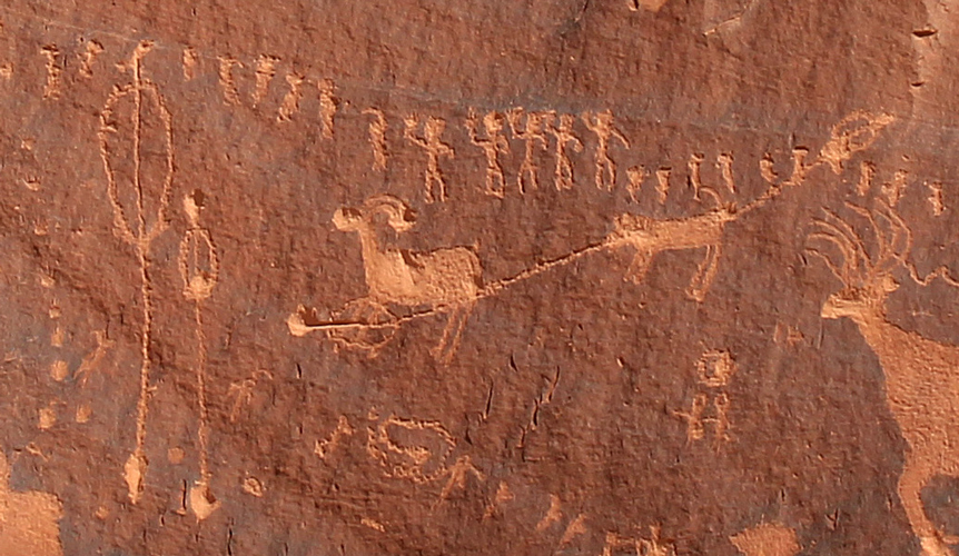
What kind of animals are represented here? Are those antlers extending from the heads of the large animals to the right? If so, why are they depicted with toes and not hooves?
 |
In this section of the panel, could the vertical lines to the left, be representations of arrows with feathers at the top and points at the bottom? If so, are those arrows that have been shot into the animal figure to the right?
 |
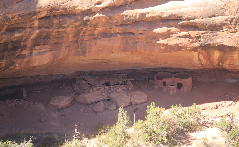
Monarch Cave Cliff Dwelling:
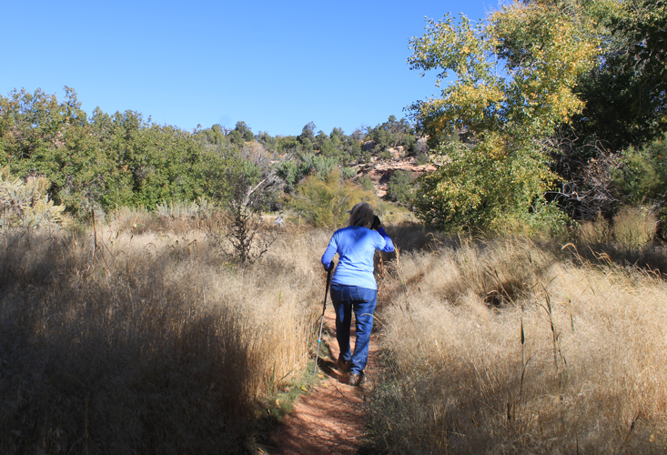
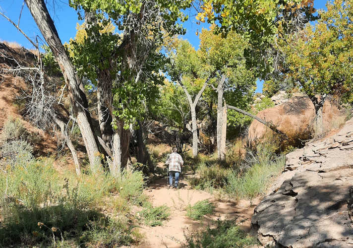
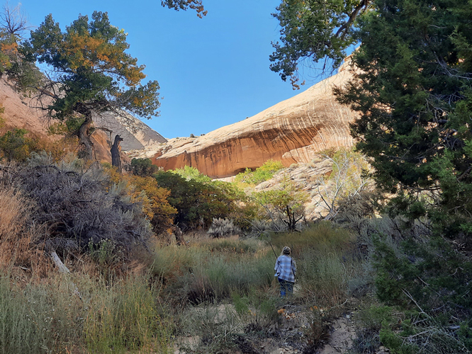
The final site that we visited along Butler Wash was the cliff dwelling that is named Monarch Cave. Our treks to the other two sites had been largely out in the open and across the slickrock of Comb Ridge. The hike to Monarch Cave followed very closely the bottom of a side drainage that ran out from the slickrock of the Ridge.
Tall cottonwood trees created quite a bit of shade along the path. Once again, there was not a developed path to follow, but there were many footprints to follow.
 |
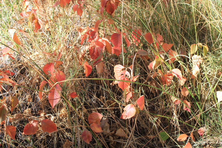
One plant, which was poison ivy, caught our attention. We were thankful that it had changed to its fall colors so that we could keep track where it was growing.
 |
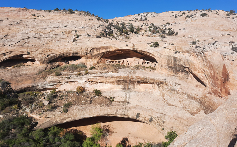
At this point in the trail, the alcove at the base of the cliff in the distance, which holds the Monarch Cave Ruin, first came into view.
 |
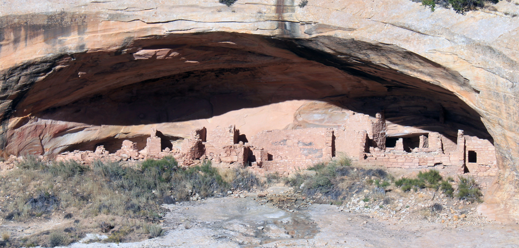
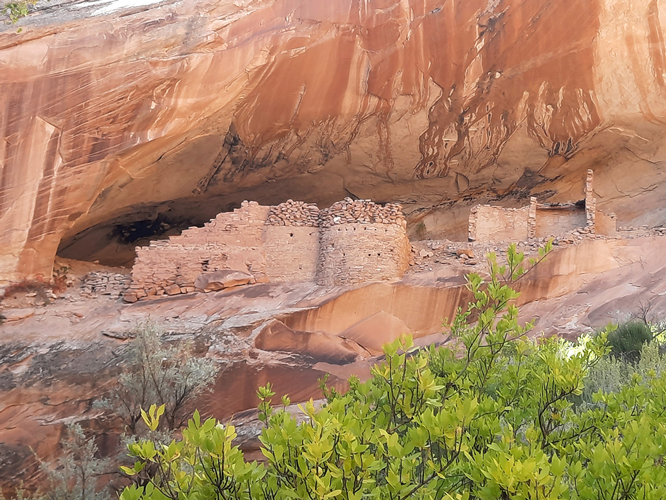
This is the Monarch Cave Ruin. We could have approached the ruin a bit closer, but did not. In the bottom of the wash to the lower left beyond the edge of the photo was a pool of water that was probably utilized by the early inhabitants of this structure.
 |
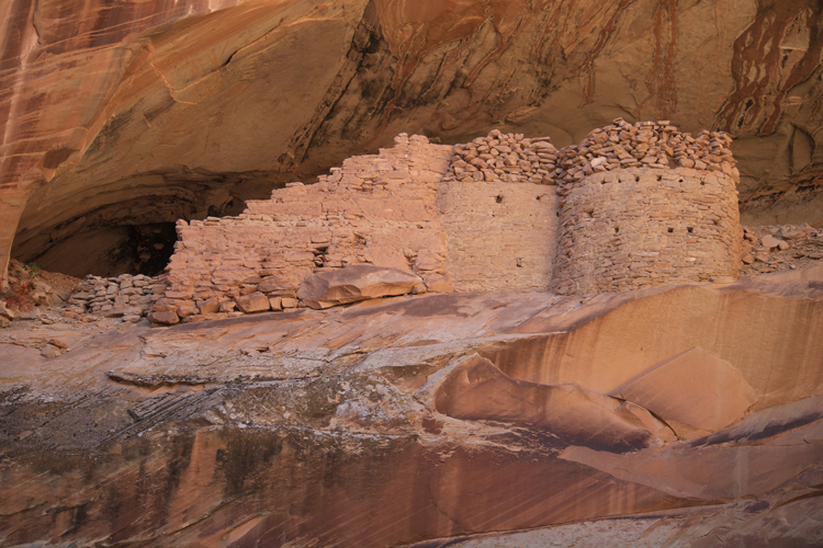
The upper portions of the round rooms were constructed differently that the lower sections. The rock materials in the lower sections appear to have been mortared together. The rocks in the upper sections seem to have simply stacked on one another.
 |
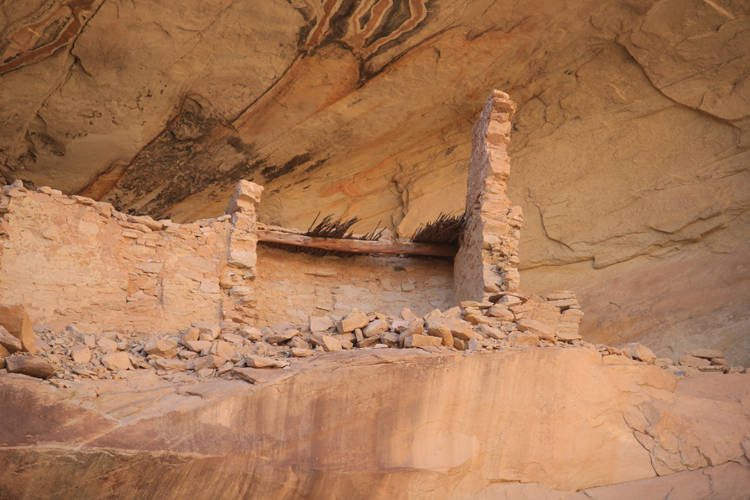
Roof materials have survived in this section of the ruin.
 |
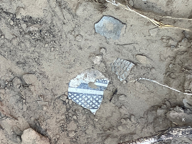
These pieces of pottery were interesting. The painted one was really neat.
 |
After our first real hiking excursion in the the monument, which had been to the House On Fire Ruin, we were not certain that we wanted to do any others. There had been too many people for us. Fortunately, on the hikes to the sites in Lower Butler Wash, we saw only two or three small groups, either at the sites or on the trails along the way. There were times at each location, where we had the sites to ourselves. We are anxious to return to the monument and see what else that we can find.