 |
Two Trips
into the Sierra Ancha Mountains Arizona |
 |
 |
Two Trips
into the Sierra Ancha Mountains Arizona |
 |
My friends Mike C., Neil F. and I have spent many years exploring the roads of the Sierra Anchas north of Roosevelt Lake in Central Arizona. There aren't too many that we haven't driven at one time or another. And in our younger days, we always tried to time our adventures to be able to arrive at the Antler Cafe in Young Arizona on Friday or Saturday evenings.
There were a couple of places that I hadn't been to in the area, and in the summer of 2006, it was time to take care of those places on my "to do" list.
The first one was the drive into Boyer Cabin. This rancher's shack is at the end of a 12 mile forest road that takes off from the A Cross road north of Roosevelt Lake. This easy/moderate 4wd road climbs pretty steeply up through Sonoran Desert vegetation to Juniper and Oak elevations where it drops into a canyon that leads down to the Cabin. At this point you are just south of the Salome Wilderness. A hiking trail northward departs from the cabin area.
The 12 miles into the cabin took me several hours--its a pretty rocky road.
Click on Photos to Enlarge:
|
Boyer Cabin Road Northbound |
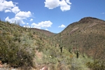 Sonoran Desert Scenery |
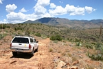 Slow Going |
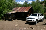 Boyer Cabin |
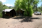 Boyer Cabin Wider View |
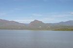
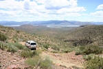 Heading South towards Roosevelt Lake |
The second trip was an overnighter a few weeks later out the FS 134 road west of Young Arizona to look over the Pranty Cabin and Mine and check out the end of the road at the Hellsgate Wilderness boundary. To the bottom of Spring Creek Canyon, a wide and very deep canyon, the road is a decent 2wd dirt road. On the climb out the other side and onward it becomes a rocky 4wd road that is slow going to its end. There are scenic geologic features, rock walls of Indian origin, and mining claims to be seen as you bounce along. The Pranty Cabin is down in a side canyon. I walked to it--there is a very narrow tippy spot against a boulder as you work down the canyon that I am not sure that a vehicle could get by. There were a few mine rails around the cabin.The few tunnels that I saw were caved in. Near the end of the 134 road is a private rancher's shack, barn and corrals called Soldier Camp.
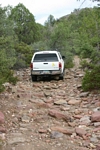 134 Road |
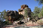 Looking West Balancing Rocks |
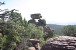 Looking East Balancing Rocks |
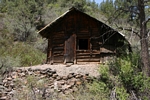 Pranty Cabin |
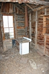 Interior Pranty Cabin |
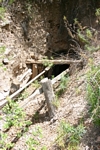 Collapsed Tunnel |
The next day I drove down into Upper Spring Creek and and walked upstream a short distance to the Spring Creek Mine. This old mine produced from 1926-31 and is listed as a gold, lead, silver, copper mine. The main tunnel has collapsed down and is completely sealed.
| Trips |
| Home |